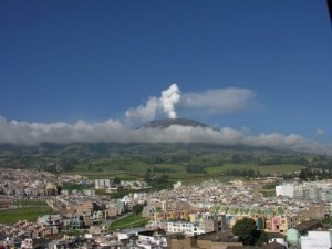
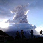
Galeras, a stratovolcano with a large breached caldera located immediately west of the city of Pasto (a city with approx. 400,000 inhabitants), is one of Colombia's most frequently active volcanoes.
The dominantly andesitic Galeras volcanic complex has been active for more than 1 million years, and two major caldera collapse eruptions took place during the late Pleistocene. Long-term extensive hydrothermal alteration has affected the volcano. This has contributed to large-scale edifice collapse that has occurred on at least three occasions, producing debris avalanches that swept to the west and left a large horseshoe-shaped caldera inside which the modern cone has been constructed.
Major explosive eruptions since the mid Holocene have produced widespread tephra deposits and pyroclastic flows that swept all but the southern flanks. A central cone slightly lower than the caldera rim has been the site of numerous small-to-moderate historical eruptions since the time of the Spanish conquistadors.
Eruptions
Galeras is considered the most active volcano in Colombia, followed by Nevado del Ruiz. Its earliest activity during the Holocene has been dated at 7050 BC ± 1000 years through radiocarbon dating. Other eruptions similar to this event include those in 3150 BC ± 200 years, 2580 BC ± 500 years, 1160 BC ± 300 years, 490 BC ± 100 years, and in 890 AD ± 200 years. Typically these eruptions consist of a central vent explosion, conducive to an explosive eruption causing pyroclastic flows and/or lahars. Eruptions in more recent times, which have been recorded consist of those in 1535, December 1580, July 1616, 1641, 1670, 1754, November 1796, June 1823, October 1828, 1834, October 1865, July 1889, 1891, December 1923, October 1924, October 1932, February 1936, July 1947, January 1950, 1974, February 1989, January 1990, January 1993, March 2000, June 2002, July 2004, November 2005, and October 2007. Reported incidents with no official proof occurred in 1836, 1930, 1933, and 1973.
Galeras became active again in 1988 after 10 years of dormancy. A Decade Volcano conference in the city of Pasto, in 1993, ended in disaster when several of the scientists present mounted an impromptu expedition on 14 January to the crater of Galeras. An eruption occurred unexpectedly while they were at the summit, which resulted in the deaths of six scientists and three tourists. Elements in the media made the event controversial by suggesting the team leader Stanley Williams, who survived, had ignored safety procedures. A prediction had been made three days before the eruption based on B-Type activity seen on a seismograph. Seismic B-types had been used successfully to predict eruptions on other volcanoes. However, the prediction was based simply on the one seismographic printout viewed in the light of previous history of Galeras, without any additional scientific measurements showing any serious activity within the volcano.
Activity at a low level has continued at Galeras, with small explosions occasionally dusting nearby villages and towns with ash.
Earthquakes
The list below shows the earthquake activity in a narrow radius around the volcano. Unfortunately we are only able to report the stronger earthquakes reported by the most important seismological agencies in the world. Our earthquakes database began registering early 2012.
| Refresh this list | ||||||
| SRC | Location | UTC Date/time | M | D | INFO | |
| EMSC | Colombia | Jan 24 23:26 | 3.5 | 5 | MAP I Felt It INFO | |
| USGS | Narino, Colombia | Sep 11 06:08 | 3.2 | 10 | MAP I Felt It INFO | |
| EMSC | Colombia | Sep 11 06:08 | 4.0 | 9 | MAP I Felt It INFO | |
| GEOFON | Colombia | Jun 12 09:35 | 4.4 | 10 | MAP I Felt It INFO | |
| EMSC | Colombia | Jun 12 09:35 | 4.9 | 10 | MAP | |
| USGS | Sandona, Colombia | May 29 14:15 | 3.4 | 10 | MAP I Felt It INFO | |
| EMSC | Colombia | Jan 29 00:44 | 3.9 | 0 | MAP | |
| EMSC | Colombia | Sep 05 08:37 | 3.2 | 0 | MAP | |
| EMSC | Colombia | Sep 15 02:59 | 2.3 | 8 | MAP | |
| EMSC | Colombia | Jul 30 21:39 | 2.7 | 7 | MAP | |
| EMSC | Colombia | Jan 21 00:48 | 2.6 | 5 | MAP | |
| EMSC | Colombia | Oct 27 10:42 | 3.6 | 0 | MAP | |
| EMSC | Colombia | Sep 13 04:54 | 3.6 | 6 | MAP I Felt It INFO | |
| PTWC | Colombia | Feb 09 14:24 | 6.9 | 130 | MAP I Felt It INFO | |
|
|
||||||
| INGEO | Pasto, Colombia | Feb 09 14:16 | 6.9 | 186 | MAP I Felt It INFO | |
| USGS | Colombia | Feb 09 14:16 | 6.9 | 129 | MAP | |
|
|
||||||
| USGS | Colombia | Feb 09 14:16 | 6.9 | 153 | MAP | |
| EMSC | Colombia | Feb 09 14:16 | 7.0 | 136 | MAP | |
| USGS | Colombia | Feb 09 14:16 | 6.9 | 130 | MAP | |
| WCATWC | Colombia | Feb 09 14:16 | 6.9 | 129 | MAP | |
| ER | Seismicity Startup Record | Jan 01 00:00 | 0.0 | 0 | MAP I Felt It | |
| James Daniell CATDAT | Colombia | Aug 14 08:00 | 0.0 | 10 | MAP | |
| James Daniell CATDAT | Colombia | Jan 09 08:00 | 7.0 | 10 | MAP | |
Webcams
webcam Ingeominas 1 - Ingeominas 2 - Ingeominas 3
Videos
Some text and images courtesy : Smithsonian Institution and Wikipedia
To follow eventual activity at this time, please check also our Daily Volcano Activity reports.


