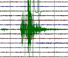
M 4.8     2011/02/14 23:44    Depth 66.6 km    MYANMAR
February 15, 2011 at 06:14:34 AM at epicenter
Epicenter in a vast wilderness area in Myanmar at approx. 100 km from the India border.
140 km (90 miles) NW of Myitkyina, Myanmar and 200 km (125 miles) SE of Dibrugahr, Assam, India
Quake-maps.com satellite map + I Did Feel It form
Alternative satellite map
M 5.4     2011/02/14 21:56    Depth 96.5 km   TARAPACA, CHILE
06:56:44 PM at epicenter
Harmless subduction earthquake at an intermediate depth.
120 km (75 miles) E of Iquique, Tarapaca, Chile
Quake-maps.com satellite map + I Did Feel It form
Alternative satellite map
M 4.2     2011/02/14 12:43     Depth 5.0 km   GERMANY
01:43:10 PM at epicenter
Please read our in-depth report about this earthquake - Click here
M 4.9     2011/02/14 12:18     Depth 10.1 km    MAULE, CHILE
09:18:27 AM at epicenter
Please read our in-depth report about this earthquake - Click here
Quake-maps.com satellite map + I Did Feel It form
Alternative satellite map
M 4.0     2011/02/14 09:17   Depth 5.0 km   ALBANIA
local time 10:17
Weak but shallow earthquake with epicenter 6 km from Vlorë (pop 89,546)
Vlorë or Vlora is the second largest port city of Albania, after Durrës, with a population of about 94,000 (2008 estimate). It is the city where the Albanian Declaration of Independence was proclaimed on November 28, 1912. The city was shortly the capital of Albania. An important settlement, continuously inhabited for about 26 centuries, Vlorë is now the most important economical and cultural city of southwestern Albania and home to the University of Vlorë. (Source Wikipedia)
Quake-maps.com satellite map + I Did Feel It form
Alternative satellite map (green arrow)
M 4.5     2011/02/14 06:02    Depth 9.9 km   MOROCCO
06:02:55 AM at epicenter
Epicenter 55 km (35 miles) SE of Beni Mellal, Morocco
Quake-maps.com satellite map + I Did Feel It form
Alternative satellite map
M 4.5     2011/02/14 04:54    Depth 96.9 km   MENDOZA, ARGENTINA
01:54:40 AM at epicenter
Moderate earthquake at an intermediate depth
75 km (45 miles) E of Los Andes, Valparaiso, Chile and 95 km (60 miles) W of Mendoza, Mendoza, Argentina
Quake-maps.com satellite map + I Did Feel It form
Alternative satellite map
M 6.6     2011/02/14 03:40    Depth 25.4 km   OFFSHORE MAULE, CHILE
12:40:10 AM at epicenter
Please read our in-depth report about this earthquake - Click here
Very powerful aftershock in Maule, Chile close to the shoreline and close to Constitucion
70 km (45 miles) NNW of Cauquenes, Maule, Chile
95 km (60 miles) W of Talca, Maule, Chile
Quake-maps.com satellite map + I Did Feel It form
Alternative satellite map
Earthquakes occurred yesterday (UTC time), but today local time
M 5.2     2011/02/13 23:51    Depth 43.8 km   NEW IRELAND REGION, PAPUA NEW GUINEA
February 14, 2011 at 09:51:01 AM at epicenter
Moderate earthquake at an intermediate depth below the wilderness of Latangai Island. No people around.
89 km (55 miles) E (95°) from Rabaul, New Britain, PNG
Quake-maps.com satellite map + I Did Feel It form
Alternative satellite map
M 5.0     2011/02/13 19:12    Depth 41.8 km    KYRGYZSTAN
February 14, 2011 at 01:12:35 AM at epicenter
Moderate earthquake at an intermediate depth near the Chinese border and only a few km from Nura and Irkeshtam
58 km (36 miles) ESE (105°) from Sary-Tash, Kyrgyzstan
Quake-maps.com satellite map + I Did Feel It form
Alternative satellite map
3-dimensional view of the earthquake area (USGS epicenter location)
 Useful information to read this daily earthquake list
This earthquake list covers important earthquakes in the world.
If a more detailed page is present, the earthquake line will be linked to the detailed page.
For your comfort, we will provide in most cases Google Satellite Map links to give you an idea where the earthquake struck, which terrain it happened and if villages or cities are located in the immediate vicinity. The reference for the time zone is UTC (Coordinated Universal Time, also called GMT)
The page is regularly updated to add new earthquakes.
green color = NOT dangerous for damage or injuries
orange color = MODERATE risk for damage or injuries
red color = CONSIDERABLE risk for damage or injuries
 QuakeSOS+ is an iPhone application developed by Armand Vervaeck, the creator and main contributor to Earthquake Report. The Application simplifies immediate group communication to friends and family members (with your exact GPS location) and is constantly feeding the users with œEarthquake Report news. Together with your own family and friends, QuakeSOS+ will be your closest earthquake friend. Buying QuakeSOS+ will support the activities of SOS Earthquakes.
a
 Quake-Maps.com was also created by SOS Earthquakes. Quake-Maps.com makes it easy to let the world know which shaking people have experienced during the earthquake. Quake-Maps.com gives also the opportunity to write some additional text. Filling up the form takes only 1 minute. Quake-Maps.com gives an overview of all the resent earthquakes and let you even go back in time and retrieve earthquakes of a certain date in the past.
Earthquake-Report.com headlines on twitter
@OnlyQuakeNews : Get all the headlines of our earthquake-report.com articles + regular updates on ongoing events
@QuakeSOS : earthquake-report.com news + automatic earthquake notifications of USGS earthquakes of M 4.0 or higher with emphasis to earthquakes in the America’s and the Pacific Ocean sphere (4 and up) and a lot of the rest of the world (5 and up). This account was created for our QuakeSOS and QuakeSOS+ iPhone applications
@ShakingEarth : earthquake-report.com news + automatic earthquake notifications of EMSC earthquakes of M 4.0 or higher with emphasis to earthquakes in European and Asian / Middle East sphere (4 and up) and a lot of the rest of the world (5 and up). This account was originally created to stimulate our Facebook account
@QuakeMaps : earthquake-report.com news with mapping notifications of ALL earthquakes M 3.0 and higher from all over the world via EMSC and USGS. This account was created for our http://www.quake-maps.com website


Moderate earthquake in the Katowice area, Poland