On this page : Fogo (Cabo Verde), Bardarbunga (Iceland), Kilauea (Hawaii), Stromboli (Sicily), Aso (Japan), Popocatepetl (Mexico), Reventador (Ecuador), Chiles and Cerro Negro (Colombia), Erebus (Antarctica), Pavlof (Alaska), Sinabung (Indonesia), Mayon (Philippines), Tokashidake (Japan)
New additions will always be on top and if the page gets too long, we will cut off a part of it and archive it. This url will always be the one to follow and if you leave your tab open in your browser, the page will refresh every 30 minutes automatically.
This report is compiled out of many information sources.
On Twitter follow us on @volcanoreport and @JanineKrippner
Earthquake-report.com can only survive with PRIVATE DONATIONS
Your gift will be highly appreciated, Thank You
For our El Hierro volcano report : Click here
We are happy to tell our readers that volcanologist Janine Krippner will now post on her own page in this site.
This page will no longer update for the time being.
Click on the link to be referred to that page. Same system than this page.
Volcano news by volcanologist Janine Krippner
-
Sinabung, Indonesia, April 2, 15:45 UTC (Janine)
There are reports of pyroclastic flows reaching 4 km from the dome, igniting fires around the village of Sibintun. There are no current reports of any injuries or casualties and I am unaware of how many were in the area at the time. Updates will be provided when more news comes through.
Colima, Mexico - March 26, 14:30 UTC (Janine)
An explosive eruption occurred this morning (8:18 am local time) producing a 4 km high ash plume and pyroclastic flows.
Shiveluch, Kamchatka - March 26, 14:00 UTC (Janine)
KVERT reports an eruption that occurred today producing an ash plume that reached 5000 - 5500 m above sea level.
Semisopochnoi, Alaska - March 25, 17:58 UTC (Janine)
AVO/USGS has increased the aviation color code to Yellow and the volcano alert level to Advisory following the increasing intensity of seismic activity. The activity could indicate moving magma or magmatic gasses. No other signs of activity have been observed through remote sensing or other data.
Popocatepetl, Mexico - March 25, 12:30 UTC (Janine)
Explosions continue daily with these two images captured by the webcam this morning.
See live webcam here.
Zhupanovsky, Kamchatka - March 25, 11:35 UTC (Janine)
KVERT has released a volcano observatory notice for aviation today after a moderately explosive eruption. The ash plume reached 8 km above sea level and has drifted ENE.
Shiveluch, Kamchatka - March 23, 13:00 UTC (Janine)
An explosion at Shiveluch yesterday (22 March) produced an ash plume reaching 6 km above sea level. KVERT released a Volcano Observatory Notice for Aviation for the ash plume that drifted to the north east.
Villarrica, Chile - March 23, 12:25 UTC (Janine)
Ash emission is visible on the four webcams around Villarrica.
See webcams here.
Ngauruhoe, New Zealand - March 23, 12:20 UTC (Janine)
GNS Science has increased the Alert Level to 1 (minor volcanic unrest) following an increase in number and magnitude of shallow (<5 km) earthquakes around the volcano. The previous period of unrest in 2006-2010 did not result in eruptive activity and it is also unlikely that this unrest will lead to an eruption. The last eruption of Ngauruhoe was in 1975, producing vulcanian activity.
Villarrica, Chile - March 18, 15:42 UTC (Janine)
Here is a video taken during a SERNAGEOMIN flight showing ash emission:
Villarrica, Chile - March 18, 15:25 UTC (Janine)
SERNAGEOMIN reports an increase in alert level to ORANGE. The increase in activity includes continuing explosions producing ballistic deposition around the crater and fine ash emission. The continuous low magnitude tremor suggests greater internal activity in a partially open system. This elevated activity may progress into a phase of greater instability that could lead to similar eruptive activity to that seen on 4 March.
Lewotobi, Indonesia - March 18, 12:30 UTC (Janine)
The alert level has been raised from NORMAL (Level I) to VIGILANT (Level II) due to an increase in seismic activity that may be due to an increase in pressure in a rising magma body. Visual observations noted steam ("white smoke") 15-20 m above the Laki-laki crater.
Shiveluch, Kamchatka - March 18, 12:15 UTC (Janine)
Volkstat.ru reports an eruption at Shiveluch on 17 March at 00:53 local time. The eruption produced ash plumes and lightening strikes, ash was reported falling on Ust-Kamchatsky at 07:00 local time.

The eruption produced lightening that illuminated the ash plume. Photo by Yu.Demyanchuk, volkstat.ru.
Kilauea, Hawaii- March 14 13:20 UTC (Janine)
The latest Hawaii Civil Defense update discusses the declining activity of the June 27th lava flow. Activity appears to have ceased along the active flow front. The video with recent footage of the flow and questions and answers is below:
Volcano activity of the world (last 7 days) – March 14, 15:17 UTC (Armand)
Bulletin collected and published by the Smithsonian Institution

Asosan | Kyushu (Japan)
JMA reported that, based on seismicity and infrasound data, the eruption from Asosan’s Nakadake Crater that began on 25 November 2014 continued during 2-6 March. Incandescent material was sometimes ejected onto the crater rim and plumes rose 1 km above the crater. High-amplitude tremor continued to be detected and infrasound data sometimes indicated eruptions. The Alert Level remained at 2 (on a scale of 1-5).
Fuego | Guatemala
INSIVUMEH reported that during 5-10 March explosions at Fuego produced ash plumes that rose 550-850 m above the crater and drifted 10 km NW, W, and SW. Avalanches descended the Santa Teresa (W), Cenizas (SSW), Trinidad (S), and Las Lajas (SE) ravines, and ash fell in nearby areas including Panimache I and II, Morelia, and Santa Sofía. Incandescence from the crater was sometimes observed at night.
Popocatepetl | Mexico
CENAPRED reported that during 3-10 March the seismic network at Popocatépetl recorded between 39 and 211 gas, steam, and ash emissions. Crater incandescence at night sometimes increased coincident with emissions. During 3-4 March there were 45 explosions detected; an explosion at 2004 on 3 March ejected tephra 700 m from the crater onto the NE flank, and other explosions ejected material 100 m onto the flanks. Gas-and-ash plumes drifted NE. On 5 March there were 29 explosions. Ash plumes mostly rose less than 1 km, although one gas, steam, and ash plume rose 3 km and drifted NE. The next day an explosion generated an ash plume that rose 1.2 km and drifted NE. A series of explosions on 7 March produced ash plumes that rose 1-2 km and drifted SW and N. Incandescent tephra was ejected 800 m onto the flanks and ashfall was reported in Ecatzingo (15 km SW). A series of explosions on 8 March produced ash plumes that rose 2 km and drifted NE. Ashfall was reported in Amecameca (20 km NW), Ecatzingo (15 km SW), and Tepextlipa. On 9 March a low-intensity explosion detected at 1014 generated a water vapor, gas, and ash plume. On 10 March two explosions were detected (at 0747 and 0859). The Alert Level remained at Yellow, Phase Two.
Soputan | Sulawesi (Indonesia)
Based on information from PVMBG and weather models, the Darwin VAAC reported that on 7 March an eruption at Soputan generated ash plumes that rose to an altitude of 9.1 km (30,000 ft) a.s.l. and drifted 260 km SE and SW. A thermal anomaly was detected in satellite images. BNPB noted that the eruption occurred at 1709, and produced ash plumes that rose 4.5 km above the crater and drifted E. Pyroclastic flows traveled 2.5 km down the W flank. Minor ashfall was reported in the Silian Raya district, Touluaan, Tombatu, and party in the districts of Pasan and Rataha. The Alert Level remained at 3 (on a scale of 1-4). The next day the VAAC noted that an ash plume rose to an altitude of 3.7 km (12,000 ft) a.s.l. and drifted almost 95 km SE.
Villarrica | Chile
Based on OVDAS-SERNAGEOMIN data, representatives from ONEMI, SERNAGEOMIN, Sistema Nacional de Protección Civil, and others reduced the exclusion zone around Villarrica to 5 km on 5 March. OVDAS-SERNAGEOMIN reported that the Alert Level for Villarrica was lowered to Orange (the second highest level on a four-color scale) on 6 March, citing that seismicity had declined to below baseline levels and visual observations indicated no active lava lake. During an overflight on 9 March scientists observed subsidence of material in the crater which partially obscured the conduit. Weak degassing was also noted. On 10 March the Alert Level was lowered to Yellow; OVDAS-SERNAGEOMIN warned of avalanches of unconsolidated material and maintained an exclusion zone of 3 km.
Turrialba, Costa Rica - March 13, 16:45 UTC (Janine)
Below is a video of the eruption that took place yesterday:
Ruang, Indonesia - March 13, 11:50 UTC (Janine)
BADAN GEOLOGI has reported a change from Alert Level 1 to Level 2 following an increase in seismic activity that could be attributed to increased pressure in the magma reservoir.
Turrialba, Costa Rica - March 13, 00:20 UTC (Janine)
An eruption occurred today from 13:38 to 15:24 local time with an ash plume reaching 1000 m. OVSICORA posted the video below:
Kilauea, Hawaii- March 12 12:00 UTC (Janine)
Breakouts continue on the June 27 lava flow. USGS HVO reports that the leading tip of the active flow front remains stalled 500 m upslope of Highway 130 with scattered breakouts behind. A breakout near the stalled tip has advanced along the southern margin over the past few days 1 km upslope from Highway 130, and another breakout is active 700 m upslope of the Pahoa Marketplace. Back at the Pu'u 'O'o cone there are two active areas of breakouts, with a new breakout that began two days ago near the Kahauele'a cone.
Villarrica, Chile - March 12 11:23 UTC (Janine)
Villarrica was lowered to Alert Level Yellow a few days ago. The following before and after images released by NASA show the extent of the deposits from the March 3 eruption.
Shiveluch, Kamchatka - March 9, 14:15 UTC (Janine)
KVERT reports the continuation of dome growth, avalanches, moderate ash explosions, fumerolic activity, and incandescence at the summit of the dome. Yesterday an explosion sent an ash plume up to 7-8 km above sea level, which drifted further than 885 km to the east.
Villarrica, Chile - March 3, 17:25 UTC (Janine)
SERNAGEOMIN has released photographs of the summit taken after this morning's eruption:
Villarrica, Chile - March 3, 13:45 UTC (Janine)
SERNAGEOMIN increased the Alert level to Red after a significant increase in seismicity related to volcanic tremor. Activity at the crater has intensified in energy and continuity, producing an ash column reaching altitudes of 3 km.
Thermal image of #Villarrica #volcano via. @Sernageomin https://t.co/UV9xsU9Upd pic.twitter.com/eagDdnw2f8
— Janine Krippner (@janinekrippner) March 3, 2015
Villarrica, Chile - March 3, 10:25 UTC (Armand)
Foto Captada en el momento de la Erupción #VolcánVillarrica #Temuco pic.twitter.com/YnFJufMw9p
— Araucania de Todos (@AraucaniadDTodo) March 3, 2015
Amazing photos of the Villarrica volcano in Chile WOW HT @Sim0nRedfern MT “@fpizarro: pic.twitter.com/0zku7AXr95”
— kirsty grainger (@kirstygrainger) March 3, 2015
Bardarbunga, Iceland - March 2, 18:00 UTC (Janine)
The Icelandic Meteorological Office continues to monitor gas dispersion from Holuhraun after the eruption has ended. The NASA Landsat 8 image below shows depressions and cauldrons in the Vatnajökull glacier in the lower left portion, with Holuhraun in the upper right.
Villarrica, Chile - March 2, 17:45 UTC (Janine)
SERNAGEOMIN has raised the alert level to Orange with the sustained increase in seismicity suggesting a greater instability in the volcanic system. Discontinuous strombolian activity is occurring at the summit with projectiles reaching distances up to 600 m from the crater. The alert was raised to Yellow on 6 February.
Nishinosima, Japan - March 2, 17:05 UTC (Janine)
The Japan Coast Guard has released photos taken on 23 February of the growing Nishinoshima volcanic island. The eruption surfaced in 2013 and has since been producing consistent activity with explosions several times per minute. The below video contains footage originally published by the Japan Coast Guard.
Shiveluch, Kamchatka - March 2, 15:30 UTC (Janine)
Volkstat.ru has a released a video of the 28 February eruption that produced a 9 km high plume, and pyroclastic flows to 5 km.
Bardarbunga, Iceland - February 28, 12:19 UTC
The volcanic eruption in Holuhraun has come to an end. See http://t.co/hvpF3n1DcD og á Ísl http://t.co/2RxK5pscmD #bardarbunga #Holuhraun
— Almannavarnir (@almannavarnir) February 28, 2015
This was the latest official report on Friday when the eruption was still going on
Merapi, Java, Indonesia - February 28, 09:28 UTC
#foto | @LeopoldAdam: 27 Feb 2015 #Merapi dan Mentari pagi ini dari MVO Babadan. cr. Alzwar Nurmanaji pic.twitter.com/FoLbgKKRgn
— info jogja (@infojogja) February 27, 2015
Scheveluch, Kamchatka, Russia - February 28, 09:28 UTC
#volcan #volcano #Sheveluch puissante explosion + multiples écoulements pyroclastiques/powerfull explosion + big PDCs pic.twitter.com/dYM7BrhKId
— CultureVolcan (@CultureVolcan) February 28, 2015
Yasur, Tanna Island Vanuatu - February 25, 23:15 UTC
Great drone footage of explosions. Miraculously, the drone survived.
Volcano activity of the world (last 7 days) – February 25, 23:48 UTC (Armand)
Bulletin collected and published by the Smithsonian Institute
 Ambrym | Vanuatu
On 21 February the Vanuatu Geohazards Observatory issued a notice reminding the public that a minor eruption was occurring at Ambrym from a new vent inside the caldera. The Alert Level was raised to 3 (on a new scale of 0-5). Hazardous areas were identified as being near and around the active vents (Benbow, Maben-Mbwelesu, Niri-Mbwelesu and Mbwelesu), and in downwind areas prone to ashfall.
Chikurachki | Paramushir Island (Russia)
KVERT noted that the eruption of Chikurachki that began on 16 February produced ash plumes during 16-18 February. Satellite images detected the ash plumes rising to altitudes of 7.5-8 km (24,600-26,200 ft) a.s.l. and drifting about 280 km W and E. No activity was detected during 19-22 February; the Aviation Color Code was lowered to Yellow. Chikurachki is not monitored with seismic instruments but is observed by ground-based means and satellite images.
Fuego | Guatemala
INSIVUMEH reported that during 19-20 February explosions at Fuego produced dense ash plumes that rose 650-1,250 m above the crater and drifted 12-15 km W, S, and SE. Shock waves from some of the explosions rattled structures in nearby areas including Panimache (8 km SW), Morelia (9 km SW), and Santa Sofía (12 km SW). Crater incandescence was visible at night and block avalanches that descended the Santa Teresa (W), Cenizas (SSW), Trinidad (S), and Las Lajas (SE) ravines. Ashfall was reported in Panimache and La Rochela. During 21-22 February explosions occurring at a rate of 5-7 per hour generated dense ash plumes that rose 550-850 m and drifted 10-15 km NE, W, and SW. Ash fell in Panimache I and II, Morelia, Santa Sofía, and Yepocapa (8 km NW). During 22-23 February explosions at a rate of 4-6 per hour were detected. Gray plumes rose 650-850 m and drifted 10-12 km. Explosions ejected tephra 100 m above the crater. Ashfall was again reported in nearby communities including Panimaché I and II, Morelia, Santa Sofía. Explosions continued to be detected during 23-24 February and incandescent material was ejected 100 m.
Karymsky | Eastern Kamchatka (Russia)
KVERT reported that moderate seismicity at Karymsky was detected during 13-20 February. Satellite images showed that the volcano was quiet or obscured by clouds. The Aviation Color Code remained at Orange.
Klyuchevskoy | Central Kamchatka (Russia)
KVERT reported that during 13-20 February a Strombolian and Vulcanian eruption at Klyuchevskoy continued. Incandescence at the summit was visible and bombs were ejected 150 m above the crater. Explosions generated ash plumes that rose to altitudes of 5-8 km (16,400-26,200 ft) a.s.l.; ashfall was reported in Klyuchi Village (30 km NNE) during 13-16 February. A lava flow effused onto the E flank. Satellite images showed a daily, big, bright thermal anomaly over the volcano, and ash plumes drifted about 600 km mainly E, SE, and S. The Aviation Color Code remained at Orange.
Sinabung | Indonesia
Based on satellite images and weather models, the Darwin VAAC reported that on 20 February an eruption from Sinabung generated ash plumes that rose to an altitude of 13.7 km (45,000 ft) a.s.l., drifted almost 540 km NW, and became detached. A lower-level eruption later that day produced an ash plume that rose to an altitude of 7.3 km (24,000 ft) a.s.l.
For your information
We have archived a huge part of this page (period from January 16 until February 18)
Ambrym, Vanuatu - February 24, 09:05 UTC (Armand)
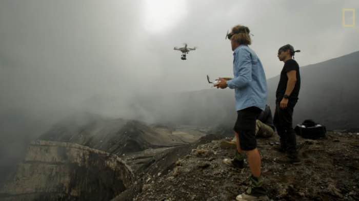
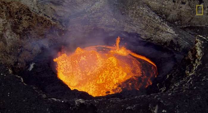
Below the tweet from John Seach about the disappeared Marum crater lava lake. Below his tweet our screenshots who are proving that he is right. We also attract your attention on the strong thermal activity on the 21th, the day of the eruption cloud that we mentioned earlier on this page (date there is February 22 but it shows clearly what happened). Let us truly hope that nobody camped alongside the crater at the time of the eruption. An almost certain death would have been the result. So far we have no news of eventual missing persons. Also bad news for those teams wanting to do research the Marum lava lake in the near future. An example of such a research team (with a drone) can be seen in the video below. The video is one of the greatest Ambrym / Marum video's we have seen so far (there are many on YouTube). It may now be over for a long time or perhaps re-appear later today. The great secrets of our planet.
https://twitter.com/johnseach/status/570146472961798145
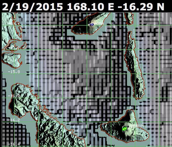
Green blocks = thermal heat of Marum Lava lake (Ambrym volcano)
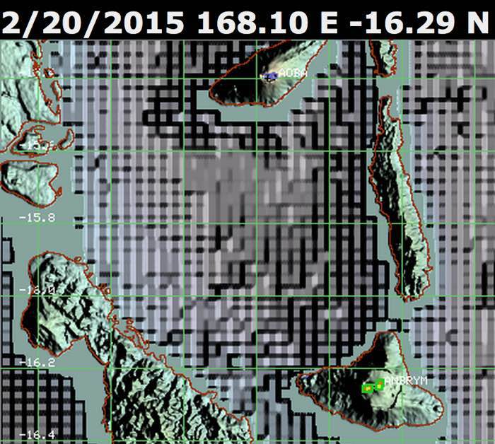
Green blocks = thermal heat of Marum Lava lake (Ambrym volcano) - February 20 was the day of the earthquake and we see some orange color appear within the green blocks, a sign activity increased
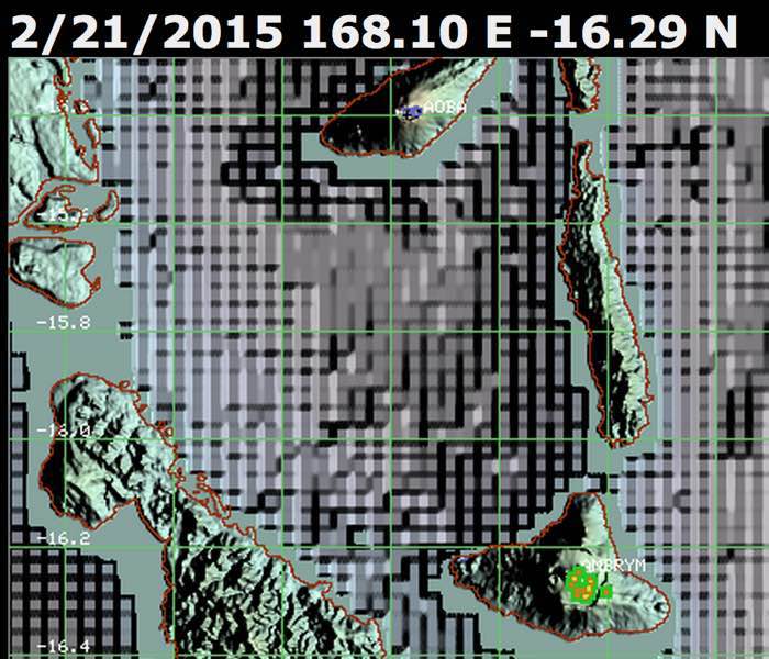
Green blocks = thermal heat of Marum Lava lake (Ambrym volcano) - The day of big eruption Many more orange color and a much wider heat area. On the right side a possible lava flow descending towards the Eastern part of the island
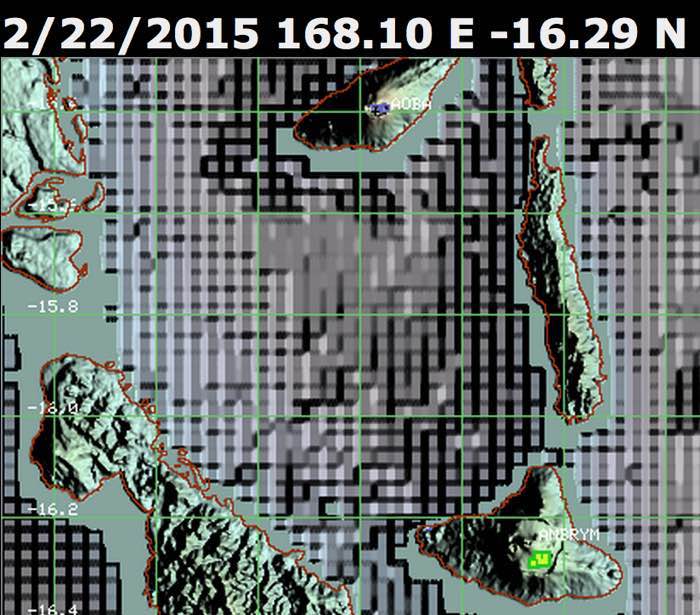
Green blocks = thermal heat of Marum Lava lake (Ambrym volcano) - still a lot of heat blocks but the heat area decreased in size and in Temperature
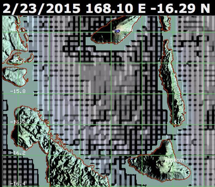
No more heat detected buy the satellite
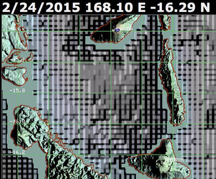
No more heat detected buy the satellite which normally confirms the John Seach theory
National Geographic Marum crater drone video.
http://video.nationalgeographic.com/video/news/150220-volcano-drones-vin?source=relatedvideo
Ambrym, Vanuatu - February 23, 19:55 UTC (Janine)
The Vanuatu Geohazards Observatory released a report on 21 February with an Alert Level increase from 2 to 3 (Danger on the crater rim, possibility of moderate eruption, also chance of flank eruption). A minor flank eruption has begun from a new vent inside the caldera.
Ambrym, Vanuatu - February 22, 09:15 UTC (Armand)
See also below (nice to find out that our expectations were right)
New eruption at #Ambrym #volcano, #Vanuatu preceded by magnitude 6.4 earthquake on 20th February 2015.
— John Seach (@johnseach) February 22, 2015
#Ambrym #volcano, #Vanuatu. Satellite images show detached sulphur dioxide plume extending 500 km west.
— John Seach (@johnseach) February 22, 2015
Bardarbunga, Iceland - February 20, 18:20 UTC (Janine)
The Institute of Earth Sciences has released a report describing the decrease in activity at Holuhran. There appears to be only one active vent remaining and the level of the lava lake is lowering. The lava field remains active with the dominant growth mechanism being inflation. Breakouts were observed on the 17-18 February ENE of the vent with a maximum temperature of 1180-90°C.

FLIR thermal image showing a single active vent in the central section of the high-rise rampart. Courtesy of the Institute of Earth Sciences.
Volcano activity of the world (last 7 days) – February 20, 17:48 UTC (Armand)
Bulletin collected and published by the Smithsonian Institute
Chikurachki | Paramushir Island (Russia)
According to KVERT, the Tokyo VAAC stated that an eruption at Chikurachki began at 1000 on 16 February. A Support to Aviation Control Service (SACS) notice described a large amount of aerosol near the Northern Kuriles Islands at 1322 that same day. Satellite images detected ash plumes that rose to altitudes of 7-7.5 km (23,000-24,600 ft) a.s.l. and drifted 80 km W. The Aviation Color Code was raised to Orange. At 0641, 1328, and 1635 on 17 February satellite images showed ash plumes rising to altitudes of 3-3.5 km (10,000-11,500 ft) a.s.l. and drifting 95-230 km SW.
Colima | Mexico
Based on satellite images, the Washington VAAC reported that on 11 February continued discrete emissions from Colima drifted NE and dissipated after 55 km. On 14 February a small eruption recorded by the webcam produced gas emissions with a low ash content that rose to an altitude of 4.9 km (16,000 ft) a.s.l. and drifted NNE.
In a 17 February bulletin, the Unidad Estatal de Protección Civil reported that Colima remained active, although there continued to be a slight decrease in the number and size of lava-block avalanches. Lava flows minimally advanced. Explosions continued but also decreased in intensity, producing ash plumes that rose 2-3 km above the crater. The lava dome had been partially destroyed, forming a carter about 140 m in diameter. Residents were warned not go within 5 km of the volcano.
Fuego | Guatemala
On 12 February INSIVUMEH reported that explosions from Fuego produced water vapor, gas, and ash plumes that rose 350-800 m above the crater and drifted E and S, and at times NW, drifting as high as 1.7 km. During 12-14 February explosions generated ash plumes that rose 800 m and drifted 10-11 km E and SE. Incandescent material was ejected 100-150 m above the crater, causing avalanches in the Trinidad (S) drainage. During 15-16 February block avalanches descended the Cenizas (SSW), Trinidad, and Las Lajas (SE) drainages. Ashfall was reported in Panimache (8 km SW), Sangre de Cristo (8 km WSW), San Pedro Yepocapa (8 km NW). In a special report on 16 February INSIVUMEH noted 4-6 explosions per hour, and ash plumes that rose, based on pilot reports, to altitudes of 7-9.1 km (23,000-30,000 ft) a.s.l. and drifted more than 15 km SW and W. Another special report issued on 17 February stated that 4-6 explosions per hour continued to be detected. Large amounts of ash formed mushroom-shaped clouds that rose 0.6-1.1 km above the crater and drifted over 15 km NW, W, SE, and S. Incandescent material was ejected 150 m above the crater, causing avalanches in the Trinidad, Ceniza, Las Lajas, and Santa Teresa drainages.
Karymsky | Eastern Kamchatka (Russia)
KVERT reported that during 6-13 February a moderate explosive eruption at Karymsky continued. Satellite images showed a thermal anomaly over the volcano on 6 February; weather prevented views of the volcano on the other days. The Aviation Color Code remained at Orange.
Klyuchevskoy | Central Kamchatka (Russia)
KVERT reported that during 6-13 February a Strombolian and Vulcanian eruption at Klyuchevskoy continued. Incandescence at the summit was visible and bombs were ejected 200-300 m above the crater. Explosions generated ash plumes that rose to altitudes of 5.5-6.5 km (18,000-21,300 ft) a.s.l.; ashfall was reported in Kozyrevsk Village (50 km W) on 7 February and Klyuchi Village (30 km NNE) on 11 February. A lava flow effused onto the E flank. Satellite images showed a daily, big, bright thermal anomaly over the volcano, and ash plumes drifting about 400 km mainly NW and N at altitudes of 5.5-6.5 km (18,000-21,300 ft) a.s.l.
On 15 February at 1035 the webcam recorded ash plumes rising to altitudes of 6-6.5 km (19,700-21,300 ft) a.s.l. and drifting 74 km E. At 1211, 1347, and 1524 ash plumes rose to an altitude of 8 km (26,200 ft) a.s.l. and drifted 110-232 km E and ESE. The Aviation Color Code was raised to Red. At 1656 ash plumes rose to altitudes of 7.5-7.8 km (24,600-25,600 ft) a.s.l. and drifted 232 km ESE. The Aviation Color Code was lowered to Orange. At 1512 on 16 February ash plumes identified in satellite images rose to an altitude of 6 km (19,700 ft) a.s.l. and drifted 270 km S. The next day, at 0641, 1503, and 1505, ash plumes rose to an altitude of 5.5 km (18,000 ft) a.s.l. and drifted 114-240 km SE.
Pacaya | Guatemala
INSIVUMEH reported that during 12-13 February a series of weak explosions from Pacaya's Mackenney Crater generated dark gray ash plumes that rose 500-700 m above the crater and, along with fumarolic plumes, drifted 1.5 km S. During 14-15 February weak explosions continued to generate ash plumes; ash and fumarolic plumes drifted 800 m SE. The next day fumarolic and ash plumes drifted S and SW at a low altitude. During 16-17 February fumarolic plumes with small amounts of ash rose 100 m and drifted E.
Piton de la Fournaise | Reunion Island (France)
OVPDLF reported that during 11-13 February visibility of the eruption at Piton de la Fournaise that began on 4 February from vents located 100 m outside and to the W of Bory Crater was hampered by poor weather conditions; tremor remained elevated. Tremor began to decrease at 1700 on 15 February, intensely fluctuated, and then disappeared around 2230. Incandescence visible with a webcam likely indicated draining lava tubes.
Soputan | Sulawesi (Indonesia)
Based on information from PVMBG and weather models, the Darwin VAAC reported that during 11-12 February an eruption at Soputan generated ash plumes that rose to an altitude of 3.7 km (12,000 ft) a.s.l. and drifted almost 30 km SE. Ash was not identified in satellite images due to darkness and meteorological clouds.
Villarrica | Chile
OVDAS-SERNAGEOMIN reported that activity significantly increased at Villarrica during 1-16 February, characterized by increased seismicity, crater incandescence, and explosions. On 6 February seismicity increased significantly, explosions occurred in the crater, and ash emissions rose above the crater rim. The Alert Level was raised to Yellow (the second lowest level on a four-color scale). DOAS (Differential Optical Absorption Spectrometry) data showed an average monthly sulfur dioxide emission value of 222 tons per day; a high value during this period of 450 tons per day was recorded on 11 February. The highest number of explosions, five per minute, during the period occurred on 16 February. Explosions ejected incandescent material out of the crater as far as 1 km onto the S flank. During an overflight on 16 February, supported by ONEMI, volcanologists observed the lava lake and recorded temperatures near 800 degrees Celsius, tephra in and around the active crater, and a diffuse layer of ash on the flanks.
Ambrym, Vanuatu - February 19, 15:00 UTC (Armand)
A very strong M6.4 earthquake happened along Ambrym Island Vanuatu. Ambrym Island is the location of Ambrym volcano and Ambrym volcano has one well know crater, the Marum lake/crater (see a 2009 picture below). Ambrym is not at all an innocent steady erupting volcano but had explosive sequences in recent history.
Ambrym volcano has erupted 50 times in the last 150 years, an average of once every 3 years with eruptions usually between VEI 1 and VEI 3. In 1950, a VEI 4 eruption occurred (equivalent to that of the Icelandic eruption of 2010).
Around 2000 years ago, it erupted with VEI 6 (equivalent to Pinatubo 1991).
Colima, Mexico - February 19, 12:45 UTC (Janine)
Activity continues at Colima with numerous explosions producing ash and steam throughout the day, such as the larger vulcanian eruption shown below.
Popocatepetl, Mexico - February 19, 12:35 UTC (Janine)
CENAPRED reports a new dome with 150 m diameter and a height of 100 m. The following video was taken by CENAPRED during a flight over the volcano on 17 February.
Klyuchevskoy, Kamchatka - February 19, 12:20 UTC (Janine)
KVERT reports continued strombolian and vulcanian eruptive activity. Ash plumes reach 5-5.5 km above sea level and have drifted to the southeast. Volkstat.ru has released the following images of ongoing activity.

Hot material has been recorded reaching 150 m above the crater. Image courtesy of Yu.Demyanchuk, Head of the Kamchatka vulkanostantsii.
Chikurachki, Kurile Islands - February 19, 12:10 UTC (Janine)
KVERT reports the continuation of an explosive eruption. On 18 February satellite data indicated an ash plume to 3 km above sea level drifting about 120 km to the southeast.

Ash cloud drifting to the southwest. NASA Landsat 8 OLI (Operational Land Imager) image acquired 17 February.

Ash cloud drifting to the southwest. NASA Landsat 8 OLI (Operational Land Imager) image acquired 17 February.
Sinabung, Sumatra, Indonesia - February 19, 09:26 UTC (Armand)
overnight event marked by the emergence of new lava spine at the peak of #Sinabung volcano cr Sadrah PS @chematierra pic.twitter.com/FPsr5zCEJK
— Leopold Kennedy Adam (@LeopoldAdam) February 19, 2015
Sinabung, Sumatra, Indonesia - February 19, 09:25 UTC (Armand)
The 2,600-meter (8,530-foot) Mount #Sinabung has sporadically erupted since September. cr: Ulet Ifanstati pic.twitter.com/rUTkwFeYyG
— Volcano Alert (@infoVolcano) February 18, 2015
OLDER ARCHIVED PARTS OF THIS REPORT :
2013 : July 8 - July 31
2013 : June 24 - July 7
2013 : June 8 - June 23
2013 : May 26 - June 7
2013 : June 8 - August 20
2013 : August 21 - October 27
2013 : October 28 - December 12
2013 : December 13 - January 30
2014 : February 1 - May 20
2014 : May 21 - August 20
2014 : August 21 - August 28 (Bardarbunga volcano Iceland)
2014 : August 29 - September 4 (Bardarbunga and Tavurvur)
2014 : September 5 - September 18 (Bardarbunga and Mayon)
2014 : September 19 - October 6 (Bardarbunga, Mayon, Long Valley and Ontakesan deadly eruption)
2014 : October 7 - November 4 (Bardarbunga, Kilauea, Chiles, Sinabung)
2014 : November 5 - November 22 (Bardarbunga, Long Valley, Colima, Pavlov, Kilauea, etc)
2014 : November 23 - November 28 (Fogo, Aso, Bardarbunga, etc)
2014 : November 29 - December 4 (Fogo, Bardarbunga, Kilauea, etc)
2014 : December 5 - December 13 (too many to describe)
2015 : December 14 - January 15 (too many to describe)
2015 : January 16 - February 18 (too many to describe)


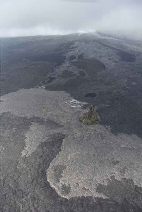




We have been so concerned and have been posting on Twitter for prayers and help in the U.S.A. We are so grateful to see this story getting out! Thanks be to God and to all the people who prayed and worked with us to make this happen! Bob&Sharonjoy Glass
Hello Armand,
Two good pieces of news found in the same day!
You made your funds target and Italian Justice develops common sense.
http://www.bbc.com/news/world-europe-29996872
Best Regards
Colin
Thank you for this great comment Colin (nice to hear you again)
I have not been to far away Armand, just lurking and visiting Volcano Cafe
Hey
Today you have a picture of when they are installing a new GPS in the caldera of Bardarbunga.
Here is a direct link to the data from that GPS: http://brunnur.vedur.is/pub/vatnavakt/bardarbunga/
Best Regards
/martin
Thanks a lot Martin