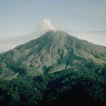
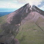
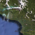
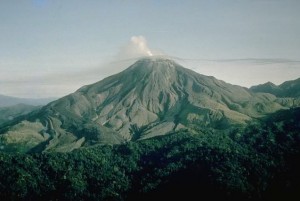
 Bagana is an active volcano located in the central part of the island of Bougainville, Papua New Guinea, the largest island of the Solomon group.
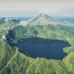
It is the most active volcano in the country. Just northeast of Bagana is the volcano crater lake Billy Mitchell (see other picture). Bagana is one of 17 post-Miocene stratovolcanos on Bougainville. U.S. General Floyd L. Parks flew over the Solomon Islands on 27 October 1948 and witnessed the eruption of Bagana. His photographs of Bagana erupting were published in Life magazine.
Bagana volcano, occupying a remote portion of central Bougainville Island, is one of Melanesia's youngest and most active volcanoes. Bagana is a massive symmetrical, roughly 1750-m-high lava cone largely constructed by an accumulation of viscous andesitic lava flows. The entire lava cone could have been constructed in about 300 years at its present rate of lava production. Eruptive activity at Bagana is frequent and is characterized by non-explosive effusion of viscous lava that maintains a small lava dome in the summit crater, although explosive activity occasionally producing pyroclastic flows also occurs. Lava flows form dramatic, freshly preserved tongue-shaped lobes up to 50-m-thick with prominent levees that descend the volcano's flanks on all sides.
Eruptions ( based on data of volcanodiscovery.com )
2008-12 activity
Bagana continues to erupt small ash explosions from time to time, producing ash plumes that rise to 2.4-3 km altitude and are monitored by the Darwin VAAC.
2008 earthquake
A magnitude 6.2 earthquake occurred 38 km SW of Bagana volcano on Tuesday 23 December 2008.
2007-08 eruptions
Lava flows, ash explosions and pyroclastic flows occurred at Bagana volcano between June 2007 and March 2008. On 12 June 2007, a strong ash emission was noted and glow was visible in the night of 14 June. This activity continued into July.
On 14 July, Bagana generated a powerful explosion that generated a pyroclastic flow, which descended the S flank and stopped at the base near a small hot-spring-fed lake located at the head of the Torokina river.
On 6 August, the lava flow from the summit crater on the SE flank became active again and continued through 23 August. Continuous incandescence was visible down the SE flank during 6-10 August.
The activity was occasionally accompanied by ash plumes generated by rockfalls from lava-flow edges. Darwin VAAC reported that a diffuse plume at an altitude of 3.7 km (12,000 ft) a.s.l. on 23 August.
2004 eruptions
In April and May 2004, Bagana produced lava flows which traveled 3 km from the summit and came within 3 km of some villages.
1966 eruption
A large ash eruption occurred on 30 May 1966 and generated pyroclastic flows.
1962 eruption
Bagana's activity increased in early 1962 and culminated in a major strombolian-type eruption on 15 February. Lava bursts followed at intervals of 5-10 minutes. Earthquakes and ash emissions continued until April.
1950 eruption
The first time pyroclastic flows were reported from remote Bagana volcano was in 1950, when the summit contained a lava dome, which generated pyroclastic flows by partial collapse. Violent explosions occurred between June and October 1950 and were accompanied by intense earthquakes and loud ash explosions generating ash plumes rising to up to 3-4 km altitude.
1943 effusive eruption
A new lava flow appeared on the NNE flank of Bagana volcano in late March or early April 1943, as aerial photos taken between 18 February and 7 April showed.
1937 eruption
The sound of a loud explosion from Bagana was heard in Kieta village 50 km away in September 1937, when a new eruption began at Bagana. The The Sydney Morning Herald reported on 9 September:
"A violent volcanic eruption began on Tuesday morning at Mt. Bagana, near Kieta, on the island of Bougainville, 250 miles south-east of Rabaul. Columns of smoke rose more than 15,000 feet.
There is no danger to the township of Kieta but the area near the mountain is thickly populated by natives."
1875 eruption
Dense steam and ash clouds were observed at Bagana volcano from the German ship SMS Gazelle on 25 August 1875.
Earthquakes
The list below shows the earthquake activity in a narrow radius around the volcano. Unfortunately we are only able to report the stronger earthquakes reported by the most important seismological agencies in the world. Our earthquakes database began registering early 2012.
| Refresh this list | ||||||
| SRC | Location | UTC Date/time | M | D | INFO | |
| EMSC | Bougainville Region, P.n.g. | Jul 18 12:46 | 4.7 | 152 | MAP I Felt It INFO | |
| GEOFON | Solomon Islands | Jul 18 12:46 | 4.8 | 170 | MAP | |
| USGS | Panguna, Papua New Guinea | Jul 18 12:46 | 4.7 | 152 | MAP | |
| GEOFON | Solomon Islands | Jun 13 18:26 | 4.9 | 196 | MAP | |
| EMSC | Bougainville Region, P.n.g. | Jun 13 18:26 | 4.8 | 209 | MAP I Felt It INFO | |
| USGS | Panguna, Papua New Guinea | Jun 13 18:26 | 4.7 | 158 | MAP I Felt It INFO | |
| PTWC | Jan 22 06:41 | 7.9 | 0 | MAP | ||
| PTWC | Jan 22 04:38 | 8.0 | 0 | MAP | ||
|
|
||||||
| GEOFON | Solomon Islands | Jan 22 04:30 | 7.8 | 154 | MAP | |
| EMSC | Bougainville Region, P.n.g. | Jan 22 04:30 | 7.9 | 150 | MAP I Felt It INFO | |
| USGS | Arawa, Papua New Guinea | Jan 22 04:30 | 8.0 | 167 | MAP | |
| GEOFON | Solomon Islands | May 01 02:35 | 4.8 | 10 | MAP I Felt It INFO | |
| EMSC | Bougainville Region, P.n.g. | May 01 02:35 | 4.8 | 80 | MAP I Felt It INFO | |
| EMSC | Bougainville Region, P.n.g. | Mar 29 04:26 | 4.7 | 100 | MAP I Felt It INFO | |
| USGS | Bougainville Region, Papua New Guinea | Dec 26 16:50 | 4.4 | 159 | MAP | |
| ER | Seismicity Startup Record | Jan 01 00:00 | 0.1 | 0 | MAP I Felt It | |
Webcams
There are unfortunately NO webcams pointed in the Bagana volcano area
Some text and images courtesy : Smithsonian Institution, Volcanodiscovery.com and Wikipedia
To follow eventual activity at this time, please check also our Daily Volcano Activity reports.


