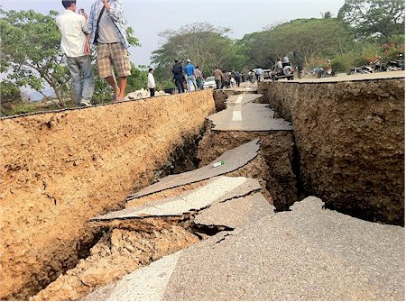
The picture below are copyright of Noppatjak Attanon, a Thai journalist who visited the earthquake damaged area 48 hours after the mainshock. No comment or caption has to be given with these images.
Short description
The Myanmar, Tachileik county earthquake occurred in the evening of March 24, 2011 local time.
The earthquake devastated a lot of towns and villages mainly in Tachilek county (Shan province).
The earthquake had a magnitude of 6.8 (USGS) at a focal depth of 10 km.
Chinese earthquake authority, who is measuring with their own instruments close to the epicenter area recorded a M 7.2 magnitude at a depth of 20 km.
The fault that originated this earthquake is the Nam Ma fault originating from Laos to Myanmar.


A tristesa que nos da de observa a populaçao mais sofrida ,fico triste porque tive o prazer conheçer o pais ,o mais lindo ,povo sofrido,a cultura diferente dos demais, oro a Deus pra ajudar esse povo mas o Deus deles que buda esqueçeu deles.
---------- Translation by Google
The sadness that in the notes of the population suffered most, I'm sad because I had the pleasure to know the country, the most beautiful, suffering people, culture different from the others, I pray God to help these people but the God of them forgot their Buddha .