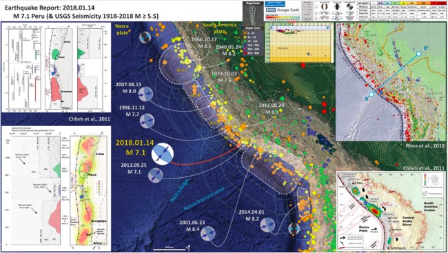
Damage report in cooperation with the 2018 Earthquake Impact Database. EID on Google Docs
–
Update - Probably final damage result :
** 2 people killed
** 107 people injured
** 672 people displaced (due to damaged houses)
** 832 houses/buildings damaged
** 169 houses/buildings destroyed
Update - The ultimate explanatory earthquake poster from this earthquake comes from geologist Dr. Jay Patton. Click on the image or this link to be linked to his site. The poster contains lots of important scientific information and can be viewed in full format in his site
Update - At least 25 houses have been destroyed by the shaking
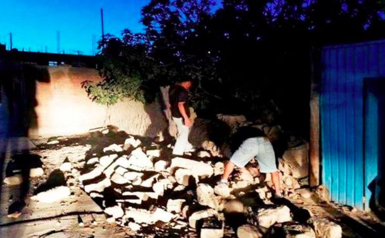
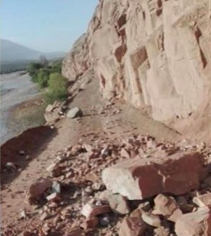
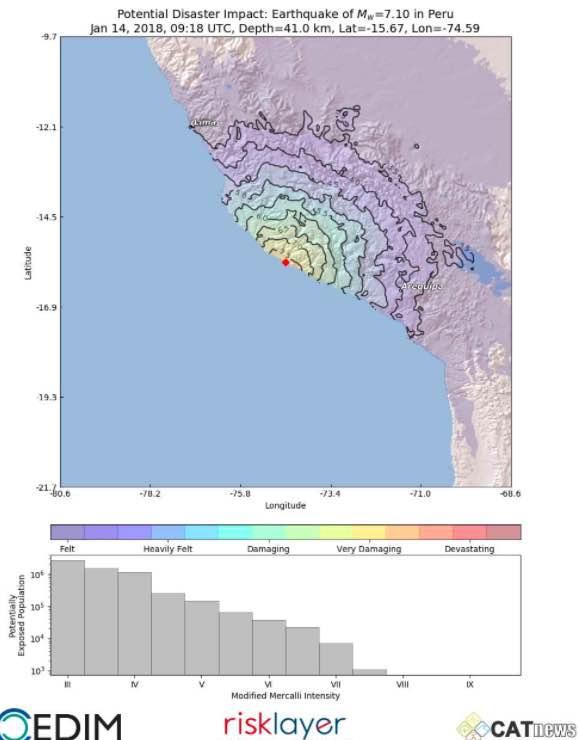
Update - Theoretical shaking and damage map from the specialists at CEDIM, Karlsruhe, Germany
Update - Another person was reportedly killed. The number of injured has increased to 115
Update - We are sad to report that at least 1 person lost his life and that 50 others have been injured. This is sadly enough the first deadly earthquake of 2018
Confirmed so far: 1 fatality in #Yauca (rock fall), more than 40 casualties and at least 25 homes destroyed in Acarí, Nazca and surrounding area (mainly abobe). #Sismo #Temblor #Peru
— Juan Carlos Villegas (@peruvill) January 14, 2018
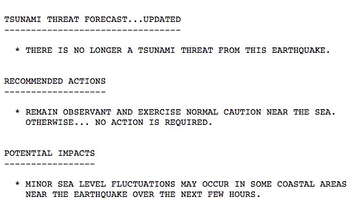
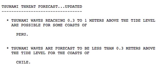
Update - The tsunami threat has been lifted
Update - Very strong to Massive earthquakes are comlmon at this part of the South American coast. The Nazca plate collides with tha South American plate at approx. 7 cm per year!
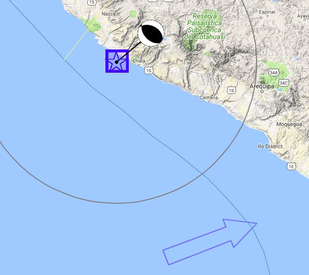
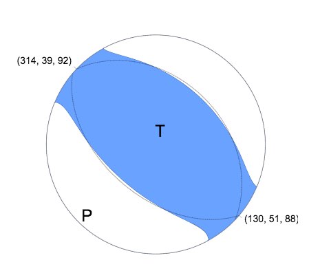
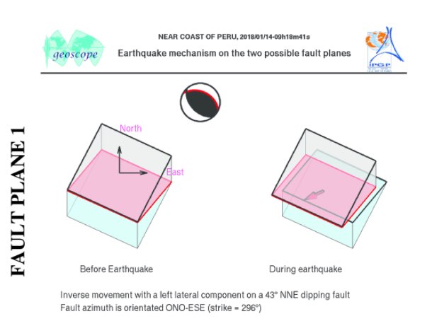
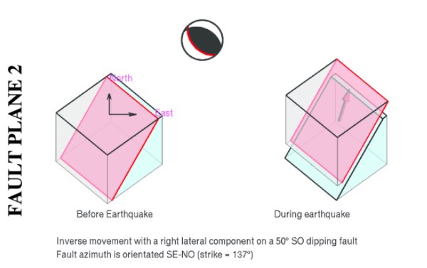
Update - Focal mechanism shows a thrust earthquake which explains partly the tsunami threat for the coast at this not so strong magnitude.
Update - Professor Max Wyss, who specializes in theoretical prognoses of injuries and fatalities expects : 0 to 20 fatalities and 10 to 100 injured people
Update - Tsunami update
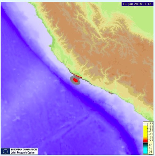
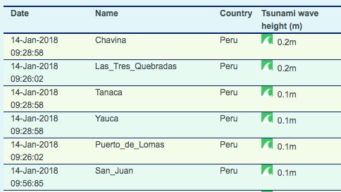
Update - Tsunami threat as reported by GDACS - maximum calculated waves: 0.2 meters (0.6 ft)
Update - Shaking intensity per location and intensity impact on the population
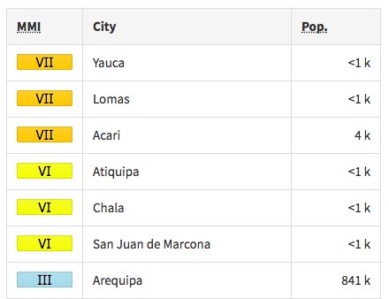
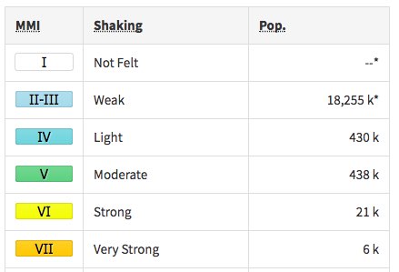
Update - shaking map reveals a maximum Very Strong shaking at coastal towns
Update - A Tsunami threat has been called for the Peruvian and Chilean coast
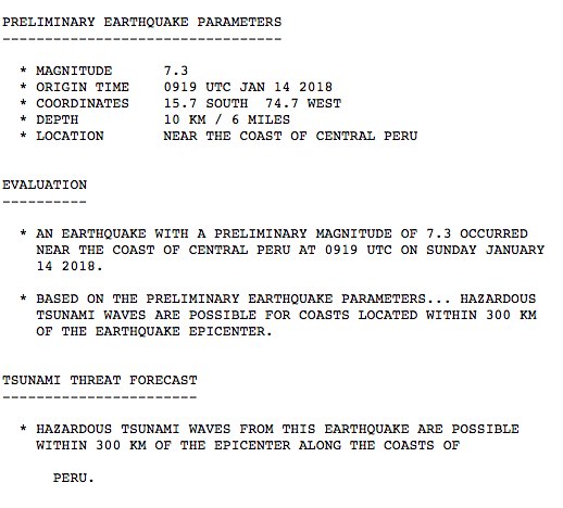
Update - Based on the current preliminary earthquake data, earthquake-report.com calls this earthquake extremely dangerous and expects injuries and serious damage
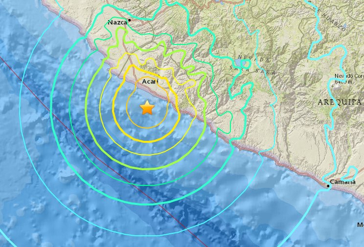
Lomas, Peru, 25.7 km (15.9 mi) Population: 0
Minas de Marcona, Peru, 73.7 km (45.8 mi) Population: 15,478
Nazca, Peru, 106.6 km (66.3 mi) Population: 23,556
Puquio, Peru, 135.9 km (84.5 mi) Population: 10,491
Ica, Peru, 216.6 km (134.6 mi) Population: 246,844
Most important Earthquake Data:
Magnitude : 7.3
Local Time (conversion only below land) : 2018-01-14 04:18:42
GMT/UTC Time : 2018-01-14 09:18:42
Depth (Hypocenter) : 12.09 km
Depth and Magnitude updates in the list below.

Share your earthquake experience (I Have Felt It) with our readers.
Click on the "I Felt It" button behind the corresponding earthquake. Your earthquake experience is not only important for science, but also for people in the area as well as our global readership.

| Refresh this list | ||||||
| SRC | Location | UTC Date/time | M | D | INFO | |
| PTWC | Jan 14 10:29 | 7.1 | 0 | MAP | ||
| PTWC | Jan 14 09:26 | 7.3 | 0 | MAP | ||
|
|
||||||
| USGS | Acari, Peru | Jan 14 09:18 | 7.3 | 10 | MAP | |
| USGS | Acari, Peru | Jan 14 09:18 | 7.1 | 36 | MAP | |
| GEOFON | Near Coast Of Peru | Jan 14 09:18 | 7.1 | 41 | MAP | |
| USGS | Acari, Peru | Jan 14 09:18 | 7.3 | 12 | MAP I Felt It INFO | |
REAL TIME EARTHQUAKE LISTS - WORLD - REGIONS - COUNTRIES - STATE
Our Fast Earthquake and Tsunami Twitter Accounts : M4+ - ALL - M5+ - M6+ - CHILI – CANADA – BRITISH COLUMBIA - CALIFORNIA - OREGON – WASHINGTON - HAWAII – TEXAS – OKLAHOMA
Other earthquakes in the greater epicenter area
Strongest earthquakes (since 1900) within a 150 km radius from this earthquake


