 Click here to read the latest part of our report
This report is compiled out of many information sources.
For our El Hierro volcano report : Click here
Shiveluch, Kamchatka - February 18, 15:25 UTC (Janine)
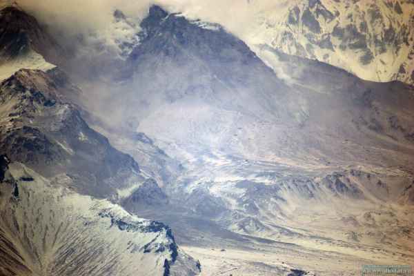
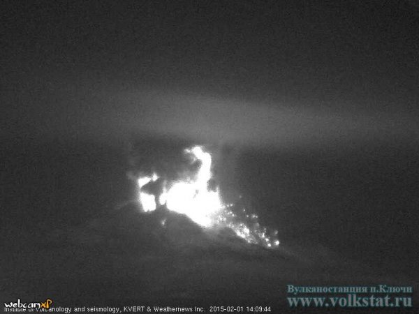
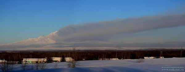
Volkstat.ru reports an eruption at Shivelcuh at 05:30 am local time. Ash plumes reached up to 6 km above sea level and a pyroclastic flow traveled about 3 km from the dome.
Chikurachki, Kurile Islands - February 17, 15:25 UTC (Janine)
KVERT reports an ongoing eruption. An ash plume reaching 3000-3500 m height has traveled about 145 km to the southwest and a thermal anomaly has been detected at the volcano. The Tokyo VAAC has issued a volcanic ash advisory.
Villarrica, Chile - February 17, 13:20 UTC (Janine)
SERNAGEOMIN reports an increase in activity with the alert level recently raised to yellow (level two out of four) due to increased seismic energy alongside incandescence and explosions at the crater. Gas readings indicate possible new magma at shallow levels in the system. A lava lake at the surface has been measured to be around 800 °C, with ash and pyroclastics present around the crater. An area of 1 km around the crater is considered to be high risk.
Kilauea, Hawaii - February 17, 13:05 UTC (Janine)
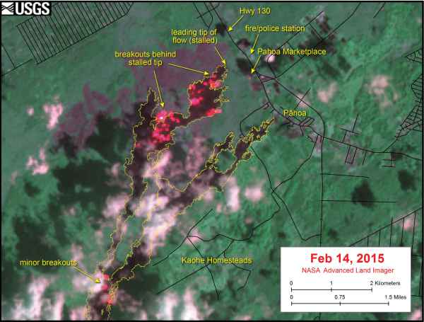
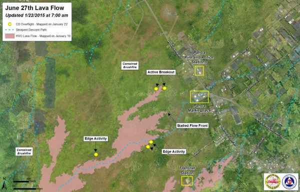
There has been no advancement of the June 27th lava flow front that is still situated ~500 m (~550 yards) from Highway 130. An active breakout on the southern margin, ~550 m (600 yards) up slope of the flow front had advanced 36 m (40 yards) between the 15-16th of February. USGS released the map below produced on 14th February that shows the active areas of the flow.
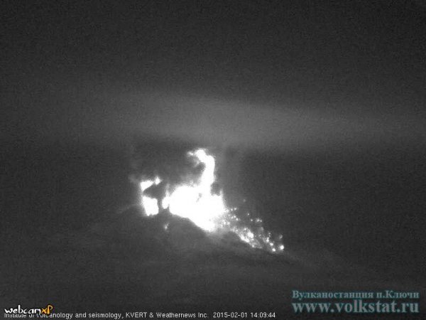
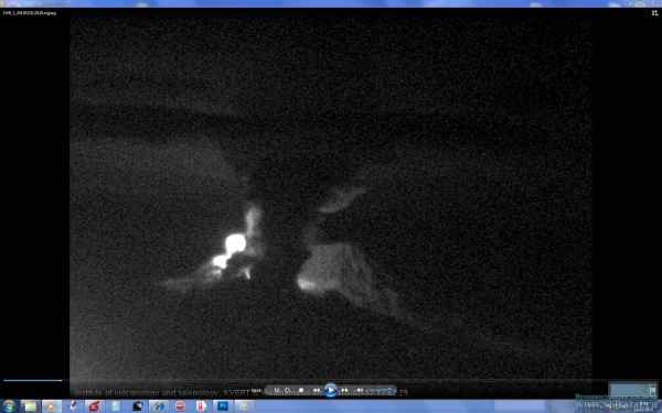
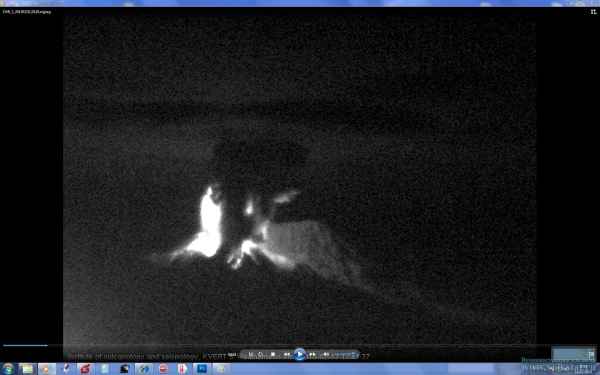
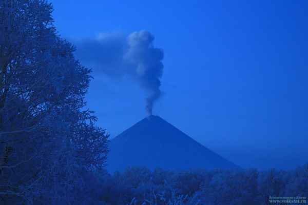
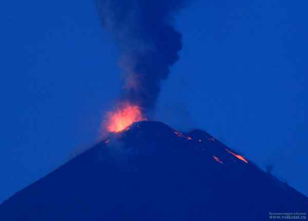
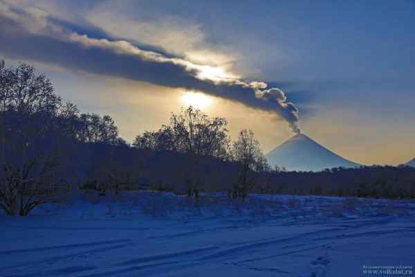
Klyuchevskoy, Kamchatka - February 28, 13:55 UTC (Janine)
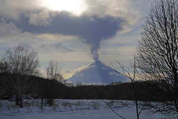
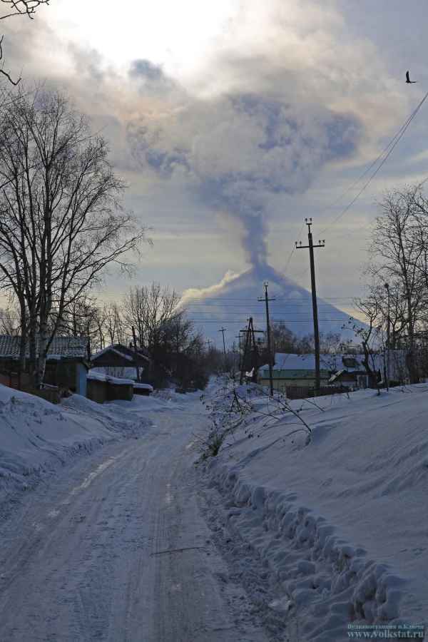
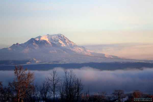
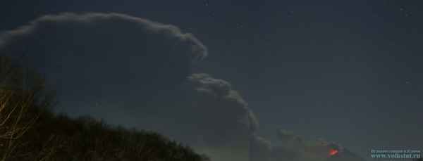
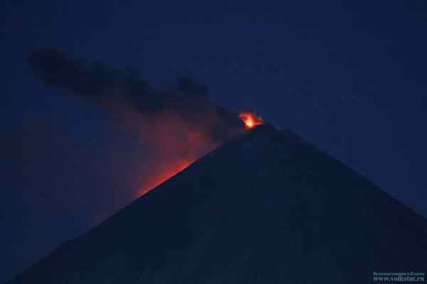
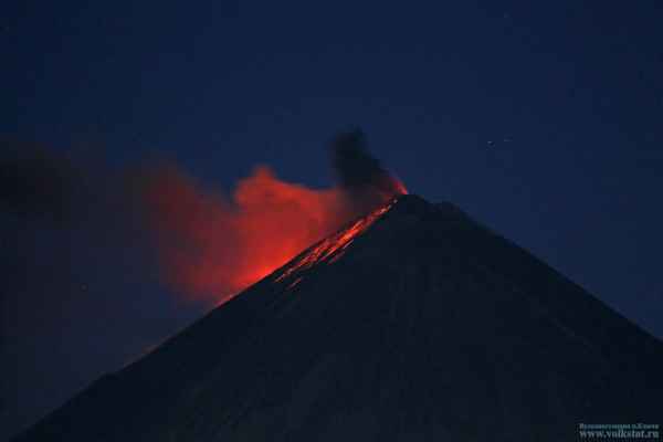
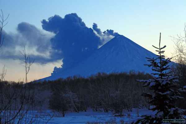
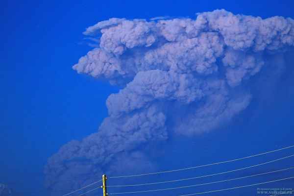
Activity continues at Klyuchevskoy with strombolian and vulcanian eruptions producing ash plumes (KVERT). The Plume in the below images reached 10 km above sea level.
Bardarbunga, Iceland - February 16, 13:40 UTC (Janine)
The Icelandic Met Office reports that activity remains persistent, although activity is lower compared to recent weeks and months. An updated lava flow field map from the 12 February shows the current flow outline. At the time the flow field measured exactly 85 km² in size.
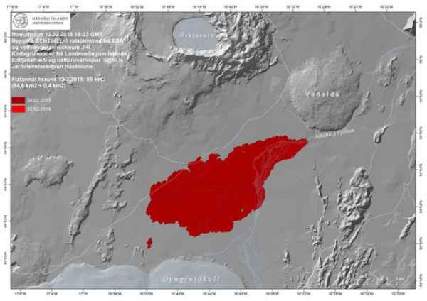
ESA SENTINEL-1 radar image acquired 12 February. Courtesy of the Institute of Earth Sciences and the Icelandic Met Office.
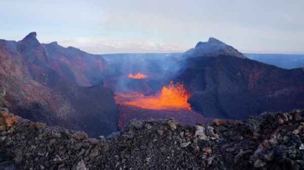
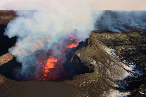
View of the boiling lava lake from the southern rim. Image taken on 12 February. Courtesy of Ármann Höskuldsson and the Institute of Earth Sciences.
Colima, Mexico - February 12, 08:08 UTC
Impressive HD video footage from Photovolcanica of the explosions of Colima volcano, Mexico. Video comment: Colima volcano can be considered one of the potentially most devastating volcanoes on earth. Repeatedly, within about 5000 year cycles, the volcano has built a new edifice and then collapsed again, devastating large swathes of surrounding landscape. Today around 400000 people live in the areas that may be affected.
Soputan, Indonesia - February 11, 12:35 UTC (Janine)
PVMBG Cvghm reports an eruption today at 7:29 pm local time producing a grey plume to 3,500 m.
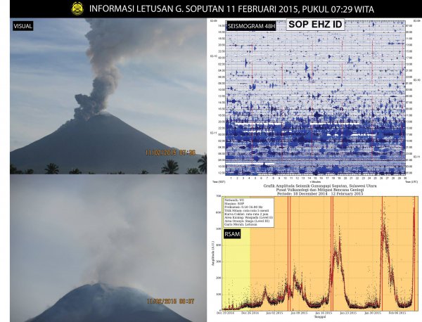
Image shows the grey plume produced during the eruption, Seismogram (top right) and RSAM (bottom right) data. Courtesy of PVMBG Cvghm on Facebook.
Fogo, Cape Verde - February 10, 12:25 UTC (Janine)
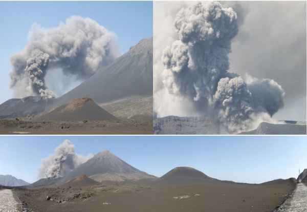
The UniCV team reports continuing activity at Fogo. Explosions expel ash, blocks, bombs, and spatter to 400-600 m heights. As of 6 February explosions were occurring 2-3 times per hour. On 7 February an increase in activity erupted ash to over 1000 m above the crater, as seen below.
Shishaldin, Alaska - February 10, 11:40 UTC (Janine)
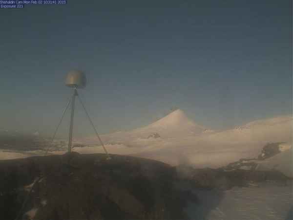
AVO reports continued elevates temperatures at the summit as observed in satellite data. A light steam plume is visible in webcam images over the past 24 hours and at the time of the most recent report (21:31 UTC, 9 February) seismicity had been increasing over the previous few hours.
Sinabung, Indonesia - February 10, 11:30 UTC (Janine)
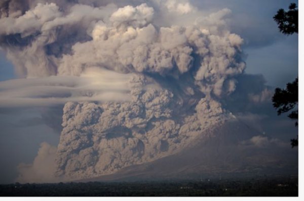
The Jakarta Post reports that the Monday eruption of Sinabung has interrupted plans for refugees to return home this week. Up to 2,443 people are planned to return home by 12 February. The eruption on Monday saw 17 eruptions occurring between 7:11 and 10:30 am local time, producing pyroclastic flows and ash emission. Ash reached 4,500 m south and 3,500 m northwest and southwest, with the eruption audible within a 5 km radius. At least 10 villages in the Tiganderket and Payung villages have been affected by ashfall, especially the nearby villages of Mardinding and Payung.
Bardarbunga, Iceland - February 9, 11:35 UTC (Janine)
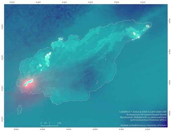
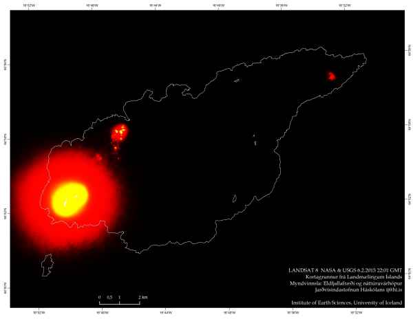
The Iceland Met Office released a Landsat 7 thermal image taken on 5 February with enhances thermal areas to show the active areas of the flow, and an unprocessed image showing the highest temperatures of the Holuhraun lava field.
Mc Murdo Base Antarctica February 8 (Armand)
The website http://www.e-musing.net/ shows a video showing ash/steam explosions of an Antarctic Volcano. The website writes : There are a number of WebCams around the planet. This link http://www.usap.gov/videoclipsandmaps/mcmwebcam.cfm is to the McMurdo Station Website with 3 Camera Tabs available for viewing. As interesting things happen in the shot of each camera I try to capture the images that catch my eye as often as I can. This morning as I opened the page for the McMurdo Pier Camera, I noticed what appeared to be an ash cloud on top of a mountain in the distance, so I have taken a series of image captures and put together a film clip of the eruption. I can’t find any information about this particular volcano. I am reasonably sure from the angle/direction the camera is facing that this is not Mt Erebus.
Volcano activity of the world (last 7 days) – February 5, 18:53 UTC (Armand)
Bulletin collected and published by the Smithsonian Institute
Colima | Mexico
Based on webcam views and satellite images, the Washington VAAC reported that on 29 January a brief emission from Colima with low ash content drifted 30 km SW. The next day a few brief emissions rose from the crater and dissipated about 37 km SW. In a 2 February bulletin, the Unidad Estatal de Protección Civil reported that Colima remained active, although there was a slight decrease in the number and size of lava-block avalanches. Lava flows on the SW and WNW flanks minimally advanced, and small landslides of lava blocks were observed. Residents were warned not go within 5 km of the volcano.
Etna | Sicily (Italy)
INGV reported that a new eruptive episode at Etna began on 31 December and lasted through the morning of 2 February. Poor meteorological conditions prevented views of the summit area during the first 36 hours of the eruption. During improved viewing conditions on the evening of 1 February, volcanologists observed Strombolian activity from a single vent in the saddle between the cones of the Southeast Crater (SEC). Explosions occurred every few seconds and ejected incandescent bombs 200 m high. At the same time a vent at the base of the southern SEC cone issued a lava flow that traveled 2 km S, dividing into two branches. At dawn on 2 February the Strombolian activity produced a dense ash cloud that drifted E. At about 0550 emissions stopped and volcanic tremor suddenly decreased.
Karymsky | Eastern Kamchatka (Russia)
KVERT reported that during 23-30 January a moderate explosive eruption at Karymsky continued. Satellite images showed a daily thermal anomaly over the volcano, and ash plumes that rose 3.5-4 km above the crater and drifted 160 km E and N during 21-23 and 27 January.
Klyuchevskoy | Central Kamchatka (Russia)
KVERT reported that during 23-30 January a Strombolian and Vulcanian eruption at Klyuchevskoy continued. Incandescence at the summit was visible and bombs were ejected 200-300 m above the crater. Explosions generated ash plumes that rose to altitudes of 6-7 km (19,700-23,000 ft) a.s.l.; ashfall was reported in Klyuchi Village (30 km NNE) and near the Khapitsa River on 27 January, and in Kozyrevsk Village (50 km W) on 28 January. A lava flow effused onto the E flank; phreatic explosions at the lava flow front produced gas-and-steam clouds with minor amounts of ash that rose 7-8 km (23,000-26,200 ft) a.s.l. during 27-28 January. Satellite images showed a daily, big, bright thermal anomaly over the volcano, and ash-and-gas plumes drifting 300 km W, N, NE, E, and SE at altitudes of 5.5-7 km (18,000-23,000 ft) a.s.l. The Aviation Color Code remained at Orange.
Pacaya | Guatemala
In a special notice INSIVUMEH reported that on 28 January ash emissions originating from Pacaya's Mackenney Crater drifted 4 km S and SW. During field observations, scientists saw a defined central crater, 40-50 m in diameter, and ash emissions. Gas plumes rose from an area on the S flank. Seismic data was characterized by tremor and low-frequency events. In a report from 1 February, INSIVUMEH stated that low-altitude water vapor plumes with minor amounts of ash drifted W and SW. During 1-2 February fumarolic plumes rose 50 m and drifted 600 m S.
Ruapehu | North Island (New Zealand)
On 30 January, GeoNet reported that water temperatures of Ruapehu's summit Crater Lake had been increasing since early December 2014, rising from 15 degrees Celsius to over 40. Similar temperatures were recorded in March 2011 and April 2014, before the lake cooled.
Data from a field visit on 14 January showed increased amounts of volcanic gas emissions through the lake. Other recent observations from pilots and field visits confirmed that the lake changed color from blue green to light gray due to lake convection. A GeoNet volcanologist noted that lake temperature cycling was not unusual; five heating cycles have been detected since 2010. The Aviation Colour Code remained at Green and the Volcanic Alert Level remained at 1 (signs of volcano unrest).
Soputan | Sulawesi (Indonesia)
Based on statements from PVMBG, the Darwin VAAC reported that on 2 February an ash plume from Soputan rose to an altitude of 6.1 km (20,000 ft) a.s.l. A thermal anomaly was visible in satellite images; ash was not visible at the reported altitude, but possible ash was detected to the N at 3 km (10,000 ft) a.s.l.
Piton de la Fournaise, Réunion, France outre Mers - February 4, 15:43 UTC (Armand)
The eruption as stated by the tweet of CultureVolcan is still ongoing at the time of writing this update. You can follow the LIVE webcam captures here
#volcan #volcano #PitondelaFournaise l'éruption se voit aussi du Piton Basaltes/Eruption seen on a western webcam pic.twitter.com/n6EMRBCNob
— CultureVolcan (@CultureVolcan) February 4, 2015
Vidéo : les images de l'éruption au #Piton de la #Fournaise http://t.co/JpsgNwfOs5 #pitondelafournaise pic.twitter.com/pqNCIwdx2o
— Réunion 1ère (@Reunion1ere) February 4, 2015
Shiveluch, Kamchatka - February 3, 12:40 UTC (Janine)
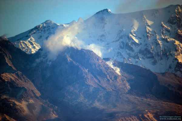
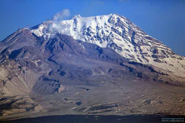
KVERT reports continuing activity at Shiveluch with growth of the lava dome, moderate ash explosions, fumerolic activity, hot avalanches, and a thermal elevation and incandescence of the dome.
Shishaldin, Alaska - February 3, 12:30 UTC (Janine)
AVO reports elevated surface temperatures at the summit over the past 24 hours. Low-level eruptive activity continues with minor ash emission and elevated seismicity.
Bardarbunga, Iceland - February 2, 09:26 UTC (Armand)
#Bardarbunga 2014- = 1.3 km3 #Grímsvötn 2011 = 0.25 km3 #Eyjafjallajökull 2010 = 0.16 km3 Thankfully the ongoing eruption isn't subglacial
— Univ. of Iceland (@uni_iceland) February 1, 2015
Aso, Japan - February 2, 09:19 UTC (Armand)
Mt Aso in ash venting mode now #volcano #Japan pic.twitter.com/ODYRVe6DtM
— James Reynolds (@EarthUncutTV) February 2, 2015
Etna; Sicily - February 2, 09:10 UTC (Armand)
#volcan #volcano #Etna belles et chaleureuses lumières ce matin/nice sweet and warm colors in the morning pic.twitter.com/DI6GE86YUl
— CultureVolcan (@CultureVolcan) February 2, 2015
Etna; Sicily - January 31, 21:12 UTC (Armand)
#volcan #volcano #Etna l'éruption continue, dans les nuages/eruption still ongoing... in the clouds pic.twitter.com/d7APtTLJ7h
— CultureVolcan (@CultureVolcan) January 31, 2015
Bardarbunga, Iceland - January 31, 10:30 UTC (Armand)
@NASA_Landsat 8 night view of Holuhraun eruption shows where the lava is flowing. The vent was covered by plume
Volcano activity of the world (last 7 days) – January 29, 17:43 UTC (Armand)
Bulletin collected and published by the Smithsonian Institute
 Colima | Mexico
Based on news articles, an explosion at 0713 on 21 January generated an ash plume that rose 4 km and drifted E. Ashfall was reported in Huescalpa (25 km NE), Tuxpan (25 km ENE), Zapotiltic (23 km NE), Vista Hermosa, Atenquique (20 km E), and Mazamitla (78 km NE). On 23 January authorities restricted access to the Parque Nacional Nevado de Colima citing increased activity during the previous days. The next day an ash plume rose 500 m and was followed by another ash plume that rose 700 m. Two ash plumes on 26 January rose as high as 1 km.
In a 24 January bulletin, the Unidad Estatal de Protección Civil reported that Colima remained active, although there was a slight decrease in the number and size of lava-block avalanches. Lava flows were active on the W and WNW flanks, and explosive activity was low to moderate. The recent explosions had partially destroyed the lava dome. Residents were warned not go within 5 km of the volcano.
Hunga Tonga-Hunga Ha'apai | Tonga Islands
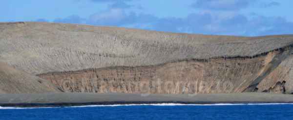
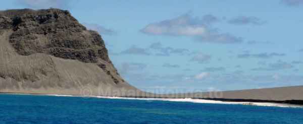
According to a news article from 26 January, the newly-formed island at Hunga Tonga-Hunga Ha'apai was about 120 m high, 1.5 km wide (N-S), and 2 km long (W-E). The island was an estimated 1 km in diameter with a crater that was 400-500 m in diameter. It had joined Hunga Ha’apai to the W and was 150-200 m short of joining Hunga Tonga to the N. The article noted that the eruption had decreased during the previous week; there were no longer emissions rising from the vent.
Karymsky | Eastern Kamchatka (Russia)
KVERT reported that during 16-23 January a moderate eruption at Karymsky continued. Satellite images showed a thermal anomaly over the volcano during 18-22 January, and ash plumes that drifted 65 km E at an altitude of 5 km (16,400 ft) a.s.l. during 19-22 January.
Klyuchevskoy | Central Kamchatka (Russia)
KVERT reported that during 16-23 January a Strombolian and Vulcanian eruption at Klyuchevskoy continued. A lava flow effused onto the SE flank. Incandescence at the summit was visible and bombs were ejected 200-300 m above the crater. Explosions generated ash plumes that rose to altitudes of 6-7 km (19,700-23,000 ft) a.s.l.; ashfall was reported in Klyuchi Village (30 km NNE) on 21 January. Satellite images showed a daily, big, bright thermal anomaly over the volcano, and ash plumes drifting 210 km SW, NW, and NE at altitudes of 5-6 km (16,400-19,700 ft) a.s.l. The Aviation Color Code remained at Orange.
San Miguel | El Salvador
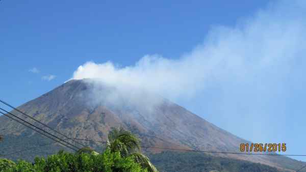
SNET reported that at 0643 on 26 January a small explosion at San Miguel generated a plume that rose 300 m and quickly dissipated to the W. Local residents reported hearing rumbling and feeling tremor during the explosion. Minor ashfall was reported SW of the crater.
Sangay | Ecuador
Based on a pilot observation, the Washington VAAC reported that on 25 January an ash plume from Sangay rose to an altitude of 7.3 km (24,000 ft) a.s.l. Weather clouds prevented satellite image confirmation of the plume, although a thermal anomaly was detected which continued through the next day.
Soputan | Sulawesi (Indonesia)
Based on analyses of satellite imagery and wind data, the Darwin VAAC reported that on 21 January an ash plume from Soputan rose to an altitude of 3.7 km (12,000 ft) a.s.l. and drifted over 35 km SW.
Bardarbunga, Iceland - January 29, 16:24 UTC (Armand)
New map of the Holuhraun magma fields. Layer after layer have created a thickness until 40 meter
Sabancaya, Peru - January 28, 12:45 UTC (Janine)
VT seismicity associated with rock fracturing continues with an average of 122 events per day, located 14 km NNE of the crater. Some events have been felt by nearby residents. The occurrence of hybrid earthquakes associated with the presence of magmatic material has increased in the past three days. Tremor events have increased in number and in power over the past three days and LP events associated with fluid movement have decreased. Fumerolic emissions are intermittent with a decrease in emission height. No thermal anomalies have been detected by satellite monitoring. These events are interpreted to be a result of the disturbance of the hydrothermal system by magmatic intrusion.
Fogo, Cape Verde - January 28, 12:25 UTC (Janine)
Activity continues two months after the eruption commenced with an active lava flow front moving an average of 1.5 m per hour, progressing ~15 m in the past 12 hours. The Uni-CV team believes the flow may be moving through lava tunnels, with the front now 1500 m from the vent. Activity at the vent continues with degassing and explosions.
Nevado del Ruiz, Colombia - January 28, 12:00 UTC (Janine)
The Servicio Geológico Colombiano’s (SGC) Observatorio Vulcanológico and Sismológico de Manizales reports the continuation of VT seismic activity associated with rock fracturing within the volcano, occurring mainly to the north, northeast, southeast, and near the Arenas crater at depths between 1.0-9.0 km. Seismic activity associated with fluid dynamics in the conduit and gas (including water vapor and sulfur dioxide) and ash emission is also being recorded. An ash column reached 1500 m above the crater, mainly white but with some grey indicating the presence of ash.
Shiveluch, Kamchatka - January 28, 01:10 UTC (Janine)
KVERT reports that a thermal anomaly remains over the active dome accompanying incandescence, fumerolic activity, and moderate ash explosions.
Klyuchevskoy, Kamchatka - January 28, 01:10 UTC (Janine)
KVERT reports the continuation of strombolian and vulcanian activity producing ash and incandescence at the summit.
Chaparrastique/San Miguel, El Salvador - January 27, 20:40 UTC (Janine)
MARN reports a small explosion yesterday ay 6:43 am local time. The presence of ash in local areas was confirmed by volcanologists and the below photo was taken showing gas emission from the crater.
Shiveluch, Kamchatka - January 26, 20:40 UTC (Janine)
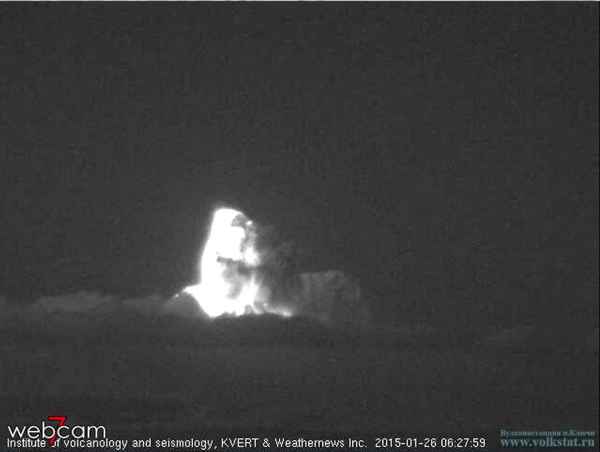
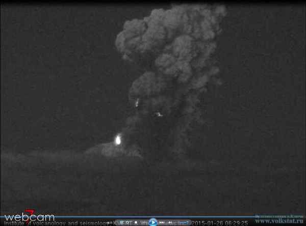
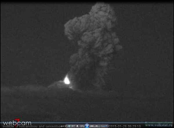
Volkstat.ru reports an eruption at Shiveluch today at 18:25 local time producing an ash column to 8 km and lightening as seen in the black and white infrared images below. The eruption is due to the explosive dome growth and collapse that is ongoing at Shiveluch.
Hunga Tonga-Hunga Ha’apai, Tonga - January 26, 13:45 UTC (Janine)
Tonga's news website Matangi reports that there is currently no sign of activity. The islands dimensions are 120 m high, 1.5 by 2.0 km in size, with crater diameter estimated to be 400 - 500 m. They have released the following images of the new crater, taken on 24 January.
The following image shows the growth of the island from 2 July 2014 to 19 January 2015, courtesy of Airbus Defence and Space.
Nishinoshima, Japan - January 26, 13:30 UTC (Janine)
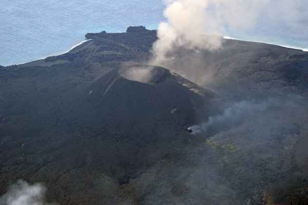
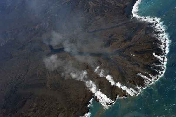
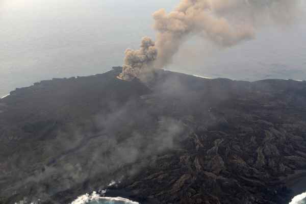
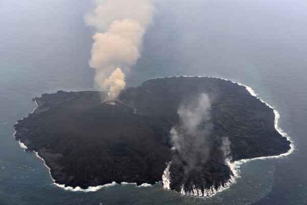
Nishinoshima continues to add to the young island off the Coast of Japan. The following photos and video have been released by the Japan Coast Guard Hydrographic and Oceanographic Department on January 21.
Klyuchevskoy, Kamchatka - January 26, 13:00 UTC (Janine)
KVERT reports the continuing strombolian and vulcanian activity at Klyuchevskoy with observed incandescence and ash explosions. Satellite data shows a bright thermal anomaly at the summit. The below photos are of activity on 25 January.
Sakurajima, Japan - January 24, 16:00 UTC (Janine)
A video has been released of an explosion at Sakurajima ejecting incandescent material and an ash plume to 4000 m.
Shishaldin, Alaska - January 24, 14:15 UTC (Janine)
The Alaska Volcano Observatory (AVO) has released a weekly update for Shishaldin reporting low level activity that has increased over the past 2 days. Satellite images show strongly elevated temperatures that are consistent with lava in the crater. Seismicity is slightly above background levels and small explosions at the crater have been indicated by ground-coupled air waves. This activity is consistent with the observations over the past months that has included lava effusion and small volumes of ash that deposit onto the volcano.
Karymsky, Kamchatka - January 24, 14:10 UTC (Janine)
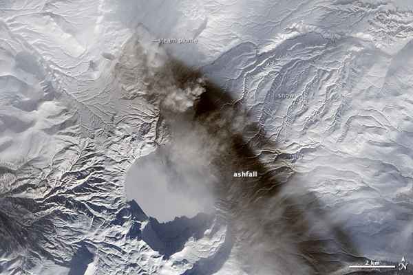
KVERT has reported moderate seismic activity and a thermal anomaly at the summit as seen in satellite data. NASA Earth Observatory released the following image that was acquired on 18 January. Visible in the image is a steam plume coming from the vent, and ashfall deposits to the southeast.
Kilauea, Hawaii - January 23, 12:35 UTC (Janine)
The Hawaii County Civil Defense reports that the original flow front remains stalled. The northern breakout is widening but showing little advancement since yesterday. Two other breakouts along the northern side show little activity and no visible advancement, as well as a number of breakouts along both flow margins and within the flow. There is no current threat to communities.
Shishaldin, Alaska, USA - January 23, 12:30 UTC (Janine)
The Alaska Volcano Observatory (AVO) reports 'strongly elevated' temperatures at the summit seen in satellite images acquired last night. This is possibly indicating lava in the crater. Light ash fall was seen on the upper snowy flanks through the webcam.
FYI - January 22, 15:29 UTC (Armand)
We have archived a big chunk of this article. See link at the bottom of this page
Sabancaya, Peru - January 22, 13:00 UTC (Janine)
The Geophysical Institute of Peru (IGP) Southern Volcano Observatory (OVS) reports a disturbance in hydrothermal systems due to minor magmatic intrusion under Sabancaya volcano. The intrusion is generating seismic activity. Activity may increase over the next few days but no violent explosive activity is expected unless the situation changes. The increase in seismic activity has resulted in some earthquakes felt by nearby residents of Maca and Pinchollo.
Bardarbunga, Iceland - January 22, 12:25 UTC (Janine)
A surveillance flight with the Icelandic Coast Guard was taken yesterday to assess the volcano. The Icelandic Met Office released the photo below showing the southern end of the rampart with the active lava lake and gas emissions. Results of this flight are pending. The Institute of Earth Sciences processed the NASA EO-1 satellite image below showing the flow field topography with enhanced active areas. The field is now 84.7 km² in size.
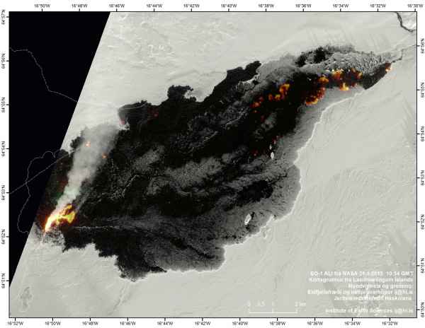
NASA EO-1 image acquired on 21.1.2015, processed by the Institute of Earth Sciences. Courtesy of the Icelandic Met Office.
Colima, Mexico - January 21, 16:25 UTC (Janine)
An explosion occurred at 9:13 am (local time) this morning and was recorded on the webcam:
GIF of the Colima #volcano explosion this morning RT @webcamsdemexico: 9:13 am pic.twitter.com/Zv8Ngptqg9
— Janine Krippner (@janinekrippner) January 21, 2015
Fogo, Cabo Verde - January 21, 16:10 UTC (Janine)
Fogo news reports that activity has intensified, with strong explosions producing incandescent pyroclastic material, gas, and ash plumes that reach 300 m. The Uni-CV team thinks that Fogo is now in the declining phase of the eruption, which has now been ongoing for 2 months.
Kilauea, Hawaii - January 21, 12:50 UTC (Janine)
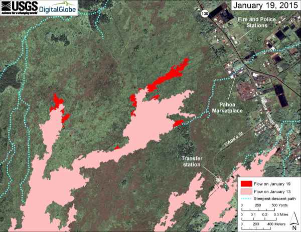
USGS has released an updated lava flow map for the June 27 flow. The Hawaii Civil Defense described a sluggish, disorganized flow, with the northern breakout only advancing 15 yards since yesterday, still 0.4 miles from Highway 130. The vigorous breakout shown in yesterday's video (see below) has slowed down.
Chiles and Cerro Negro, Ecuador/Colombia - January 21, 12:40 UTC (Janine)
Servicio Geológico Colombiano’s (SGC) Observatorio Vulcanológico and Sismológico de Pasto reports a gradual increase in seismic activity in occurrance and energy. There is a possible magma intrusion at depth but there is no change in surface activity recorded.
Cerro Machin, Colombia - January 21, 12:35 UTC (Janine)
Servicio Geológico Colombiano’s (SGC) Observatorio Vulcanológico and Sismológico de Manizales reports continued elevated seismic activity the the southeast of the main dome at depths of 2-10 km. The activity is of volcano-tectonic nature, associated with the fracturing of rock. No other monitoring parameters show any major changes.
Kilauea, Hawaii - January 20, 13:15 UTC (Janine)
Footage of a breakout on the June 27 lava flow was captured on 19 January. The breakout is occurring 1-1.5 miles from the flow front that remains stalled.
Fuego, Guatemala - January 20, 13:10 UTC (Janine)
INSIVUMEH have been recording 4-5 explosions per hour among weak, moderate, and strong plumes reaching an average altitude of 4,300 to 4,700 m and dispersing between 10 to 12 km to the west. Some homes near the volcano are feeling the shock waves produced by explosions. Weak avalanches continue down to the vegetation line.
Aso, Japan - January 20, 13:00 UTC (Janine)
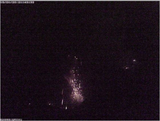
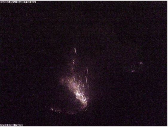
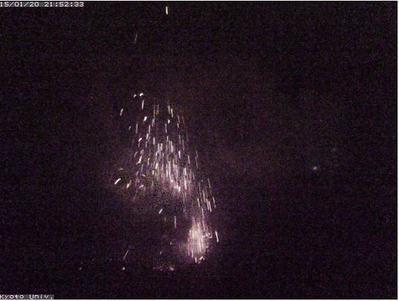
Strombolian activity continues and is visible on the Kyoto University webcam. You can see incandescent material being thrown from the vent as gas bubbles burst at the surface.
Bardarbunga, Iceland - January 19, 13:40 UTC (Janine @janinekrippner)
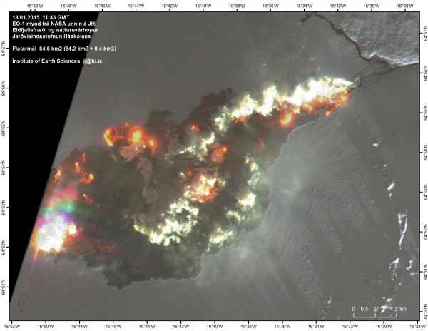
The Institute of Earth Sciences has released an image of the lava field, enhanced to display the active areas of the flow. The field is now 84.6 km².
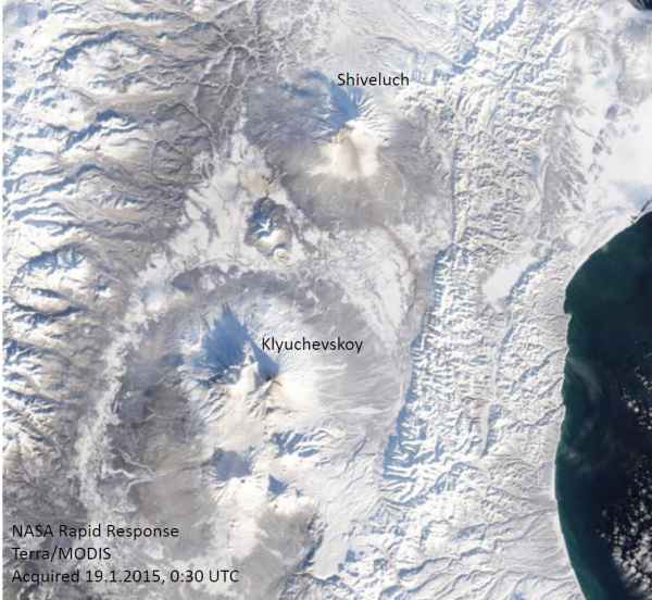
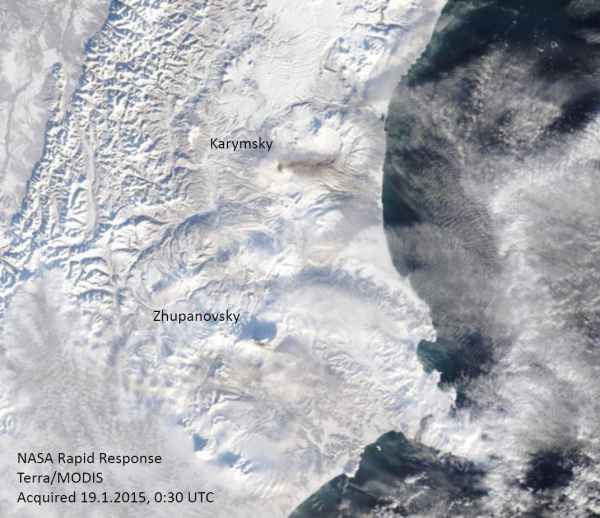
Shiveluch, Klyuchevskoy, Karymsky, and Zhupanovsky, Kamchatka - January 19, 11:15 UTC (Janine)
The below NASA Rapid Response Terra/MODIS image acquired today shows fresh deposits on the four volcanoes. Tokyo VAAC has issued ash advisories for all four.
Hunga Tonga-Hunga Ha'apai, Tonga - January 18, 15:20 UTC (Janine)
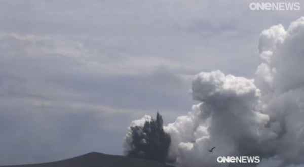
New Zealand volcanologists are investigating the ongoing eruption. The video shows white steam plumes and dark grey jets that are a result of the lava coming into contact with sea water, depositing wet, heavy ash around the vent.
See video here
Sinabung, Indonesia - January 18, 14:55 UTC (Janine)
The Indonesian National Agency for Disaster Management reports continued high levels of activity at Sinabung. The Darwin VAAC has issued a volcanic ash advisory. High seismic activity includes low-frequency events and constant tremor, and incandescent lava can be seen at the summit. 2,443 people continue to be displaced after leaving their homes in September 2013.
Soputan, Indonesia - January 18, 14:45 UTC (Janine)
The Darwin VAAC has released a volcanic ash advisory for a 4000 m ash plume. The Indonesian National Agency for Disaster Management reports thick white emissions up to 600 m above the crater, and strombolian eruption heights of 500 m above the crater scattering incandescent material around the vent. Seismic activity is very high. Soputan is on Alert level 3 and it is recommended that people stay further than 6.5 km away from the summit.
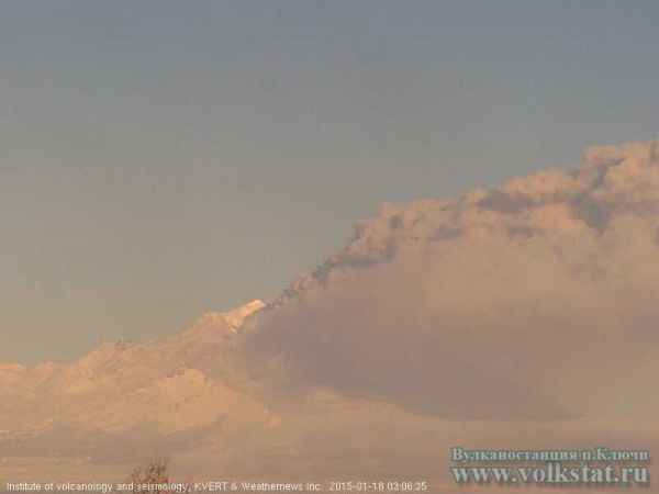
Shiveluch, Kamchatka - January 18, 14:30 UTC (Janine)
KVERT reports an eruption at Shiveluch producing an ash plume up to 5000 m (16,400 ft), moving to the southeast.
Aso, Japan - January 17, 14:30 UTC (Janine)
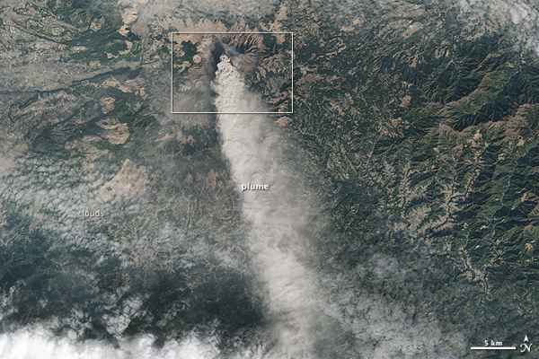
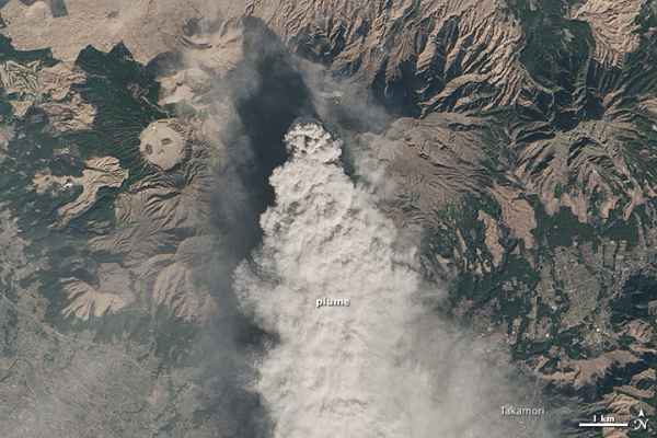
The NASA Earth Observatory has released an OLI Satellite image of an ash plume from Aso volcano, acquired on 13 January.
Bardarbunga, Iceland - January 17, 14:11 UTC (Janine)
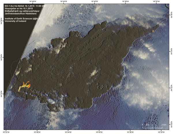
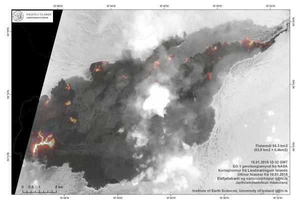
Yesterday's scientific advisory board reported a current rate of lava effusion of 50-70 m³ per second. Seismic activity continues to be strong, although is weaker than the first few months of the eruption. High sulfur dioxide levels are still being recorded. The latest EO-1 ALI satellite image from the Icelandic Met Office with an up to date lava field outline is below.
Bardarbunga, Iceland - January 16, 10:50 UTC (Janine)
The Icelandic Met Office has released a new EO-1 ALI satellite image showing the current active areas of the lava field. The lava field is now 84.3 km².
Kilauea, Hawaii - January 16, 00:50 UTC (Janine)
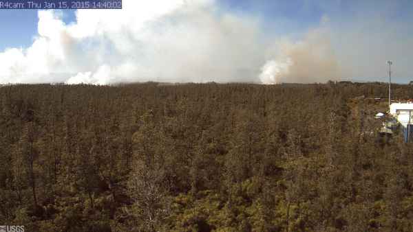
A breakout on the June 27 lava flow, 700 m (765 yards) upslope from the current flow front, is situated to become the new flow front. The breakout has been advancing at a rate ~180 m (200 yards) per day over the past 48 hours and is now ~965 m (0.6 miles) from Highway 130, is currently west of the police and fire stations. The two breakouts 1.6-2.4 km (1-1.5 miles) upslope remain active along the path of steepest descent that leads to Highway 130, moving at a slower rate of ~46 m (50 yards) per day. Bush fires are burning an area about 10 acres in size. Heavy vog (volcanic fog) and smoke are present in the lower Puna area and throughout Hilo.
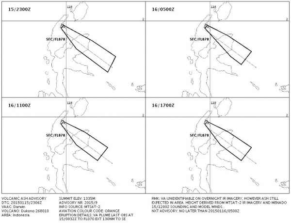
Dukono, Indonesia - January 16, 00:30 UTC (Janine)
The Darwin VAAC has released (another) ash advisory. Explosive activity continues.
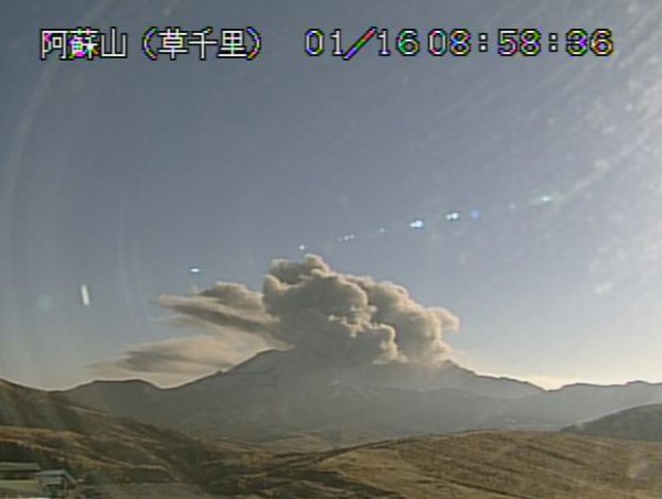
Aso, Japan - January 16, 00:15 UTC (Janine)
Eruptive activity continues, with Tokyo VAAC releasing a volcanic ash advisory. The current view from one of the Aso volcano webcams is shown below.






Deadly earthquake off the coast of Chiapas, Mexico - At least 97people killed - all Tsunami threats cancelled
Leave this page open in a browser tab as it will refresh automatically every 30 minutes Damage report in cooperation with the 2017 Earthquake Impact Database - EID on Google Docs - Special overview for this earthquake – Update 22:34 UTC: The Mexican authorities have increased the number of fatalities from 90 to 96 earlier [...]