With the collaboration of Carlos Robles, Jens Skapski, Julie Jaramillo and Pieter Nierop
–
This is the OLDEST part of the DEADLY EARTHQUAKE in BOHOL, PHILIPPINES.
CLICK HERE TO READ THE LATEST UPDATES
Update 22:53 UTC : No new updates from NDRRMC. they will surely follow the coming hours. Some local reports are mentioning that there are still a number of people buried in the rubble.
- The Abatan Bridge that connected Maribojoc to Tagbilaran City collapsed
- The highway in Cortes particularly in Lilo-an was rendered impassable due to a landslide. A part of Cortes’ highway was also damaged.
- The Municipal hall in Sagbayan was destroyed while the municipal hall in Clarin was damaged.
Update 18:04 UTC : Bohol has been no stranger to major earthquakes through history. Since 1900, 1922, 1926, 1950 and 1990 saw damaging earthquakes in the CATDAT damaging earthquakes database. The 1990 earthquake caused 7 million USD damage and 6 people died.
On this occasion however, 400 year old churches have been damaged, meaning that it is likely the strongest earthquake to have hit the region since. The death toll remains currently at 97.
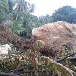
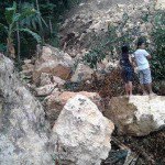
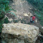
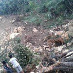
The landslides images below from landslides in Delmonte, Alicia, Bohol have been taken by Julie Jaramillo. We thank Julie for sharing them with earthquake-report.com. You can imagine that if you get caught is such a landslide, you have to be the most lucky person in the world to escape the brutal force. Click on the picture to see them in full format.
Update 16:34 UTC : More than 9,000 people living on Bohol island are displaced due to earthquake
Update 16:19 UTC : The death toll increased to 97. Most of the casualties have been reported from Bohol (the island of the epicenter) The number of dead in Bohol alone has reached 87. In Cebu, 9 have died, while one fatality was reported in Siquijor.
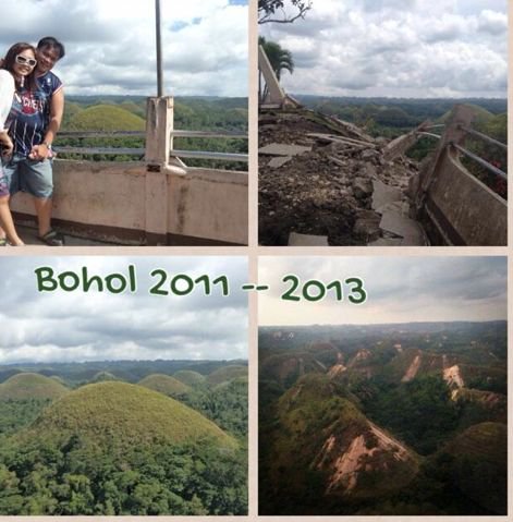
Image courtesy @docjolt
Update from a Cebu inhabitant : "hoping to be able to sleep tonight.. 37 felt over 400+ reported aftershocks.. ready to cmgo the second another hard one hits #cebu and bohol"
An experience report from one of our readers who is illustrating the hectic situation when an earthquake strikes :
Cebu City : At the office. 2nd floor. Just started with the work routine. Then the rumbling and shaking. From slow to very strong. Fast. As if on cue, in seconds, everyone stood up from their cubicles, leaving everything (including cellphones and bags). The shaking and rumbling went on and on and on. Dragging our feet, hands forward to persons in front. Shouting Go! Go! Go! Felt like the floors would fall and crumble anytime. Cement chips falling. Rumbling got louder. Shaking, strong. Out is all we care.
Update 13:55 UTC : The video below shows the shaking in Cebu City. To understand the shaking on Bohol Island you should at least double the shaking factor. only the 40 first seconds of the video are useful.
Keep an eye on the dog who runs out while the shaking is going on. He is suddenly aware that his friend, brother, sister - who knows, is still in the building and is running inside again to get him away. A little later they are exiting both. This must be true love :)) BUT as a human being you should NEVER do the same, otherwise you may end in the earthquake statistics. What to do if an earthquake strikes ? Click here !
Update 12:24 UTC : The NDRRMC reports that more than 400,000 families have been affected by the earthquake (can be in different ways, damaged and inhabitable houses, etc etc)
Update 12:13 UTC : Some fatality reasons as reported by the NDRRMC + damages is also reported in seaports and airports, government buildings, hospitals, schools, and other infrastructure, mostly in Bohol and Cebu.

Update 11:43 UTC : Most resorts on Cebu have received minor damage, but only 9 are dead on Cebu according to latest death tolls.
Update 11:40 UTC : 10 churches have been damaged or destroyed some of which are over 400 years old.
Update 11:34 UTC : The predicted economic loss due to CATDAT/James Daniell modelling historical events is expected to be around 4 billion PHP (or around 89.4 million USD) looking at the intensity and buildings affected. There is a significant range around this estimation at this point.
Update 11:28 UTC : The death toll has sadly risen to 93. Many of these deaths have occurred in a collapsed hospital (Congressman Castillo Memorial Hospital at the Loon municipality on Bohol, and due to landslides.
Update 11:15 UTC : We are still at around 73 dead being reported, although reports of 85 dead are also being seen. 89.7 million PHP (around 2 million USD) has been earmarked for the people affected in terms of food and family packs.
Update 11:12 UTC : Using the USGS intensity shakemap with the new magnitude of M7.1 and 20km depth, the fatalities through our theoretical model just through shaking come to around 65 to 100 (assuming 40% to 60% of people inside at the time of the event). It is expected that many will also be killed due to landslides. The economic losses should be in the order of 1-2 billion PHP, but a more detailed analysis will be available soon.
Update 10:53 UTC : Hardest hit areas are Tagbilaran City (Bohol and island of the epicenter) and Cebu City.
Update 10:32 UTC : BBC now reports 73 fatalities. our initial estimates where linked to an intermediate depth of 57 km. After decreasing it to 20 km (USGS) the picture turned a lot grimmer. Closer to the surface means stronger shaking.
Update 10:32 UTC : Sad News : NDRRMC says the death toll from today's earthquake has reached 67; about 167 others were injured.
Update 09:43 UTC : What some people are not aware of is that the epicenters of the aftershocks (sometimes very powerful aftershocks) are distributed in a large area. In other words this whole area is relatively unstable and people living in this area should be prepared for powerful (even damaging) aftershocks. As you can see on the map below, some of the aftershocks are almost below Cebu!
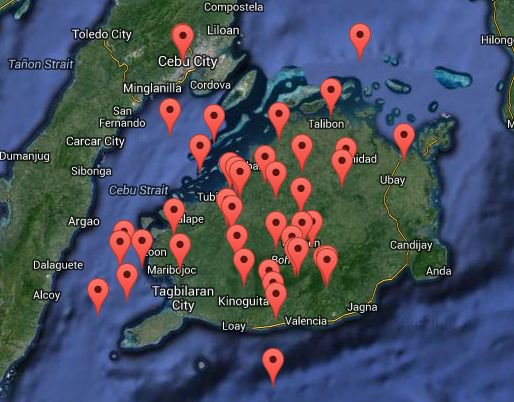
Mainshock and aftershocks epicenters
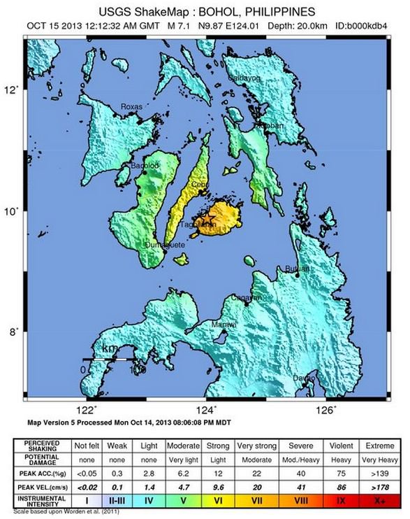
Update 09:32 UTC : USGS has manually revised the Magnitude and hypocenter depth of the earthquake. They are now reporting M7.1 at a shallow depth of 20 km. Max. shaking : MMI VIII. they have also published a new shaking map based on these data
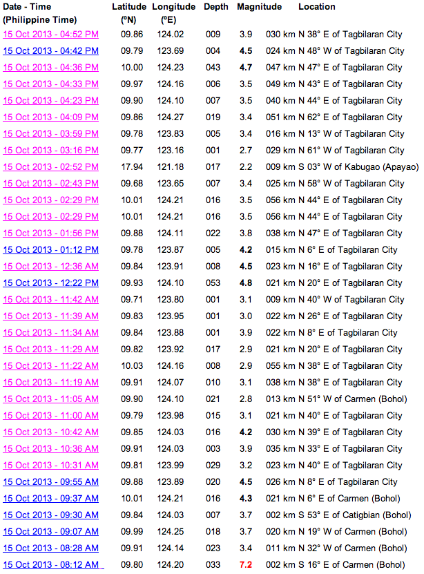
Update 09:32 UTC : Below an interesting overview of the mainshock and the strongest aftershocks as reported by PHIVOLCS (Philippines Seismological Agency)
Update 09:21 UTC : Many readers are reporting that the earth continues to shake. This may go on for days, even weeks /months. The number of aftershocks will gradually decrease as well as the strength BUT a couple of big aftershocks (+M6) are a real possibility. So be prepared for the next one. Click here to read our Preparedness Rules (internationally convened rules)
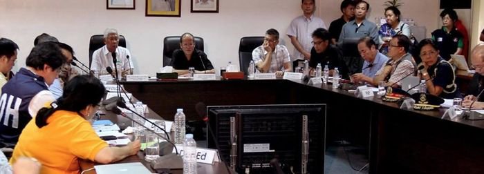
Briefing of the NDRRMC , the department who deals with natural disasters
Update 08:39 UTC : The Bohol earthquake is exactly like most of the other damaging earthquakes = press is getting reports from independent sources and is adding them up and the authorities are reporting lower numbers as they want to be certain that they are not double counting. That said, this is the latest update of the authorities : 28 dead and 159 injured
Update 08:23 UTC : The video below was recorded by a would be reporter / journalist, who jumped in his car after the earthquake and did upload the result a little bit later on YouTube. Social media information gathering 3.0 !
Update 08:12 UTC : Well informed Philippines newspaper GMA now reports "at least 32 people killed"
Update 07:58 UTC : Both telco providers stressed that they are also watching out for power disruptions.
"Smart's mobile phone service in Bohol and Cebu remains largely operational despite the damage inflicted on some cell sites and network facilities. Residents in affected areas, as well as rescue and relief groups, may access Smart stations offering free call services and mobile phone charging.
Update 07:40 UTC : - Several government agencies and the Philippine Red Cross were ordered to submit damage assessment reports before 5 p.m. Tuesday, the chairperson of the National Disaster Risk Reduction and Management Council (NDRRMC) said.
- President Aquino to go to Cebu, Bohol tomorrow; says his trip to South Korea will push through on Thursday
- Bohol and Cebu provinces are now under State of Calamity.
- Cesar Lopez (A Bohol board member) : As of 1:00PM, 26 dead in various areas in Bohol. 106 persons wounded. ER : if we add the fatalities in Cebu, the total comes closer to 40.
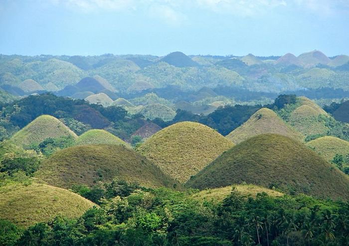
- One of the Chocolate Hills (A National Geological Monument) got hurt by a landslide
- 10 iconic churches in Bohol, Cebu have been severely damaged. These churches are National Heritage treasures and people do hope that they will be rebuild
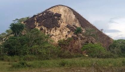
Update 06:15 UTC : In Balilihan, the Bohol Mayor, Dominisio Chatto has confirmed that 5 people died from a landslide due to the earthquake. As said earlier, it is expected that around 10-20 fatalities due to shaking will occur, and based on historic events, at least the same with landslide deaths. This brings the death toll presuming no double counting to at least 25.
We are still waiting on more information from the Chocolate Hills region and Carmen.
Update 05:35 UTC : The National Disaster Risk Reduction Management Council (NDRRMC) in a press briefing said 33 others were reported injured during the earthqauke. The report said 19 people were injured in Mandaue City when a portion of the public market collapsed, six in Toledo City and eight in Pinamungahan were injured in a stampede.
Update 05:20 UTC : A new M5.2 aftershock struck the greater epicenter area. Based on the type of earthquake we expect only aftershocks greater than 5.5 to further damage the area.
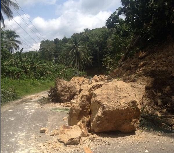
Huge blocks of earth/rocks on the roads - Landslides are always a very dangerous by-product of earthquakes
Update 05:04 UTC : 110 aftershocks hit Bohol 3 hours after magnitude 7.2 mainshock. Not all of them have been felt by people. Phivolcs reported a little earlier that the strongest aftershock measured 4.6. We are convinced that some powerful ones might still happen.
Update 04:53 UTC : A school partially collapsed in Talisay city.
Update 04:31 UTC : The Chocolate Hills viewing tower has collapsed. Sea travel has been suspended.
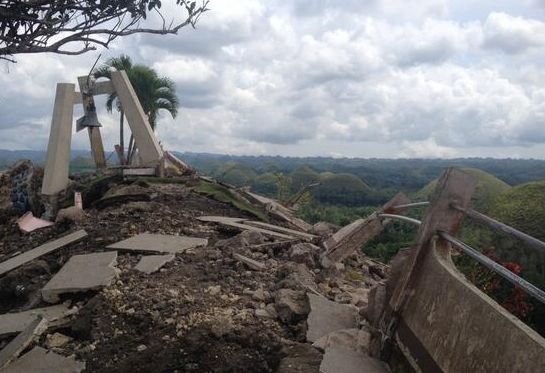
Red Cross Emergency Numbers: Cebu Chapter 032- 4124140 | 09209294645 and Bohol Chapter 038-5019175 | 09209031793 @RedCrossCebu
Update 04:11 UTC : The number of 20 fatalities has now been confirmed by the authorities : The National Disaster Risk Reduction Management Council (NDRRMC) said 20 people were reported dead in the wake of the quake: 15 in Cebu, 4 in Bohol and one person in Siquijor.
Update 04:09 UTC : Unofficial reports are mentioning a far higher death toll : 20 in total (15 in Cebu, 4 in Bohol, 1 in Siquijor)
Update 03:53 UTC : Earthquake-Report.com does thank the Filipinos who have shared their experience with other Filipinos and with the rest of the world. Important to know however is that we have not yet received 1 experience report from Bohol itself. This means that the damage on the island must be big and that many communications are still down.
Update 03:45 UTC : So far we have no news of Carmen, the location very near the Chocolate Hills. Carmen has a population of 43,579 ! Phivolcs puts the epicenter almost below the city !. It is very complicated for seismologists to calculate the exact location of the epicenter. An error margin of several km is normal.
The greater earthquake area hosts a famous geological treasure, The Chocolate Hills (see below). The Chocolate Hills is a National Geological Monument and was proposed for inclusion in the UNESCO World Heritage List.
Update 03:33 UTC : The fault who generated today's earthquake is probably the East Bohol Fault (see on the map below). More research has to be made (and will be made) to determine what triggered the earthquake.

Update 03:30 UTC : According to the local ABS-CBN news network in the Philippines, at least 9 people were killed during the earthquake.
Update 03:15 UTC : So far NO word of Balilihan, a city with 17000 inhabitants and only a couple of km from the epicenter. Sevilla, another location very close to the epicenter has about 10,000 inhabitants. Tagbilaran City, a city within a radius of 30 km from the epicenter has more than 100,000 inhabitants. The island of Bohol has a population of 1.2 million
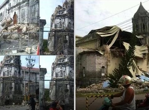
Update 03:05 UTC : At least 5 historic churches have collapsed (Baclayon, Loboc, Dauis; Loay and Loon). We have changed the fatalities in the title back to 4 as the 2 fatalities from Bohol have not yet been confirmed by the authorities
Update 02:50 UTC : The positive news from this earthquake is that the serious damage is not widespread although we have to be cautious as we have seen only few reports from the direct epicenter area. The press conference of the NDRRMC has now started.
Update 02:42 UTC : The Philippines seismological agency Phivolcs is reporting the following I Have Felt It intensities (Philippine scale = a little stronger than the MMI scale) :
Intensity VII - Tagbilaran, Bohol
Intensity VI - Inigaran, Negros Occidental
Intensity V- Iloilo City; La Carlota;
Intensity IV - Masbate City; Roxas City; San Jose, Culasi, Antique; Guihulngan, Negros Oriental
Intensity III - Davao City;
Update 02:31 UTC : The NDRRMC (comparable with the Civil Defense elsewhere) will hold a briefing at 12 noon today (local time) on the effects of the Bohol earthquake.
Update 02:26 UTC : James Daniell has calculated (based on the preliminary data we have received so far) that the damage will be 6-22 million US$, depending on intensity assumed at epicenter - this is a lot for the Philippines. We will give a closer estimate later today when we have more info from each town (= 500-800 million Philippine pesos)
Update 02:18 UTC : The death toll has unfortunately increased from 4 to 6 (Bohol : 2 and Cebu : 4)
Update 02:13 UTC : The economic damage is expected to be huge. The CATDAT engine of James Daniell may be able to give an initial result later today.
Update 02:06 UTC : We are receiving very few reports from the actual epicenter area, which may mean that mobile communication and electricity is down in that area. No new reports on injured and/or fatalities. this is normal so shortly after the earthquake as we are still in the Chaos timeframe.
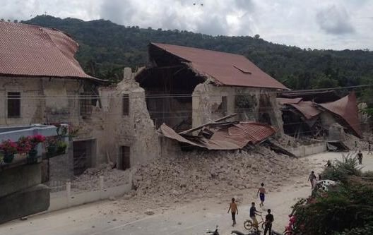
Update 01:53 UTC : Our own CATDAT theoretical model comes out with 10-20 fatalities median due to shaking... Depending on hypocenter. We have also reports of collapsed houses along the coastal roads. The historic buildings of the province have been hardly hit.
Update 01:40 UTC : The initial theoretical injured / fatalities expectation was based on a focal depth of 33 km. It is now 57 km which will bring the number of fatalities down considerably. Another reason to decrease this number is the time of the morning that the earthquake struck. Most people were on the road or at least out of the houses..
Update 01:32 UTC : The picture below shows the kind of damage that we can expect the following hours.
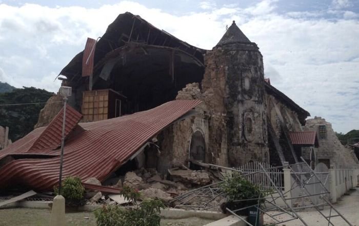
400 year old Bohol church unfortunately collapsed - Image courtesy @Tokyodrastic on Twitter
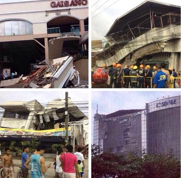
Update 01:32 UTC : Good news from Negros Oriental who is reporting no structural damage.
Update 01:30 UTC : New recalculated data from USGS are locating the epicenter in between Balilihan, Bohol and Sevilla. Also good news is that the depth of the hypocenter is at 57 km instead of the initially reported 33 km. That's a world of difference. The deeper the hypocenter, the less dangerous the earthquake is BUT this also means that the earthquake will be felt in a wider radius.
Update 01:25 UTC : A Initial Focal Mechanism is pointing to a reverse faulting (= a fault who is pushing at both ends towards each other).

Update 01:20 UTC : A 400 year old church in Bohol has collapsed
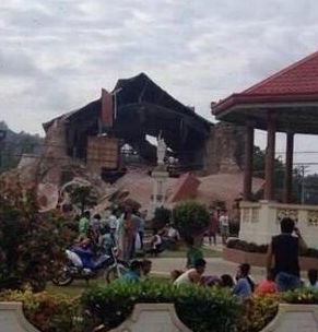
Some ER readers experiences :
Cebu City : I've been in several earthquakes in my life. This was by far the strongest & most frightening. I thought my building would fall down. Many aftershocks continuing every few minutes. Power is out everywhere. Even our generator has not come on yet.
Cebu City : Inside house was totally messed up, school beside my house destroyed.
Update 01:17 UTC : Reports from Bohol are mentioning "roads torn up, electricity cables down..."
Update 01:10 UTC : Reports are giving at least 4 fatalities. Many provincial authorities have suspended classes for today. Also reports of many collapsed houses in Bohol
Update 01:09 UTC : The theoretical damage engine from Max Wyss is giving the following grim results :
ESTIMATE OF HUMAN LOSSES
Injured Exp. min/max: 100/1500
Fatalities Exp. min/max: 0/200
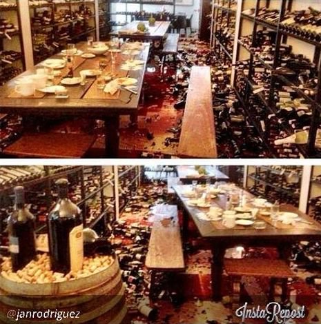
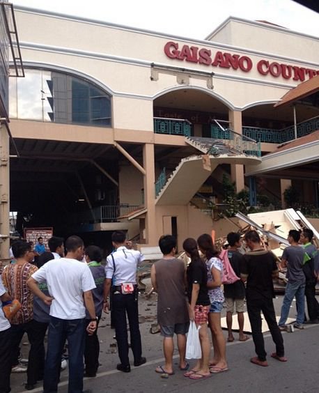
Update 01:04 UTC : The instagram image below comes from Cebu, still a considerable distance from the epicenter (approx. 60 km !)
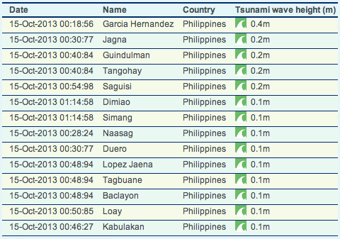
Update 00:59 UTC : GDACS reports that even with an earthquake below land, small tsunami waves may have landed on some shores. The table below gives an indication about their theoretical results :
Update 00:55 UTC : Aftershocks are currently striking the greater epicenter area. Some aftershocks are withing the M6 range and can be damaging from themselves. Expect very much damage, many injured and and also some fatalities.
Update 00:46 UTC : Another very bad sign for potential damage is that the shaking lasted very long. The longer the shaking lasts the more damage can be inflicted. This is one of the most dangerous and strongest earthquakes of the last couple of years.
We receive values of MMI V in Negros.
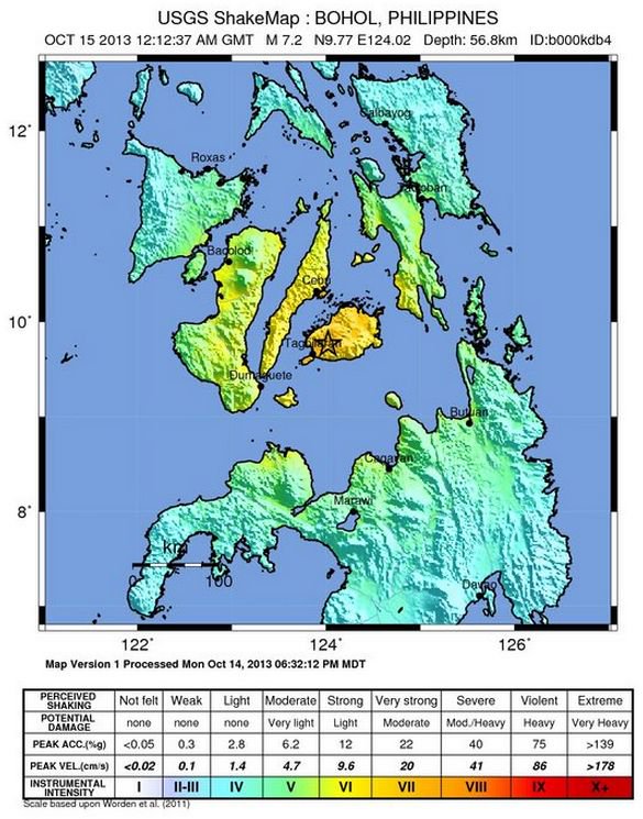
Update 00:42 UTC : Based on theoretical calculations, nearly 3.6 million people should have felt a very strong shaking and 7.6 million people a strong shaking.
Based on the incoming reader reports from places at less then 100 km from the epicenter we are receiving strong shaking values, a little less than the theoretical outcome.
Update 00:32 UTC : It would really surprise us that based on the current data, that there will be no damage, injuries or fatalities. Balilihan , very close to the epicenter has a population of 17000 people
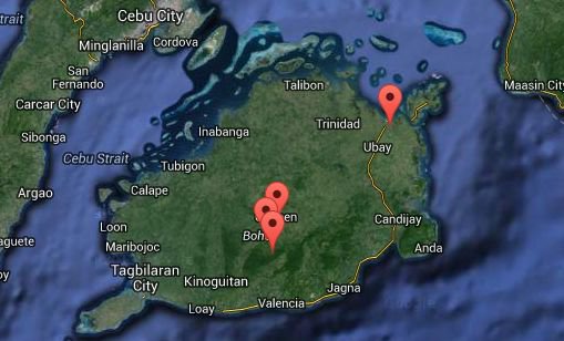
Extremely dangerous shallow earthquake (based on preliminary data). The earthquake struck below land near Carmen. More details in a moment
629 km SE of Manila, Philippines / pop: 10,444,527 / local time: 08:12:33.0 2013-10-15
60 km SE of Cebu City, Philippines / pop: 798,634 / local time: 08:12:33.0 2013-10-15
2 km NW of Mahayag, Philippines / pop: 2,353 / local time: 08:12:33.0 2013-10-15
2km (1mi) S of Carmen, Philippines
31km (19mi) ESE of Tibigan, Philippines
40km (25mi) SSW of Talibon, Philippines
41km (25mi) ENE of Tagbilaran, Philippines
636km (395mi) SSE of Manila, Philippines
Most important Earthquake Data:
Magnitude : 7.1
Local Time (conversion only below land) : 2013-10-15 08:12:35
GMT/UTC Time : 2013-10-15 00:12:35
Depth (Hypocenter) : 24 km
Depth and Magnitude updates in the list below.
Share your earthquake experience (I Have Felt It) with our readers.
Click on the "I Felt It" button behind the corresponding earthquake. Your earthquake experience is not only important for science, but also for people in the area as well as our global readership.

| Refresh this list | ||||||
| SRC | Location | UTC Date/time | M | D | INFO | |
| USGS | Panaytayon, Philippines | Oct 15 17:32 | 4.6 | 75 | MAP | |
| EMSC | Bohol, Philippines | Oct 15 17:32 | 4.5 | 45 | MAP I Felt It INFO | |
| GEOFON | Leyte, Philippines | Oct 15 17:32 | 4.6 | 15 | MAP I Felt It INFO | |
| EMSC | Bohol, Philippines | Oct 15 16:57 | 4.9 | 80 | MAP | |
|
|
||||||
| GEOFON | Mindanao, Philippines | Oct 15 16:57 | 4.8 | 15 | MAP I Felt It INFO | |
|
|
||||||
| EMSC | Negros- Cebu Reg, Philippines | Oct 15 13:51 | 5.1 | 5 | MAP | |
| GEOFON | Negros, Philippines | Oct 15 13:51 | 5.0 | 16 | MAP | |
| USGS | Calape, Philippines | Oct 15 13:51 | 5.1 | 20 | MAP I Felt It INFO | |
| USGS | Nueva Fuerza, Philippines | Oct 15 13:01 | 4.9 | 54 | MAP | |
| GEOFON | Cebu, Philippines | Oct 15 13:01 | 4.7 | 15 | MAP | |
| EMSC | Negros- Cebu Reg, Philippines | Oct 15 13:01 | 4.8 | 20 | MAP I Felt It INFO | |
| EMSC | Negros- Cebu Reg, Philippines | Oct 15 10:49 | 4.7 | 20 | MAP | |
| GEOFON | Negros, Philippines | Oct 15 10:49 | 4.7 | 10 | MAP I Felt It INFO | |
|
|
||||||
| USGS | Loon, Philippines | Oct 15 10:49 | 4.7 | 20 | MAP | |
| USGS | San Isidro, Philippines | Oct 15 10:07 | 4.6 | 20 | MAP | |
| EMSC | Negros- Cebu Reg, Philippines | Oct 15 10:07 | 4.7 | 20 | MAP | |
| GEOFON | Leyte, Philippines | Oct 15 10:07 | 4.6 | 15 | MAP | |
| EMSC | Bohol, Philippines | Oct 15 09:47 | 4.7 | 20 | MAP | |
| GEOFON | Mindanao, Philippines | Oct 15 09:47 | 4.8 | 15 | MAP I Felt It INFO | |
| USGS | Valle Hermoso, Philippines | Oct 15 09:47 | 4.8 | 17 | MAP | |
| GEOFON | Leyte, Philippines | Oct 15 09:18 | 4.8 | 11 | MAP | |
| EMSC | Leyte, Philippines | Oct 15 09:18 | 4.8 | 10 | MAP | |
| USGS | Nueva Fuerza, Philippines | Oct 15 09:18 | 4.7 | 11 | MAP | |
| EMSC | Bohol, Philippines | Oct 15 08:52 | 5.2 | 20 | MAP | |
| GEOFON | Mindanao, Philippines | Oct 15 08:52 | 5.2 | 14 | MAP | |
| USGS | Catigbian, Philippines | Oct 15 08:52 | 5.4 | 19 | MAP | |
| GEOFON | Negros, Philippines | Oct 15 08:42 | 5.6 | 19 | MAP | |
| EMSC | Negros- Cebu Reg, Philippines | Oct 15 08:42 | 5.7 | 20 | MAP | |
| USGS | Loon, Philippines | Oct 15 08:42 | 5.9 | 20 | MAP | |
| EMSC | Bohol, Philippines | Oct 15 08:36 | 5.5 | 20 | MAP | |
| GEOFON | Leyte, Philippines | Oct 15 08:36 | 5.3 | 10 | MAP I Felt It INFO | |
| USGS | Valle Hermoso, Philippines | Oct 15 08:36 | 5.5 | 19 | MAP | |
| EMSC | Negros- Cebu Reg, Philippines | Oct 15 05:47 | 4.9 | 20 | MAP | |
| GEOFON | Negros, Philippines | Oct 15 05:47 | 4.8 | 10 | MAP | |
| USGS | Buenavista, Philippines | Oct 15 05:47 | 5.0 | 19 | MAP | |
| EMSC | Negros- Cebu Reg, Philippines | Oct 15 05:12 | 4.8 | 2 | MAP | |
| GEOFON | Cebu, Philippines | Oct 15 05:12 | 4.8 | 10 | MAP | |
| USGS | Calape, Philippines | Oct 15 05:12 | 4.8 | 1 | MAP I Felt It INFO | |
| EMSC | Bohol, Philippines | Oct 15 04:22 | 5.2 | 10 | MAP | |
| USGS | Clarin, Philippines | Oct 15 04:22 | 5.2 | 25 | MAP | |
| GEOFON | Leyte, Philippines | Oct 15 04:22 | 5.2 | 14 | MAP I Felt It INFO | |
| GEOFON | Mindanao, Philippines | Oct 15 02:42 | 5.0 | 10 | MAP I Felt It INFO | |
| EMSC | Bohol, Philippines | Oct 15 02:42 | 5.0 | 20 | MAP | |
| USGS | Clarin, Philippines | Oct 15 02:42 | 5.0 | 22 | MAP | |
| USGS | Negros - Cebu Region, Philippines | Oct 15 02:36 | 4.6 | 20 | MAP I Felt It INFO | |
| EMSC | Negros- Cebu Reg, Philippines | Oct 15 02:36 | 4.6 | 20 | MAP | |
| GEOFON | Cebu, Philippines | Oct 15 02:36 | 4.7 | 10 | MAP I Felt It INFO | |
|
|
||||||
| EMSC | Bohol, Philippines | Oct 15 01:55 | 5.1 | 20 | MAP | |
| USGS | Maribojoc, Philippines | Oct 15 01:55 | 4.9 | 21 | MAP | |
| GEOFON | Mindanao, Philippines | Oct 15 01:55 | 5.0 | 10 | MAP | |
| EMSC | Negros- Cebu Reg, Philippines | Oct 15 01:38 | 5.2 | 25 | MAP | |
| GEOFON | Negros, Philippines | Oct 15 01:38 | 5.2 | 13 | MAP | |
| USGS | Loon, Philippines | Oct 15 01:37 | 5.2 | 22 | MAP | |
| EMSC | Leyte, Philippines | Oct 15 01:30 | 4.8 | 10 | MAP I Felt It INFO | |
| GEOFON | Leyte, Philippines | Oct 15 01:30 | 4.8 | 10 | MAP | |
| USGS | Naga, Philippines | Oct 15 01:25 | 4.8 | 21 | MAP I Felt It INFO | |
| EMSC | Bohol, Philippines | Oct 15 01:24 | 4.9 | 10 | MAP | |
| GEOFON | Mindanao, Philippines | Oct 15 01:24 | 4.7 | 10 | MAP | |
| EMSC | Bohol, Philippines | Oct 15 01:07 | 5.0 | 21 | MAP I Felt It INFO | |
| GEOFON | Mindanao, Philippines | Oct 15 01:07 | 5.0 | 10 | MAP | |
| USGS | Canmaya Diot, Philippines | Oct 15 01:07 | 5.0 | 20 | MAP | |
| USGS | Catigbian, Philippines | Oct 15 00:33 | 5.3 | 69 | MAP | |
| GEOFON | Leyte, Philippines | Oct 15 00:33 | 5.3 | 10 | MAP | |
| EMSC | Leyte, Philippines | Oct 15 00:33 | 5.4 | 10 | MAP | |
| USGS | Nueva Fuerza, Philippines | Oct 15 00:29 | 5.4 | 87 | MAP | |
| EMSC | Bohol, Philippines | Oct 15 00:29 | 5.4 | 42 | MAP | |
|
|
||||||
| GEOFON | Mindanao, Philippines | Oct 15 00:29 | 5.4 | 12 | MAP | |
| PTWC | Mindanao Philippines | Oct 15 00:22 | 7.2 | 33 | MAP | |
|
|
||||||
| USGS | Carmen, Philippines | Oct 15 00:13 | 7.2 | 33 | MAP | |
| WCATWC | Mindanao Philippine Islands | Oct 15 00:13 | 7.2 | 33 | MAP | |
| USGS | Nueva Vida Sur, Philippines | Oct 15 00:12 | 7.2 | 33 | MAP | |
| USGS | Balilihan, Philippines | Oct 15 00:12 | 7.2 | 56 | MAP | |
| GEOFON | Mindanao, Philippines | Oct 15 00:12 | 7.1 | 24 | MAP I Felt It INFO | |
|
|
||||||
| EMSC | Leyte, Philippines | Oct 15 00:12 | 7.1 | 7 | MAP | |
|
|
||||||
REAL TIME EARTHQUAKE LISTS - WORLD - REGIONS - COUNTRIES - STATE
Our Fast Earthquake and Tsunami Twitter Accounts :
M4+ - ALL - M5+ - M6+ - CHILI – CANADA – BRITISH COLUMBIA - CALIFORNIA - OREGON – WASHINGTON - HAWAII – TEXAS – OKLAHOMA
Other earlier earthquakes in the greater epicenter area (since 1900)
Strongest earthquakes within a 150 km radius from this earthquake (max. 60)


