Ambrym, a large basaltic volcano with a 12-km-wide caldera, is one of the most active volcanoes of the New Hebrides arc.
A thick, almost exclusively pyroclastic sequence, initially dacitic, then basaltic, overlies lava flows of a pre-caldera shield volcano. The caldera was formed during a major plinian eruption with dacitic pyroclastic flows about 1900 years ago. Post-caldera eruptions, primarily from Marum and Benbow cones, have partially filled the caldera floor and produced lava flows that ponded on the caldera floor or overflowed through gaps in the caldera rim. Post-caldera eruptions have also formed a series of scoria cones and maars along a fissure system oriented ENE-WSW.
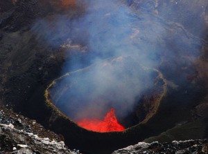
Ambrym is a volcanic island in the archipelago of Vanuatu (formerly known as the New Hebrides). It is well known for its highly active volcanic activity that includes lava lake formation.
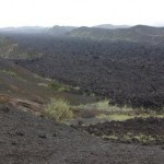
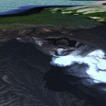
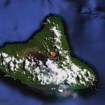
Located near the center of the long Vanuatuan archipelago, Ambryn is roughly triangular in shape, about 50 km (31 mi) wide. With 677.7 square kilometres (261.7 sq mi) of surface area, it is the fifth largest island in the country. The summit at the center of the island is dominated by a desert-like caldera, which covers an area of 100 square kilometres (39 sq mi).
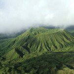
With the exception of human settlements, the rest of the island is covered by thick jungle.
Historic Eruptions
The eruption history is very well documented and goes back to approx. 400 AD. A full overview can be found here.
Eruptions
Eruptions have apparently occurred almost yearly during historical time from cones within the caldera or from flank vents. However, from 1850 to 1950, reporting was mostly limited to extra-caldera eruptions that would have affected local populations.
Ambrym has recent eruptions in 1986, 1988-1991, 1994 and from 1996 until today (2012)
|
|
Earthquakes
The list below shows the earthquake activity in a narrow radius around the volcano. Unfortunately we are only able to report the stronger earthquakes reported by the most important seismological agencies in the world. Our earthquakes database began registering early 2012.
| Refresh this list | ||||||
| SRC | Location | UTC Date/time | M | D | INFO | |
| EMSC | Vanuatu | May 16 03:15 | 5.6 | 200 | MAP I Felt It INFO | |
| USGS | Lakatoro, Vanuatu | May 16 03:15 | 5.9 | 170 | MAP | |
| EMSC | Vanuatu | Aug 15 08:08 | 4.5 | 175 | MAP I Felt It INFO | |
| USGS | Lakatoro, Vanuatu | Aug 15 08:08 | 4.5 | 175 | MAP | |
| EMSC | Vanuatu | Jul 31 19:11 | 5.0 | 191 | MAP | |
| USGS | Lakatoro, Vanuatu | Jul 31 19:11 | 5.0 | 188 | MAP I Felt It INFO | |
| EMSC | Vanuatu | Jul 31 15:02 | 6.5 | 192 | MAP I Felt It INFO | |
| GEOFON | Vanuatu Islands | Dec 26 03:23 | 4.9 | 46 | MAP I Felt It INFO | |
| USGS | Lakatoro, Vanuatu | Dec 23 20:29 | 4.7 | 10 | MAP I Felt It INFO | |
| USGS | Lakatoro, Vanuatu | Dec 17 08:04 | 4.9 | 10 | MAP I Felt It INFO | |
| USGS | Lakatoro, Vanuatu | Dec 16 09:48 | 5.5 | 9 | MAP I Felt It INFO | |
| GEOFON | Vanuatu Islands | Dec 16 09:48 | 5.6 | 10 | MAP I Felt It INFO | |
| EMSC | Vanuatu | Dec 16 07:44 | 5.2 | 80 | MAP I Felt It INFO | |
| GEOFON | Vanuatu Islands | Dec 16 07:44 | 5.2 | 10 | MAP | |
| GEOFON | Vanuatu Islands | Dec 16 02:43 | 4.8 | 114 | MAP | |
| USGS | Lakatoro, Vanuatu | Dec 16 02:43 | 5.2 | 48 | MAP I Felt It INFO | |
| EMSC | Vanuatu | Dec 16 02:43 | 5.2 | 48 | MAP | |
| USGS | Lakatoro, Vanuatu | Dec 15 20:21 | 5.6 | 34 | MAP | |
| USGS | Lakatoro, Vanuatu | Dec 15 19:29 | 4.9 | 10 | MAP I Felt It INFO | |
| EMSC | Vanuatu | Dec 15 07:19 | 4.9 | 24 | MAP I Felt It INFO | |
| USGS | Lakatoro, Vanuatu | Dec 15 07:19 | 4.9 | 23 | MAP | |
| USGS | Lakatoro, Vanuatu | Oct 29 07:41 | 5.0 | 182 | MAP I Felt It INFO | |
| USGS | Lakatoro, Vanuatu | Sep 21 00:25 | 4.9 | 49 | MAP I Felt It INFO | |
|
|
||||||
| EMSC | Vanuatu | Sep 21 00:25 | 4.9 | 48 | MAP | |
| GEOFON | Vanuatu Islands | Sep 21 00:25 | 5.0 | 52 | MAP | |
| USGS | Lakatoro, Vanuatu | Aug 22 17:34 | 5.1 | 10 | MAP | |
| PTWC | Aug 21 22:39 | 6.7 | 0 | MAP | ||
| USGS | Lakatoro, Vanuatu | Aug 21 22:32 | 6.5 | 13 | MAP | |
| GEOFON | Vanuatu Islands | Sep 05 02:50 | 5.5 | 181 | MAP I Felt It INFO | |
| USGS | Lakatoro, Vanuatu | Sep 05 02:50 | 5.5 | 172 | MAP | |
Webcams
There are unfortunately NO webcams pointed at Ambrym volcano or near the crater
Videos
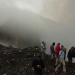
2 video's of Geoff Mackley. The first one shows part of the expedition work (bad weather prevented them from a descent into the crater. The second one with some spectacular views of the lava lake in the Marum caldera.
Some text and images courtesy : Smithsonian Institution and Wikipedia
To follow eventual activity at this time, please check also our Daily Volcano Activity reports.

i really like this site because the site gives me all the infromation that i need.
bjr
j aimerais savoir pourquoi on n a plus acces au traduction?je suis francais et vennai souvent sur votre site qui est vraiment bien fait, mais vu que je vou regarde depuis mon telephone portable plus moyen d avoir le site en francais.je voulais savoir si c était normal ou es ce le site qui déconne?
cdt
PS: votre site est vraiment bien fait beau travaille.je vous félicite pour tout ce que vous faites.j espère que vous continuerai longtemps.
La traducyion est bien présent dan ke coin droit en haut sur toutes les pages detaillés, comme les volcans