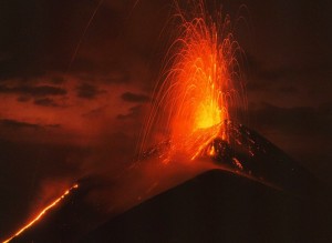
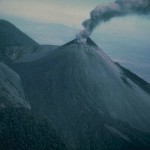
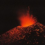
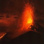
Eruptions from Pacaya, one of Guatemala's most active volcanoes, are frequently visible from Guatemala City, the nation's capital.
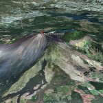
Pacaya is a complex basaltic volcano constructed just outside the southern topographic rim of the 14 x 16 km Pleistocene Amatitlán caldera. A cluster of dacitic lava domes occupies the southern caldera floor. The post-caldera Pacaya massif includes the Cerro Grande lava dome and a younger volcano to the SW. Collapse of Pacaya volcano about 1100 years ago produced a debris-avalanche deposit that extends 25 km onto the Pacific coastal plain and left an arcuate somma rim inside which the modern Pacaya volcano (MacKenney cone) grew. A subsidiary crater, Cerro Chino, was constructed on the NW somma rim and was last active in the 19th century.
During the past several decades, activity at Pacaya has consisted of frequent strombolian eruptions with intermittent lava flow extrusion that has partially filled in the caldera moat and armored the flanks of MacKenney cone, punctuated by occasional larger explosive eruptions that partially destroy the summit of the cone.
After the last caldera-forming eruption 23,000 years ago, several smaller vents within and around the caldera have seen eruptive activity. Pacaya is the largest post-caldera volcano, and has been one of Central America's most active volcanoes over the last 500 years. It has erupted at least 23 times since the Spanish conquest, producing basalt and basaltic andesite.
About 1,100 years ago, the volcano's edifice collapsed, causing a huge landslide. Deposits from the landslide travelled about 25 kilometres (16 mi) from the volcano down to the Pacific coastal plain. The landslide left a large crater, within which the current active cone has grown. The presence of a magma chamber at shallow depths beneath Pacaya means that distortion of the cone leading to instability and future landslides remains a hazard to the surrounding areas.
Historic Eruptions
The eruption history is very well documented and goes back to approx. 400 AD. A full overview can be found here.
Recent eruptions
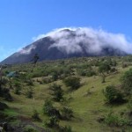
With its almost continuous activity, the volcano has been a popular location for tourism. Pacaya is easily accessible from Guatemala City and from Antigua. The volcano and surrounding area now lie within the Pacaya National Park, which was created to supervise and protect tourism in this region. The Pacaya Park generates its income from tour groups who are charged a small fee to enter the park.
In 1998, several explosive eruptions emitted lava, debris and ash columns with a height of 1500 m - 5000 m. Ash fall affected nearby cities including Guatemala city and La Aurora airport.
A lava lake was formed during the 2000-2001 active period.
During 2006, a slight increase in Pacaya's volcanic activity brought about the creation of several lava rivers that slowly flow down its slope. Word about these phenomena spread, and local tourism increased significantly.
On May 27, 2010, the Pacaya volcano erupted, followed in several tremors. At approximately 20:00 hours there was a strong eruption ejecting debris and ash columns up to 1500 meters.
Ash rained down in many Guatemalan cities to the northwest of the volcano, including Guatemala City. The volcanic ash fall pelted Guatemala City, and the international airport, La Aurora. The National Coordinator for Disaster Reduction (CONRED) declared a red alert for the communities near the volcano, and recommended the evacuation of some of them. Noti7 reporter Anibal Archila, one of the first to cover the event, was reported killed by volcanic debris.
President Álvaro Colom declared a state of calamity in the region adjacent to the volcano, and the Ministry of Education closed the schools in the departments of Guatemala, Escuintla and Sacatepequez. Heavy rainfall from Tropical Storm Agatha worsened the emergency situation, causing lahars, landslides and widespread flooding across the country. However, people working in coffee fields considered the rain brought by the storm to be helpful, removing ash from their trees
- Image courtesy Wikipedia
Earthquakes
The list below shows the earthquake activity in a narrow radius around the volcano. Unfortunately we are only able to report the stronger earthquakes reported by the most important seismological agencies in the world. Our earthquakes database began registering early 2012.
| Refresh this list | ||||||
| SRC | Location | UTC Date/time | M | D | INFO | |
| EMSC | Guatemala | Jun 13 03:31 | 4.8 | 210 | MAP I Felt It INFO | |
| GEOFON | Guatemala | Jun 13 03:31 | 4.5 | 202 | MAP | |
| USGS | Palin, Guatemala | Apr 01 01:32 | 3.3 | 5 | MAP I Felt It INFO | |
| USGS | San Vicente Pacaya, Guatemala | Mar 28 22:27 | 2.8 | 5 | MAP I Felt It INFO | |
| USGS | San Vicente Pacaya, Guatemala | Mar 27 23:44 | 2.9 | 5 | MAP I Felt It INFO | |
|
|
||||||
| USGS | Santa Maria De Jesus, Guatemala | Mar 27 22:59 | 3.2 | 5 | MAP I Felt It INFO | |
| USGS | Magdalena Milpas Altas, Guatemala | Mar 27 22:46 | 4.1 | 5 | MAP I Felt It INFO | |
| USGS | Guanagazapa, Guatemala | Oct 30 18:21 | 3.8 | 103 | MAP I Felt It INFO | |
| GEOFON | Guatemala | Jun 04 23:57 | 4.4 | 176 | MAP I Felt It INFO | |
| USGS | Amatitlan, Guatemala | Jun 04 23:57 | 4.8 | 183 | MAP | |
| EMSC | Guatemala | Feb 16 13:33 | 4.8 | 200 | MAP I Felt It INFO | |
| GEOFON | Guatemala | Feb 16 13:33 | 4.4 | 200 | MAP | |
| USGS | Petapa, Guatemala | Feb 16 13:33 | 4.9 | 197 | MAP | |
| USGS | San Vicente Pacaya, Guatemala | Jun 14 11:36 | 4.3 | 10 | MAP I Felt It INFO | |
| EMSC | Guatemala | Jun 14 11:36 | 4.3 | 10 | MAP I Felt It INFO | |
| USGS | Palin, Guatemala | May 02 16:28 | 4.5 | 190 | MAP I Felt It INFO | |
| EMSC | Guatemala | May 02 16:28 | 4.4 | 193 | MAP I Felt It INFO | |
| ER | Seismicity Startup Record | Jan 01 00:00 | 0.1 | 0 | MAP I Felt It | |
| James Daniell CATDAT | Guatemala | Nov 22 08:00 | 0.0 | 10 | MAP | |
| James Daniell CATDAT | Guatemala | Mar 14 08:00 | 0.0 | 10 | MAP | |
| James Daniell CATDAT | Guatemala | Dec 12 08:00 | 0.0 | 10 | MAP | |
| James Daniell CATDAT | Guatemala | Nov 18 08:00 | 0.0 | 10 | MAP | |
Webcams
We regret to tell you that there are NO webcams pointed on this volcano
Videos
Some text and images courtesy : Smithsonian Institution and Wikipedia
To follow eventual activity at this time, please check also our Daily Volcano Activity reports.


