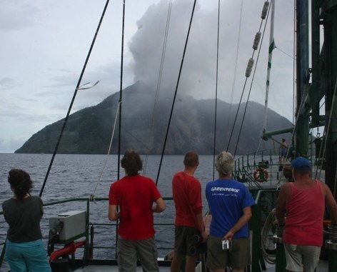
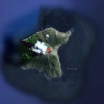
 The small isolated island of Batu Tara in the Flores Sea about 50 km north of Lembata (fomerly Lomblen) Island contains a scarp on the eastern side similar to the Sciara del Fuoco of Italy's Stromboli volcano. Vegetation covers the flanks of Batu Tara to within 50 m of the 748-m-high summit.
Batu Tara lies north of the main volcanic arc and is noted for its potassic leucite-bearing basanitic and tephritic rocks. The first historical eruption from Batu Tara, during 1847-52, produced explosions and a lava flow.
Batu Tara volcano island (Kombo Island) is unpopulated.
Joe Bauwens, a science blogger wrote : Batu Tara is located to the north of the Flores Thrust, where the Timor Microplate is being subducted beneath the Banda Sea Plate (part of the collisional area between the Australian and Eurasian Plates). As this happens the Timor Plate is forced down into the Earth's interior, where it is partially melted by the heat. Melted material then rises through the overlying Banda Sea Plate, fueling the volcanoes located upon it.
Eruptions
Except for the above mentioned eruption of 1847-1852, eruptions on the island are very badly registered, mainly because of is remote location.
Nowadays, satellite images and occasional aviation reports are filling in the gap.
Recent eruptions have been recorded, except for the current 2012 one, in 2006, 2007 and 2008. According to John Seach, 15000 people were evacuated from nearby Lembata island.
Eruptions are frequently accompanied by the ejection of incandescent ash and lava bombs, as well as flows of lava, but since the island is remote and uninhabited these are seldom recorded.
The ash clouds during the April - July 2012 eruptions have the same pattern than the 2006 - 2008 eruptions.
Eruptions at Batu Tara are followed very carefully by VAAC Darwin, who follows up ash concentration in the air for airline traffic. Batu Tara is located on the direct flying route from Jakarta to Sydney.
 Eruption in 2009 Eruption in 2009 |
 Satellite view Satellite view |
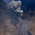
 Image kchabba Image kchabbaEruption Dec. 2008 |
 Image kchabba Image kchabbaEruption Dec. 2008 |
Earthquakes
The list below shows the earthquake activity in a narrow radius around the volcano. Unfortunately we are only able to report the stronger earthquakes reported by the most important seismological agencies in the world. Our earthquakes database began registering early 2012.
| Refresh this list | ||||||
| SRC | Location | UTC Date/time | M | D | INFO | |
| EMSC | Banda Sea | Mar 18 11:12 | 4.1 | 258 | MAP I Felt It INFO | |
| USGS | Palue, Indonesia | Nov 29 13:08 | 4.5 | 252 | MAP I Felt It INFO | |
| GEOFON | Banda Sea | Nov 29 13:08 | 4.3 | 250 | MAP I Felt It INFO | |
| EMSC | Banda Sea | Nov 29 13:08 | 4.4 | 252 | MAP I Felt It INFO | |
| ER | Seismicity Startup Record | Dec 31 00:00 | 0.1 | 0 | MAP I Felt It | |
Webcams
Unfortunately, NO webcams are present on this remote island in Indonesia
Videos
The first video below (from Marc Szeglat) shows in great detail the Strombolian eruptions which are taking place at the island.
The second video (from avdezwart)shows another blast (in 2011 ?) from a person (passenger of crew) on board of a container ship passing by the islands.
Some text and images courtesy : Smithsonian Institution, Wikipedia and Joe Bauwens.
Image 1 : courtesy Mike Mate
To follow eventual activity at this time, please check also our Daily Volcano Activity reports.


