This is Part 57 of the El Hierro Volcano eruption report
CLICK HERE TO READ THE LATEST NEWS
You may follow also Facebook Volcano Page – Google+ Volcanoes – Twitter : @VolcanoReport
With the collaboration of Joke Volta, an El Hierro resident and Julio del Castillo Vivero, photographer.
Links to earlier parts of this extensive El Hierro eruption report :
(28/7 – early 09) – (25/09 – 10/10) - (11/10 – 13/10)- (14/10 – 17-10) - (18/10 – 21/10) - (22/10 – 26/10 ) - (27/10 – 31/10 ) – (01/11 – 03/11 ) - (04/11 – 06/11 ) – (07/11 – 08/11) – (09/11- 11/11) – (12/11 – 15/11) - (16/11 – 19/11) – (20/11 – 23/11) – (24/11 – 27/11) – (28/11 – 02/12) -(03/12 – 07/12) – (08/12 – 11/12) – (12/12 – 15/12) – (16/12 – 18/12) – (19/12 – 25/12) – (26/12 – 31/12) – (01/01 – 03/01) – (04/01 – 07/01) – (08/01 – 13/01) – (14/01 – 19/01) - (20/01 – 25/01) - (26/01 – 30/01) – (31/01 – 04/02) – (05/02 – 10/02) – (11/02 – 16/02) – (17/02 – 23/02) – (24/02 –29/02) – (1/03 – 10/03) – (11/03 – 18/03) - (19/03 - 23/03) - (24/03 - 28/03) - (29/03 - 03/04) - (04/04 - 10/04) - (11/04 – 21/04) - (22/04 – 30/04) - (01/05 – 10/05) - Part 43 (11/05 – 31/05) - (01/06 – 14/06) - (15/06 – 24/06) - (25/06 – 26/06) – (27/06 – 28/06) – (29/06 – 01/07) - (02/07 – 06/07) – (07/07 – 31/07) - (01/08 – 31/08) - (01/09 – 11/09) - (12/09 – 30/09) - (01/10 – 15/12) - Part 55 (16/12 – 16/03) - Part 56 (16/03 – 26/03) - Part 57 (27/03 - 30/03)
Useful links : @VolcanoReport – El Hierro Picasa Photo Album Part 56 (16/03 – 26/03)
2013-03-30 21:16 UTC
- A calm day which does not mean that the earthquakes have halted.
- 99 listed by IGN so far today.
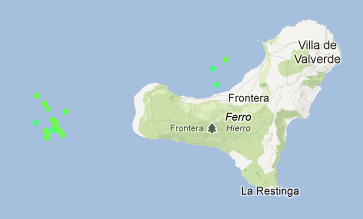
- Epicenters a little to the east + also 3 earthquakes during the last 9 hours in the El Golfo bay.
2013-03-30 17:06 UTC
- A weak seismic period (compared to the last couple of days)
- Almost impossible to comment on what is going on because IGN filters the listed earthquakes on a too high Magnitude. There is a tendency (to be confirmed by the smaller earthquakes) that the epicenters are moving again towards the East (or the coast) and are showing deeper hypocenters.
2013-03-30 12:12 UTC
- NO real changes to the pattern. Weaker earthquakes than yesterday but still enough to talk about a continuing activity
- Epicenters did move a little North West
2013-03-30 08:00 UTC
- 190 earthquakes listed by IGN yesterday (hundreds or even +1000 weaker ones more in reality)
- 14 M4+ earthquakes yesterday the strongest one being a M4.7 (thats a notification in our Daily Major earthquake list !)
- 55 earthquakes listed so far today
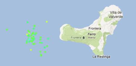
- Epicenters are still mainly in the same sector than yesterday, but we also see an increasing number of earthquakes to the south (some even at the La Restinga latitude)
- Epicenter description gets a lot more "ATLÁNTICO-CANARIAS" than yesterday. Reason : a little more to the west of the island (the description comes from automatic computer denomination).
- Almost no change in hypocenter depth (various depths from 12 to 21 km)
- Below a great 4D animation of the earthquakes who occurred during the current seismic crisis. It was made by Nahúm with the cooperation of Julio del Castillo Vivero. Congratulations. The animation shows the migration of the earthquakes both in epicenter and in depth. On our request this video (best to be watched in full format) is showing not only a dynamic 4D modus but also a helicopter view which makes it easy to see the migration of the epicenters. The animation starts at the beginning of this crisis, the last added earthquakes are those until yesterday evening. The coloring changes to give a perspective of time.
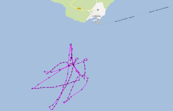
- The bottom map shows the (continued) navigation of the Ramon Margalef to the south of La Restinga
2013-03-29 23:02 UTC
- The oceanographic research vessel Ramon Margalef is currently making turns to the south of La Restinga. We do not expect that the current cruising has something to do with the current seismic crisis as this trip was planned long before the start of the seismicity. The current cruising path is also quit some distance from the earthquakes epicenters.
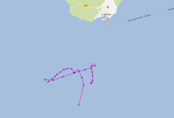
Image courtesy Marinetraffic.com
2013-03-29 21:52 UTC
- The strong seismicity continues but epicenters are migrating again more to the West. this also means that the seabed in the epicentral area goes down to approx. 3000 meter !
2013-03-29 20:05 UTC
- Mid-Strong earthquakes started at 19:10 are continuing at the time of writing, as again, being felt by the population of El Hierro. We will keep you, as always, updated.
- Earthquake depths are descending, as magma keeps pushing from below.
2013-03-29 18:51 UTC
- If you cannot reach IGN, you are not the only one ! We neither. Probably a bandwidth problem (Back live again)
- a relatively calm period at this moment
- 133 earthquakes listed by IGN today
- The M4.7 was felt as a MMI III intensity (weak shaking) at the island. The hypocenter was measured at 20 km
- Below a video which was captured by Micky Peraza @ El Hierro (Fuga de Gorreta) during the M4.7 shaking
2013-03-29 16:16 UTC
- A very powerful earthquake has been reported from El Hierro so far.
- People at the island told Julio that this felt as being the strongest so far
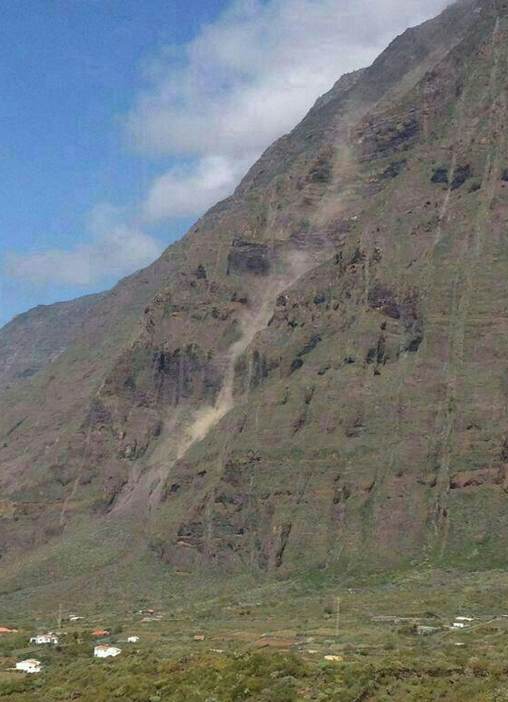
- Rockfall has been reported in different places
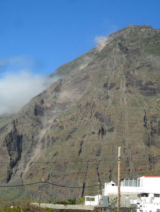
Image from Julia Sisi Parrondo @ El Hierro only shortly before this update
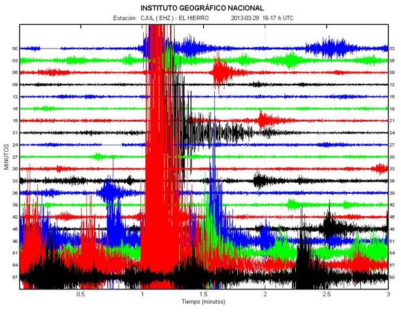
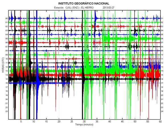
The M4.7 earthquake in the hourly praph
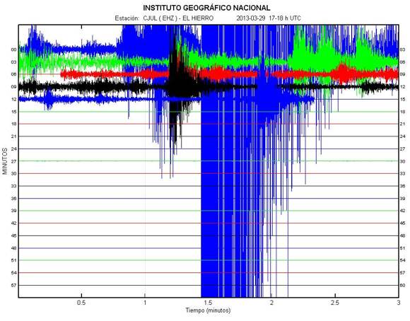
2013-03-29 16:16 UTC
- A 3D simulation video of the epicenters/hypocenters (magma intrusion) of the earthquakes since the beginning of seismicity in 2011
2013-03-29 14:13 UTC
- A somewhat calmer period right now.
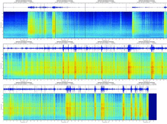
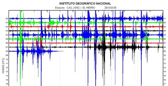
- Julio del Castillo Vivero has glued all the spectrograms since the beginning of this crisis together. Click on the image below to watch the HD-version.
2013-03-29 13:11 UTC
- Pevolca has met and says in essence what we have been telling all day.
- As seismicity is still at a safe distance from the coast (what is safe ?) no other protective measures should be taken (see earlier Pevolca report for the initial measures below).
- Pevolca also confirms that the seismic activity is moving the the South-West. ER would call it South
- The strong earthquakes are continuing at a high frequency at the time of writing
2013-03-29 11:17 UTC
Impressive seismic activity
- The released energy since the start of this crisis has surpassed the total energy released during the initial eruptive crisis in 2011
- So far today (11 hours) we have counted 51 M3+ earthquakes
- 8 M4+ earthquake - 4 of which have been felt by the people (in fact everything has been felt, but people do not report it anymore). The strongest ones have also been felt at the neighboring islands like La Palma
- Remember the words of local seismologists/volcanologists shortly after the start of this crisis "this crisis will not last long as the feeding source does not have enough energy". This remark is not meant to be offensive to those scientists, only that we have to be humble when we talk about the unknown aspects of nature.
2013-03-29 11:00 UTC
- Relatively calm period at this moment
- The seabed depth of the current seismic activity is +2000 meter (+6000 ft) = safe + weakening the shaking impact
2013-03-29 09:42 UTC
- The strong M4.6 earthquake had his epicenter at approx. 6 km out of the coast (thats closer than previous strong earthquakes).
- Hypocenters show a tendency to become shallower again (17 km), with a few shallower ones.
- The seismic active area is still below a relatively flat seabed but the distance to the submarine volcanic hills is gradually decreasing.
2013-03-29 09:07 UTC
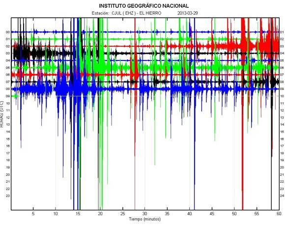
- Strong events are following each other up at a high rate today.
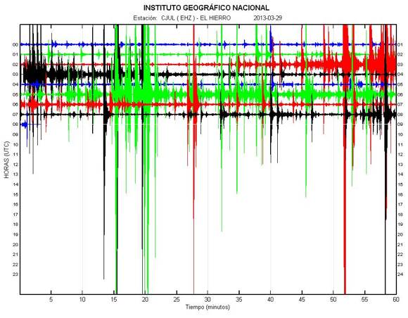
The graph image has changed again fundamentally the last 30 minutes :
2013-03-29 08:58 UTC
- The volcano does not give up so far. He continues to shake the greater epicenter area and some of these quakes can even be felt at other islands.
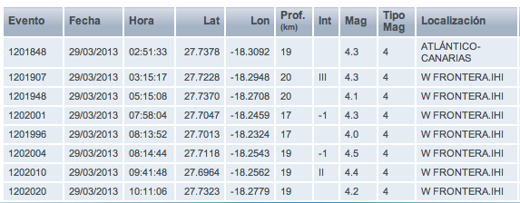
- 64 earthquakes listed by IGN so far (they only list the stronger ones now - the real number today must run already into the hundreds)
- Strongest earthquake so far today : M4.3 (initially quoted as M4.6)
- The hypocenters are again in the 20 km layer (like the crisis in mid-2012)
- Deformation is further increasing. The images below are from the Lighthouse GPS station (also western part of the island)
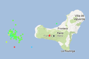
- Epicenters are a little more to the south today, which may explain the deeper hypocenters. Still far enough out of the coast to weaken the earthquake impact on the island. Red bullets are very shallow earthquakes. The red bullet in the Las Calmas sea is erroneous BUT we take special interest in the 2 shallow earthquakes below the South-Western coast of the island. They have been calculated at M2.0 and M2.2, strange ... As these quakes are far away from the seismic area it looks to us that these are earthquakes which have been triggered by the deformation of the island. IGN (with a lot more data) will certainly know what is exactly was.
- The strong action is still continuing. take a look at this seismograph!, but keep our page also open in another tab.
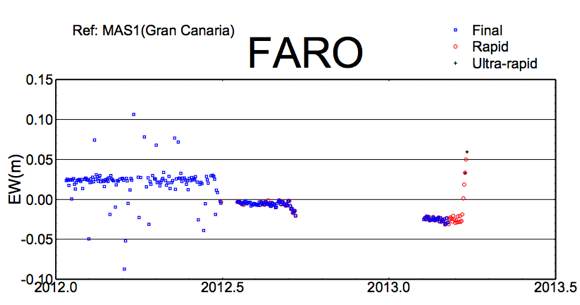
East / West movement @ FARO seismograph - image courtesy University of Nagoya / Involcan
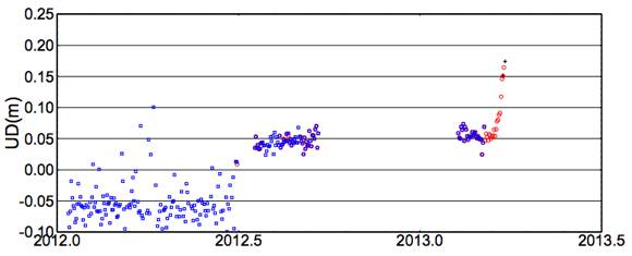
Inflation / Deflation deformation @ FARO seismograph - image courtesy University of Nagoya / Involcan
2013-03-28 23:20 UTC
- For the first time since the start of the eruptive process in 2011, there was a power failure in the western part of the island. It only lasted for a couple of minutes, but the people living there are scared that it would produce again during the night. A lot of them have now torchlights and candles near their bed in case of ...
- Rockfall has been reported in different areas of the western part.
2013-03-28 23:03 UTC
- In a time-frame of only 90 minutes we counted 10 earthquakes of M3.0 or more (strongest M4.1)
- 188 earthquakes listed so far today
2013-03-28 22:41 UTC
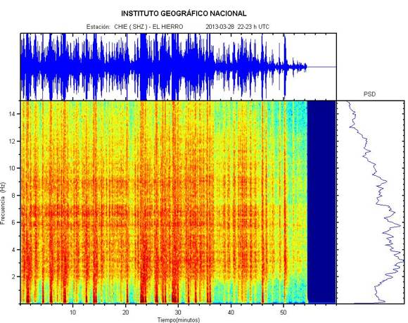
- After a relatively calm period a new set of strong earthquakes, including a M4.1, are being felt by the people. Depth 22 km.
- The hypocenters are again in deeper layers (17 to 22 km).
2013-03-28 18:20 UTC
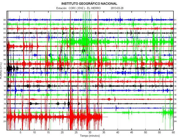
- Nothing spectacular is happening. A weaker period at the moment, but 156 listed by IGN in total so far today (also contains a number of -M2 quakes).
2013-03-28 15:31 UTC
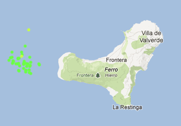
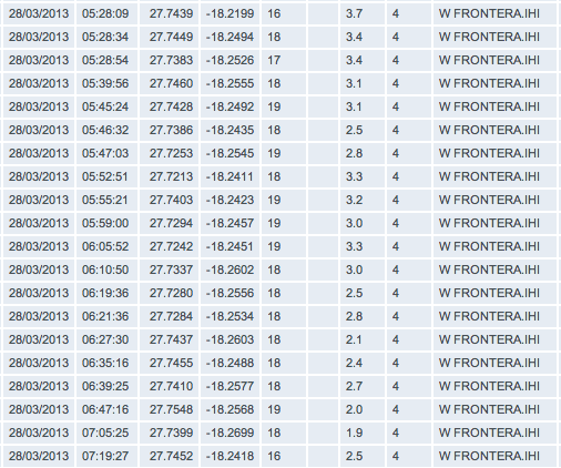
- Below a new Epicenter map with respectively 1 shallower earthquake a little to the south and 2 deeper earthquakes in the El Golfo area.
- As this page grew too long, we have archived the portion containing our March 16 to March 26 report. The link to Part 56 (Yes Part 56!) can be found at the bottom of this page.
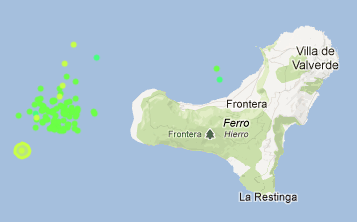
Image credit : AVCAN
2013-03-28 14:09 UTC
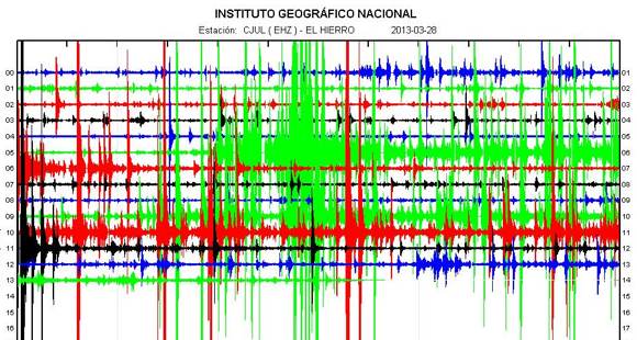
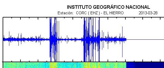
- Image of the earthquakes / tremor from the Lighthouse (Orchilla) seismograph.
- Strongest earthquake(s) so far today : M4.1
- 109 earthquakes listed by IGN today
2013-03-28 11:55 UTC
- INVOLCAN has released an updated graph on diffused CO2 levels measured around the island. There is a big gap of data in the graph because measurements are done manually at many spots of the island and they didn't receive enough money to have a constant presence. Volunteers also have helped in making this findings possible.
- Values of CO2 are superpassing greatly what is considered to be normal.
- 1684 ± 72 tons of CO2 are being released daily from below El Hierro. This reflects the strength of this crisis as they are even stronger than before the first and during second phase of the eruption.
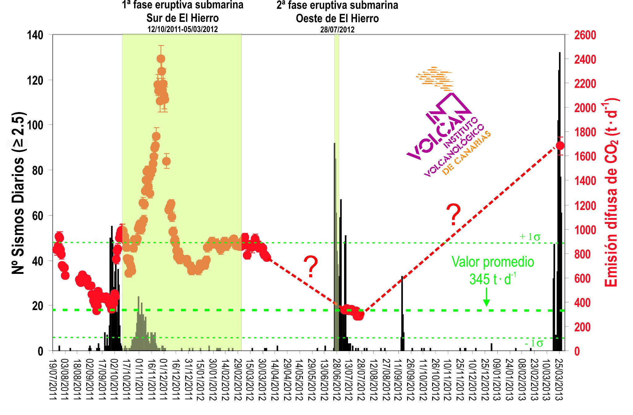
Diffuse CO2 levels. Credit: INVOLCAN
2013-03-28 11:29 UTC
- Strongest earthquake so far today, M4.1 at 11:00:16 UTC has been widely felt by the population.
2013-03-28 11:09 UTC
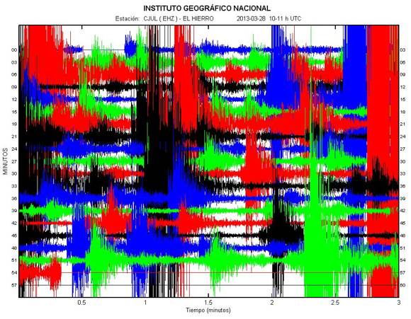
- Still vigorous activity below the seabed ! The image below shows the action in between 10:00 and 11:00.
2013-03-28 09:15 UTC
- Continuous strong action at the time of writing (M3 to M3.5)
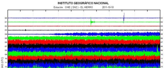
- Many of you may have forgotten how the actual eruption in 2011 could be seen on the seismograph. Below a recap of that moment. Watch out for a similar sign. The HT which is visible on the CHIE graph will however be less thick if an eruption would occur in the area where the earthquakes are battering at the moment, this because of the distance to the seismograph.
To make the picture complete, we have to tell that a limited number of very shallow earthquakes were pre-eruption triggers (1 at less than 1 km depth).
2013-03-28 08:03 UTC
- A night with 3 faces, relatively calm at the first part, strong earthquakes from 05:20 on for about an hour and relative calm again until now. The impact on the seismographs is limited because of the location of the epicenters. When the same earthquakes would have epicenters near the shore, they would have been felt all over the island.
- 46 M2+ earthquakes so far today (IGN listed, in reality hundreds already)
- 17 of these 46 earthquakes are M3 or more (thats a lot)
- Epicenters still in the same area at the elongation of the western arm of the island, 7 to 10 km out of the coast
- Hypocenters are somewhat deeper again (17 to 18 km)
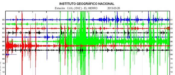
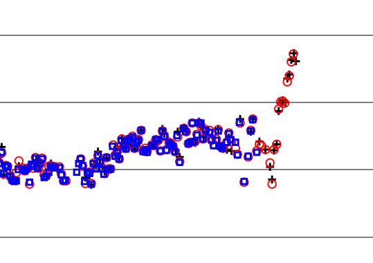
- The Upwards GPS deformation map is showing for the first time a deflation of the Sabinosa GPS station. The island is however pushed further to the East. The beginning of the end of this crisis ? Might be, as it loses momentum ! (vertical deformation). The lesson we learned after following this volcano for almost 2 years : next magma movement is unpredictable, so hang on for the time being.
- We will be cutting (archiving) a major part of this article a little later today.
Deflation of the island (negative deformation)
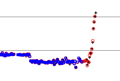
Deformation to the East
2013-03-27 23:36 UTC
- PEVOLCA has taken measures tonight to strengthen the safety of the island. The western part (which has a lot of cliffs) has been changed into a Yellow Alert zone. Pevolca stresses however that the seismicity is still at 10 km from the island.
The full translated press report :
PEVOLCA takes measures to protect the population in response to the increased seismicity.
27-03-2013 ... 20:41 - Ministry of Economy, Finance and Security
* It comprehends the higher risk zone where seismicity is taking place at 10 km. away from the island and so PEVOLCA has decided to take certain measures to protect the population due to the increased magnitude of earthquakes.Measures taken by PEVOLCA in agreement with the council of El Hierro are the following:
- Closing the lane of the tunnel closest to the exit in Frontera, closing the length of road HI-50 between 'Cruce de La Tabla' and 'Sabinosa' and the access road to 'Playa La Madera', of 'Pozo de la Salud' until the crossing with road HI-503.
- Access to 'Ermita de Los Reyes' and to 'Sabinar' through HI-503 will remain open
- Yellow informative alert for the population at the zones limited by HI-500 at 'Pozo de la Salud' to the South, en the crossing between HI-500 with HI-400 at the crossing known as 'El Tomillar'.
2013-03-27 18:50 UTC
- From the reports we are getting and as seismographs show, things seem to be less intense for now.
- So far, this crisis has released more energy than the crisis before the eruption.
- More rockfall has been reported in the roads of Frontera-Sabinosa, some of the rocks quite large, and personal is now working onsite to clear them.
- A press release from the government insists that there is no big danger to the population, earthquakes are occurring at sea, as they monitor the situation, and insist to make sure people are self-prepared at home.
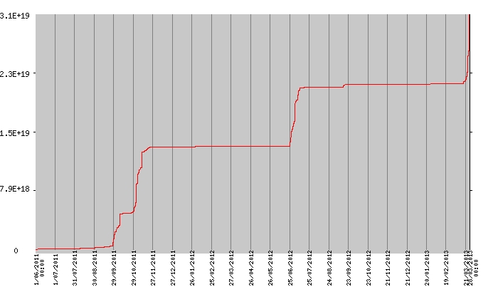
Energy released since 2011. Credit: AVCAN
2013-03-27 18:00 UTC
- Just when we thought it had calmed down for a few minutes, another series of strong earthquakes are being felt by the population at this moment. This have not yet been listed by IGN.
- We will update and you can also subscribe to our free ultra-rapid alert service for the latest earthquakes.
2013-03-27 16:13 UTC
If the epicenters are correct we are witnessing some migrating seismic events to the south (please compare with other images below). Of course some data have to revised and some epicenters may be recalculated again.
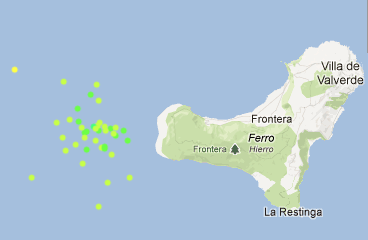
Image courtesy AVCAN, Canary Islands
2013-03-27 16:31 UTC
Spectacular earthquakes going on right now in the ocean to the west of El Hierro - A new strong earthquake (preliminary Magnitude 4.4) made chairs and ceiling lights moving and windows trembling. This last earthquake was also felt at the other islands.
Based on our earthquake experience, we expect that an M5 will be the absolute max. for volcanic earthquakes. In rare cases the Magnitude goes even higher but these are mostly volcanic explosions which nobody expect to happen + the shaking of every current earthquake is weakened by the sea.
We would advise people at El Hierro, to stay away from steep cliffs as rockfall can happen at any moment.
2013-03-27 16:13 UTC
The M4.6 (preliminary value) was, besides La Palma, also felt on La Gomera and even Tenerife (perfectly normal based on our earthquake experience)
2013-03-27 16:03 UTC
Strongest earthquake so far during this crisis, a M4.6! earthquake luckily in the ocean at a depth of 19 km.
IGN had made a prediction that there should be a 23% chance that a M4.6 would happen. They are right but people start to get a little scared anyway.
2013-03-27 15:40 UTC
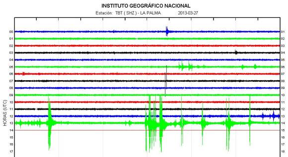
Involcan published an image on his Facebook page of a rockfall in the El Golfo area. The steep cliffs combined with near M4.0 earthquakes within 10 km of the island are a dangerous cocktail as can be seen on this image.
- Due to these stronger earthquakes we expect Pevolca to meet soon, especially to formulate additional safety rules for the steep areas of the island.
- The earthquake was felt as far as La Palma (see seismograph of La Palma below)
2013-03-27 15:08 UTC
- 11 M3+ earthquakes in only 66 minutes, luckily still out in the sea!
2013-03-27 14:41 UTC
- The 13:32 UTC earthquake has been recalculated from M3.7 to M3.9. depth : 15 km. Distance to the island : approx. 6 to 7 km.

2013-03-27 13:52 UTC
- More strong activity in the 13:00 to 14:00 time-frame (see below). The 2 first ones were M3.0 earthquakes, the last one was the strongest so far today Magnitude 3.7. The latter was also felt by the people of the island.

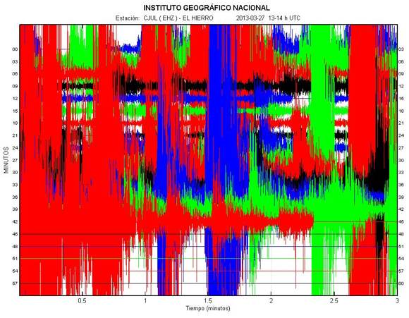
13:00 to 14:00 tremor time-frame
2013-03-27 13:22 UTC
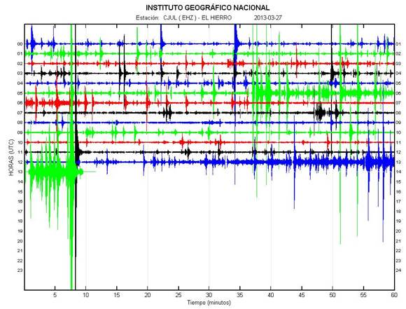
- There is the volcano again. After a period of relative weak action, a new very powerful quake occurred at 13:08 UTC
2013-03-27 12:22 UTC
- The bathymetry mission of the Oceanographic Vessel Ramon Margalef has produced a great 3D animation of the new submarine volcano (2011-2012 eruption). We do appreciate their new policy to share such material immediately with the public
2013-03-27 09:00 UTC
- 56 earthquakes so far today, less than yesterday. Strongest earthquake since midnight : M3.3
- The hypocenter depths are now stabilized at the 12 to 15 km layer
- Epicenters in the same area and still relatively far out in the deep ocean
- Deformation still continues but at a lesser rate than the preceding days
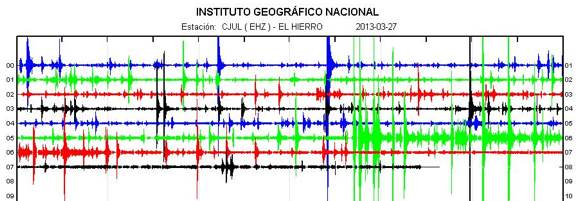
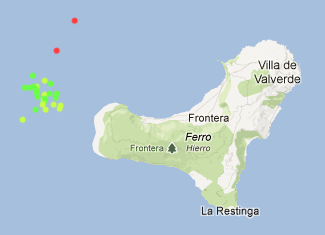
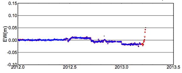
East deformation increase - image courtesy University of Nagoya, Involcan
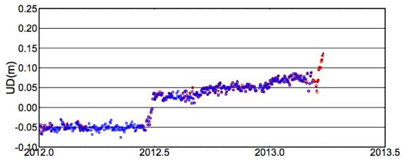
Upward deformation - image courtesy University of Nagoya, Involcan
Read also : Scientific paper reveals massive historic Tenerife volcano flank collapse
Read also: Economic impact on El Hierro and the Canary Islands if an aerial eruption would occur
Volcano Discussion Panel : If you are a person who wants to discuss and read about all aspects of volcanoes, this discussion panel might be a very good place to hang around. Especially if we start speculating about what to happen next.
