This is Part 50 of the El Hierro Volcano eruption report
CLICK HERE TO READ THE LATEST NEWS
You may follow also Facebook Volcano Page – Google+ Volcanoes – Twitter : @VolcanoReport
With the collaboration of Joke Volta, an El Hierro resident and Julio del Castillo Vivero, photographer.
Read also : (28/7 – early 09) – (25/09 – 10/10) - (11/10 – 13/10) - (14/10 – 17-10) - (18/10 – 21/10) - (22/10 – 26/10 ) – (27/10 – 31/10 ) – (01/11 – 03/11 ) - (04/11 – 06/11 ) – (07/11 – 08/11) – (09/11- 11/11) – (12/11 – 15/11) – (16/11 – 19/11) – (20/11 – 23/11) – (24/11 – 27/11) – (28/11 – 02/12) - (03/12 – 07/12) – (08/12 – 11/12) – (12/12 – 15/12) – (16/12 – 18/12) – (19/12 – 25/12) – (26/12 – 31/12) – (01/01 – 03/01) – (04/01 – 07/01) – (08/01 – 13/01) – (14/01 – 19/01) - (20/01 – 25/01) - (26/01 – 30/01) – (31/01 – 04/02) – (05/02 – 10/02) – (11/02 – 16/02) – (17/02 – 23/02) – (24/02 –29/02) – (1/03 – 10/03) – (11/03 – 18/03) – (19/03 – 23/03) – (24/03 – 28/03) - (29/03 – 03/04) – (04/04 – 10/04) – (11/04 – 21/04) – (22/04 – 30/04) – (01/05 – 10/05) – (11/05 – 31/05) – (01/06 – 14/06) – (15/06 – 24/06) – (25/06 – 26/06) – Part 47 (27/06 – 28/06) – Part 48 (29/06 – 01/07) - Part 49 (02/07 – 06/07) – Part 50 (07/07 – 31/07) -
Useful links : @VolcanoReport – El Hierro Picasa Photo Album
Your donation will keep us alive
Earthquake-Report.com is a non-profit site and receives only private donations. The site still needs financing from its own volunteers. Your donation is highly needed to cover our costs. Your donation will be shared with Joke Volta. Click here for a Paypal or Credit Card donation. Click here for our bank details
Update 31/07 - 07:15 UTC
- A M2.7 earthquake at a depth of 20 km at 03:23 earlier today. Epicenter : western tip of the island.
- NO change in vertical deformations today
Update 30/07 - 22:34 UTC
- A rather strong earthquake tonight. Magnitude : M2.8, Depth : 20 km, Time of occurrence : 20:40 UTC; Epicenter : here
Update 30/07 - 19:37 UTC
- 2 earthquakes yesterday if we believe the 10-day IGN list and 4 as mentioned at Avcan. Avcan had also 6 quakes on July 28.
- Today only 1 earthquake
- Deformations have tendency to decrease (from a few mm to more than a cm)
Update 29/07 - 09:05 UTC
- No earthquakes so far today
- Deformations seem to be stabilized
- Reader Roland writes in the comment section that further cone depth analysis may result in only 84 meters instead of the 88 meters which was reported before. These 4 meters are important if a new earthquake crisis with eruption activity in the old vent would strike. The ULPGC will examine the Atlantic Explorer data early this week. Some are writing that the lesser depth have occurred the last couple of weeks (since the last Atlantic Explorer mission). Some are skeptical as there was no visible action in the Las Calmas sea and as no HT was noticed on the seismograms.
Update 28/07 - 23:55 UTC
- No earthquakes today
- Very few changes in vertical or horizontal deformation
Update 27/07 - 15:18 UTC
- The first earthquake occurred at 14:12 UTC. It measured a depth of 20 km and a Magnitude of 2.1
- Vertical deformation of station SABI dropped again to the levels of the day before yesterday. On the other hand PINA shows a 1.5 cm climb today, a very strong deformation if the Ultra Rapid data are confirmed later on.
- Reader Roland reports that the Captain of the Atlantic Explorer, currently cruising the Las Calmas sea made a statement that magnetism values are very high, probably due the presence of a lot of iron the the moving magma below the sea bed.
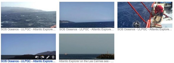
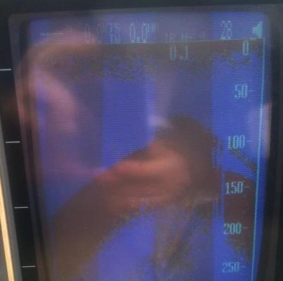
- Image of the submarine volcano in La restinga captured by the probe of the Atlantic Explorer on July 27 during the campaign of the ULPGC - QSTAR Guayota.
Update 26/07 - 21:59 UTC
- Well, well !!! The shallow quakes are gone again in the IGN list and are replaced with the single initial 1 km one. We have no other choice than reporting what IGN reports. As far as we could see, no word of apology and no explanatory words.
A total of 5 earthquakes today .
- The Tourism operators are happy that the ferry companies have introduced an almost daily Tenerife link (6 days on 7).
Update 26/07 - 10:59 UTC
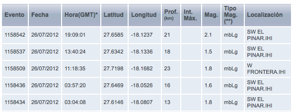
- 2 earthquakes so far today. Both hypocenters were at unusual depths (13 km for the M1.8 earthquake and 16 km for the M1.6 earthquake). Both epicenters were located in the old vent area in the Las Calmas sea. Another "to follow" evolution.
- The University of Nagoya's deformation stats are showing a strong climb in Ultra Rapid vertical deformation at SABI (more than 1 cm). The other stations are stabilized.
- We do not know whether we are the only ones having trouble in reaching some data from the IGN website.
- The Atlantic Explorer (chartered by the ULPGC or in long words the University of Las Palmas de Gran Canaria) is back in town and is doing some research in the Las Calmas sea (also in the Lighthouse area).
Update 25/07 - 15:39 UTC
- The island is wobbling again + a lot of shallow earthquakes (some were recalculated from yesterday). In order to give a good overview of the earthquakes from yesterday and today, we have recapitulated all these earthquakes. The least we can say is that what is happening is very curious. The epicenter of most of the earthquakes is still in the line of the lighthouse but the depths are peculiar. Are all these quakes from stress related deformations or is there more to tell ?. Scientists have the clues in their hands, but as far as we know have not yet communicated about it.
The 3 first shallow earthquakes occurred in a matter of only 2 minutes.
The recalculation of these quakes is making the El Golfo shallow quake with the coloring of the water less credible as all the shallow epicenters are below the island (close to the Orchilla or lighthouse)
25/07/2012 08:59:53 Depth 20 km M 1.8 mbLg W EL PINAR
25/07/2012 08:39:40 Depth 21 km M 1.7 mbLg W FRONTERA
25/07/2012 06:16:38 Depth 24 km M 1.6 mbLg SW FRONTERA
25/07/2012 06:04:20 Depth 18 km M 1.8 mbLg W FRONTERA
25/07/2012 05:46:43 Depth 3 km M 1.7 mbLg SW FRONTERA
24/07/2012 21:17:49 Depth 21 km M 2.9 mbLg SW EL PINAR
24/07/2012 20:13:21 Depth 2 km M 1.9 mbLg SW FRONTERA
24/07/2012 20:12:09 Depth 2 km M 2.1 mbLg SW FRONTERA
24/07/2012 20:11:38 Depth 2 km M 1.7 mbLg SW FRONTERA
24/07/2012 12:19:43 Depth 21 km M 1.9 mbLg SW FRONTERA
24/07/2012 10:23:13 Depth 18 km M 1.7 mbLg W EL PINAR
Update 25/07 - 14:04 UTC
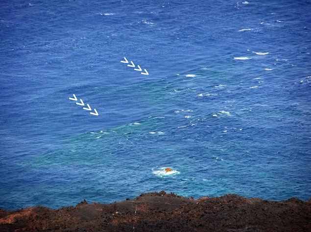
ER reader Mafl commented below this article that a German language El Hierro blogsite has spotted some coloring of the coastal waters in the El Golfo bay. The coloring was noticed after the 1 km depth earthquake with epicenter in the El Golfo Bay. The writer says that he only reports what he saw and that science have to find out whether what was seen has a volcanic background or not.
Image courtesy ElHierro1.blogspot.de
Update 25/07 - 08:37 UTC
- The last earthquake of July 24 was recalculated as a M2.9 earthquake at a depth of 21 km. This quake was felt by the people of the island as a very weak shaking (MMI II).
- The 1 km depth earthquake is still in the IGN charts, which means that it was confirmed. We do not see however any shallow eruptive action at that location (El Golfo bay) as there were almost no other earthquakes in that area. The probable cause is the deformation stress.
- The first earthquake of today was a M1.8 quake at a depth of 18 km below the western part of the island
- Vertical deformations are up again at PINA and FRON stations
Update 24/07 - 22:43 UTC
- One of the more active days today. 4 earthquakes is already a while ago. The extremely shallow quake in the El Golfo bay has still to be confirmed by IGN (preliminary data). This earthquake is rather weak and similar shallow earthquakes during the strong swarm period were probably caused by deformation stresses.
21:17:49 Depth 19 km M 2.8 mbLg SW EL PINAR
20:11:37 Depth 1 km M 1.6 mbLg W FRONTERA
12:19:43 Depth 21 km M 1.9 mbLg SW FRONTERA
10:23:13 Depth 18 km M 1.7 mbLg W EL PINAR
Joke Volta Weekly report
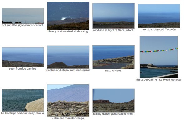
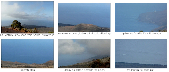
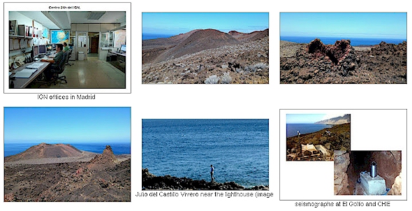
As the volcano below El Hierro has started his strike again, our daily updates have been reduced to limited activity updates. Life at the island does however continue and Joke Volta keeps track of what happens at El Hierro and the neighboring islands, takes some images now and then and reluctantly looks for information about the volcanic process.
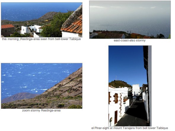
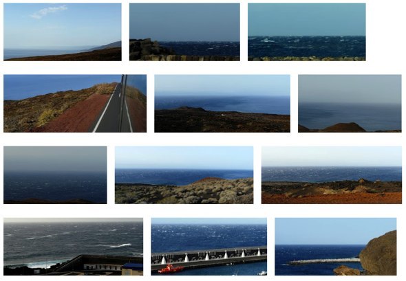
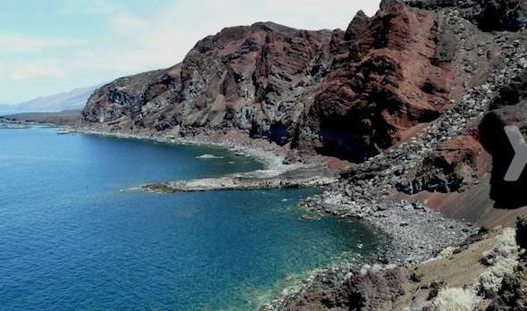
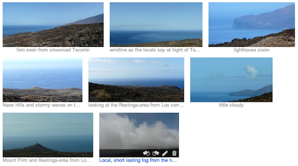
She made a lot of effort in creating a weekly overview, which you can read here (a PDF document with integrated pictures - the same pictures can be looked at in greater size if you click on the thumbnails below).
Update 23/07 - 12:35 UTC
- The day ended yesterday with 4 earthquakes. Respectively M1.9 @ 26 km, M1.5 @ 18 km, M1.7 @ 22 km and M1.6 @ 20 km
- We witnessed 1 earthquake today, a M1.8 @ 18 km West of El Pinar
- Dr. Sagaya's deformation data are showing a further stabilization at the vertical component compared to the values of the preceding days.
Update 22/07 - 07:39 UTC
- At 01:51 this morning, a M1.9 earthquake occurred at a depth of 26 km at the westernmost tip of the island. This is the first earuption zone earthquake since a long time (swarm crisis included)
- No fundamental deformation changes this morning
Update 21/07 - 23:56 UTC
- We noticed also a second M1.9 earthquake today at 22:14 UTC at a depth of 15 km in the normal Las Calmas eruption feeding area. Epicenter location and depth are clearly different from what we have seen during the last crisis
Update 21/07 - 15:56 UTC
- A M2.5 earthquake occurred at 09:10 at a depth f 23 km to the west of the lighthouse.
Update 21/07 - 09:15 UTC
- Nothing to report this morning except the CSIC seem to be in serious trouble as they can't pay part of their contractors anymore. CSIC is a huge government agency with a workforce of 15000 people, among them a big number f scientists. The problems are probably due to the very severe financial problems of the Spanish government. We guess that's also bad news for the regional agencies like Involcan and other subsidized agencies like IGN. Politicians and science has never been an easy marriage and budget cuts are mostly easily found in such scientific institutions.
Update 20/07 - 13:12 UTC
- Vertical deformations are increasing again at stations PINA and FRON. Very slight at FRON and appox. 1 cm at PINA
- 2 new earthquakes so far today :
01:02 Depth 20 km M 2.0 SW FRONTERA
00:06 Depth 19 km M 1.6 W FRONTERA
Update 19/07 - 08:30 UTC
- NO earthquakes so far today
- The uplifting from PINA and FRON as reported yesterday and the day before yesterday has reversed into a strong decrease of approx. 0.5 to 1 cm
- The conclusion of the current non-events is that the new swarm episode seems to be completely over
Update 18/07 - 21:32 UTC
- No more earthquakes or important events since this morning
Update 18/07 - 07:37 UTC
- 1 M2.0 earthquake at a depth of 27 km to the north of Valverde. The location is approx. 10 km to the north of the island and is far away from the magma feeding area which we looked at since June 24. Epicenter location.
- We have the impression that some stations from the Univ. of Nagoya are no longer followed (like SABI). No improvement whatsoever in readability of the graphs. No dates on the x axis means that it is almost impossible to read the values. It always surprises us that the science people behind those graphs are not seeing such shortcomings. Of course they will have the numeric value too, but what is the sense to make a daily graph if you cant read him properly.
Stations PINA and FRON are confirming the small uplift from yesterday.
Update 17/07 - 21:50 UTC
- It looks like the day will end with only 3 earthquakes, the third earthquake being a M1,7 at a depth of 20 km to the west of Frontera
Update 17/07 - 10:59 UTC
- Our estimate was quiet right for the 07:46 quake. IGN listed a value of M3,4 at a depth of 18 km. Epicenter near the lighthouse. This earthquake was felt by the population.
- The second earthquake today measured M2,5 at a depth of 25 km.
- No other special events to mention.
Update 17/07 - 08:07 UTC
- A new strong earthquake occurred 21 minutes ago. IGN has not listed this earthquake yet. Based on what we see on CHIE we estimate the quake to be in the M3 to M3.5 range.
Update 17/07 - 07:39 UTC
- It looks like IGN (or the webmaster of their website) is in strike this morning. They simply stopped working (or showing) new data from 01:18 UTC!
- We do not know whether it has something to do with it, but IGN did not report an earthquake so far today
- ER reader Roland attracted our attention to a report (mainly in Spanish) published by Spanish scientists, which describes the October 2011 until March 2012 El Hierro events. Click here to read it. We are encouraging our readers to at least take a look at the numerous graphics which explain in sequences what was happening during the different phases. The images will show at the same time why the just ended swarm did not succeeded in reaching an eruption status (layers).
- Vertical deformation at stations PINA and FRON is up again. The other values are not reported yet.
Update 16/07 - 22:13 UTC
- At 22:00 UTC 5 more quakes were reported by IGN (7 total today). Depth of the hypocenter in between 18 and 24 km.
- The seismograph at CHIE showed almost a flat line today.
Update 16/07 - 07:38 UTC
- There were finally 2 earthquakes at El Hierro yesterday : a M2,1 and a M1.7 at 21 and 22 km depth.
- 2 earthquakes so far today:
03:01:09 Depth 20 km 2.0mbLg SW EL PINAR
05:42:25 Depth 21 km 1.8mbLg SW FRONTERA
- Vertical deformations are down from 1 to 2 cm (one of the biggest deflations so far).
- We expect Pevolca to announce a further normalization of the situation and to change the Yellow alerts on some parts of the island soon to Green again.
Update 15/07 - 10:13 UTC
- 1 earthquake so far today. A M2,1 at a depth of 21 km at 01:06
- We cannot say that it is completely over as 2 stations (Pinar and Frontera) are still showing positive vertical deformation values.
Update 14/07 - 21:13 UTC
- At 19:52 UTC, El Hierro got another (but luckily isolated) strong M 3,4 earthquake. The epicenter was at the usual lighthouse area and the depth was reported at 20 km. People at El Hierro are reporting that they have felt this earthquake.
- This last earthquake brings the total number listed by IGN today on 9.
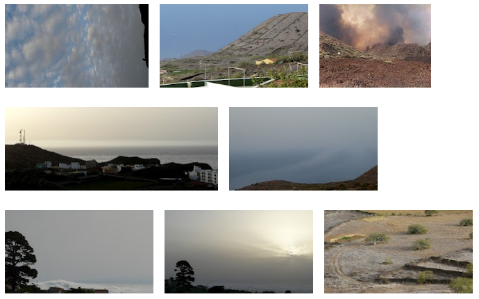
- Joke did her best to show our readers how El Hierro looked today. Click on the images to watch the photos in their real size.
Update 14/07 - 15:53 UTC
- 7 earthquakes so far. Depth 18 to 24 km.
Update 14/07 - 14:02 UTC
- 4 earthquakes since midnight. The strongest being a M2,5 earthquake at 13:13 UTC. Depth 18 km.
Update 14/07 - 10:26 UTC
- Only 1 very weak M0.6 earthquake at 01:52 UTC - depth : 20 km
- Vertical deformations as showed in Univ. of NagoyaGPS station graphs are generally down, another sign of the decreasing to halted activity
- Based on what we have seen the last couple of days, we can conclude that the current activity is over. We will (of course) continue to follow up what will happen in the coming days and weeks as a new swarm maybe possible.
Update 13/07 - 21:50 UTC
- 15 earthquakes so far today
- The latest earthquake listed by IGN occurred at 09:44 UTC!
- Joke Volta made 3 pictures today + a report that there was nothing to report. How events can change in such a short time!
 Update 13/07 - 07:29 UTC
- Yesterday has ended with a total of 12 "deep" earthquakes (17 to 23 km).
- Today was "earthquake-free" until 05:05. This period was followed by a weak new swarm of 8 earthquakes varying from M1,9 until M2,2. The epicenters were all located in the Las Calmas sea to the south of the lighthouse.
- In our Daily volcano activity report from yesterday July 12, we gave more information about volcanoes in Colombia, Mexico, Ecuador, Indonesia, Papua New Guinea, Nicaragua and the USA. Click here to read it.
Update 12/07 - 23:08 UTC
- The day will probably end with 10 earthquakes, the smallest number since June 24. Unless something exceptional will happen, we can conclude that the swarm is over without creating a big risk for an eruption.
Update 12/07 - 15:00 UTC
- 9 earthquakes so far today. NO change in depths or epicenter areas.
- New images from Joke Volta from a couple of hours ago. No special news to report.
Update 12/07 - 08:34 UTC
- 3 earthquakes so far today. The swarm looks to have been ended completely
- A rather strong M3,0 earthquake occurred at 05:30 this morning
- Deformations are or stabilized or are decreasing in the vertical component
- yesterday, the day ended with 22 earthquakes
- the depth never changed fundamentally and may have been the main reason why the recent eruption lava tubes were not found by the new magma feeders
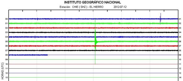
Update 11/07 - 16:40 UTC
- 7 earthquakes so far today. Our comment from this morning still holds.
- one of the earthquakes, a M1,6 West of Frontera has a depth of 3 km, but it is unsure whether madma intrusion is responsible for this quake. We don't think so.
- As it is calm at El Hierro, volcano lovers may like our today's Daily Volcano Activity report with a great video of Erta Ale in Ethiopia
- Below todays Joke Volta's images. As you will see, it was very windy today at El Hierro (which explains in part some thicker lines on the seismograms)
Update 11/07 - 08:18 UTC
- No fundamental change in deformations based on the graphs of Involcan / Univ. of Nagoya
- Almost NO earthquake activity since midnight. One should conclude that the swarm is almost completely over. Will there be another even more powerful swarm coming up ? Nobody knows!
- Only 2 earthquakes since midnight

 Update 10/07 - 21:44 UTC
- 65 earthquakes so far today and that means that in the last 4 hours the number almost quadrupled.
- Earthquakes are getting weaker with some isolated stronger ones
- Still a surprise to many that 2 very shallow earthquakes appeared earlier today, however not repeated later on. Specialists like Richard Wilson, our daily volcano activity reporter, are saying that those isolated shallow weak earthquakes are mostly due to deformation stresses (in whatever direction).
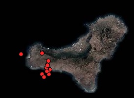
- We have at present a stronger episode of earthquakes (almost flat with a few exceptions earlier on). The present swarm started at 17:33. Hypocenter depths : still the same. Epicenter locations : little more to the east and as well below the island than just south in the Las Calmas sea (see Avcan map at right).
Update 10/07 - 17:17 UTC
- 17 earthquakes so far today
-Geomorphosites and Geotourism in Volcanic Landscape: La Corona del Lajial, El Hierro Volcano, located in the Canarian island of El Hierro (Spain). El Hierro receives a type of sustainable tourism related to its ecotourist offer based on products like diving or hiking. However, the volcanoes on the island are not appreciated enough as a tourist attraction. The objective of this paper is to highlight the tourist potential of volcanic geomorphology as a tourist resource and alternative activity to diving, by means of the creation of new ecotouristic products such as volcanic hiking. Click here to read the total content of this paper (a more readable large extract would be advisable for normal tourists).
Comment ER : We agree on the subject (of course). However there is more needed to make this ecotourism to a success. A positive approach to active volcanism is the first thing a volcano fan needs to feel welcome. Secondly and even more important is an island who is ready to accept open gates to the world. For the Canary Islands this means European tourists who hardly speak Spanish. We hope that just like younger people are doing right now, that also the authorities and tourist board are willing to communicate in a few other languages than Spanish (and not only via a few glossy leaflets made by advertisement agencies). The volcanic crisis has proved that we have hardly seen a trace of this. Our website has published (by means of Joke Volta) a few thousand pictures focusing on the beauty of the volcanic landscape. Not 1 word of appreciation to Joke or us, even more : they never have replied to the few emails we have send to them. Our pages are today and will be in future the biggest "advertisements" for El Hierro (we have welcomed more than 2 million unique readers since the beginning of the volcano activity). If the content of the paper will be realized, organizers are welcome to send us their programs. We will be happy to mention them and to link to them (at no cost of course).
Update 10/07 - 12:52 UTC
- 3 pictures photographed by Joke this morning
- Joke also told us that she hasn't felt the M3,8 during the early morning. She is a good sleeper she says :). Other people in El Pinar told her that they however felt it well
Update 10/07 - 11:57 UTC
- Involcan released new CO2 data. The results are as if there was no volcanic crisis going on!
- Yesterday we wrote about the (very) late info from the Helium-3 detection prior to the June 24 earthquake swarm. The reason for involcan publishing this info now is they didn't have the results until a few days a go. Samples can not be analysed in Spain as there is not a machine that can do that and they have to be sent to Japan! Then in Japan things were busy, so until now, it wasn't possible.
Update 10/07 - 10:00 UTC
- We agree, a little late (due to my PC migration problems) but nevertheless, we do not like you to miss Joke's beautiful pictures from yesterday. No activity seen by Joke.
 Update 10/07 - 07:15 UTC
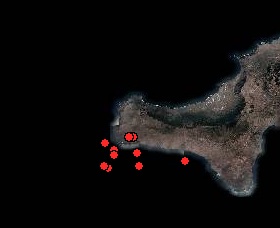
- 10 earthquakes so far today
- As ER reader Roland was mentioning earlier today, a strong quake occurred to the east of the normal epicenter area, close to the Tacoron coast, it was however at a depth of 22 km. This earthquake was well felt on the island.
- Deformations from the Univ. of Nagoya / Involcan seem to climb again (always difficult to determine because of the lack of date details)
- 10 earthquakes is the least we have seen so far at this time of the day, but as we all now, everything can change quickly at El Hierro
- Hopefully it will be today the last day of my PC migration problems (at least those who make working difficult)
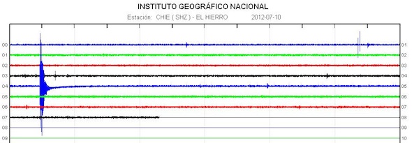
- Yesterday Involcan disclosed data that they has measured increased helium about 1 week before the earthquake swarm started at June 24. Very interesting but rather late to report this to the public. May we expect from now on that these data will be reported earlier ?
Update 09/07 - 19:08 UTC
- luckily it is a calm day today as i am migrating all files from one PC tp another (and of course the wizard is not working!)
- 70 earthquakes so far today
- earthquakes epicenters are still on the western side of the island (both on land and below the Las Calmas sea)
- hypocenters are still too deep to generate other events
 Update 09/07 - 07:20 UTC
- We have ended yesterday with 121 earthquakes, which means another day of strong energy release
- 30 earthquakes so far today
- depths are getting slightly deeper instead of getting more shallower, now within a range of 20 to 25 km
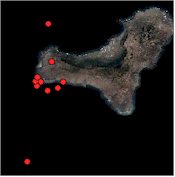
- The Avcan image at right is showing the epicenters of the last 10 earthquakes. A little more dispersed than yesterday night, but still very concentrated to the western side of the lighthouse
- We can only repeat what we have said since many days, as long as the depth of the earthquakes remains below the 20 km and as long as the epicenters do not migrate into another area of the island or the Las Calmas sea, nothing fundamentally will change. Instead of leading to an eruption, the current activity may soon come to end (prolonged strong seismic activity is rather seldom).
Update 08/07 - 22:19 UTC
- 110 earthquakes today and until this update
- The earthquake swarm is coming to an end but has generated an important number since a couple of hours
- Joke took an additional scan (3 zoom pictures and binoculars) of the Las Calmas sea and was unsure to see a stain or not. So, lets assume there was no stain at all (she was still thinking about the fisherman's comment this morning).
Update 08/07 - 20:24 UTC
- 98 earthquakes so far today
- A new series of earthquakes has started at 19:48 UTC
- Based on the epicenters and depths, we do not expect any fundamental change
Update 08/07 - 16:47 UTC
Richard Wilson, a geologist who is specialized in volcano seismicity and who is also the main contributor to our "(almost) daily Worldwide Volcano Acitivity report", describes the El Hierro situation as follows:
Apparently a new round of seismicity at El Hierro (Spain) during the past 24-48 hours. This is typical of intrusive activity, but not eruptive activity. Typically eruptive seismicity is sustained and builds to a crescendo (and occurs at much shallower depth) before material is erupted at the surface. Also, the up-down-up pattern in GPS data also suggests lateral spreading and intrusion rather than an eruptive pattern, which would also build and build and build. Now, that being said, this is my interpretation, with very limited resources as far as instrumental data and does not preclude a sudden shallowing and intensification of seismicity and deformation (and,...finally eruption!). All instrumental signs of intrusive activity beneath a volcano must be watched vigilantly while they are in-progress in order to "catch" any of these "signs" of a forthcoming eruption. This has been what is so intriguing/challenging for me to watch volcanoes since I was in my 20s (I'm 52 years old now!).
Update 08/07 - 16:29 UTC
- 89 terremotos or earthquakes listed by IGN so far today. 12 of these earthquakes had Magnitude of M3.0 or more. The strongest one was a M 3.6 earthquake at 11:13 UTC
- Pevolca issued a new report which has no real news in it. Click here to read it (Spanish)
Update 08/07 - 11:38 UTC
- Based on what we see on the seismogram but which has not been reported yet by IGN, we think that the Magnitude will be M3.5 to M4.0! A number of these earthquakes are well felt by the people living in the southern part of the island
- It is probably too soon to talk about a major shift in the earthquake pattern, but we notify a migration of epicenters to the east and we see more depths in the 17 to 19 km layers.
- The earthquake swarm is still continuing at this moment
Update 08/07 - 11:34 UTC
- Joke just returned from an inspection of the Las Calmas sea. She could not see any special color in the water (but she said that the view was quiet bad).
- Joke also talked to a fisherman who said to her that he saw a stain this morning above the old vent. Joke checked it and could not confirm the story of the fisherman
- The recent swarm has suddenly boosted the number of earthquakes (54 since midnight have been listed by IGN)
- The recent swarm is still continuing and the center of the activity is still at the lighthouse side of the island
- People who have subscribed to our earthquake list are getting regular notifications of new quakes
Update 08/07 - 10:24 UTC
-At 09:25, a new series of earthquakes has started at El Hierro. A number of earthquakes have been felt by the people, but are not yet listed at IGN
- The strongest earthquakes in this series are in between M2.5 and M3.0

Update 08/07 - 07:18 UTC
- the earthquake swarm yesterday evening had as a result that 113 earthquakes were listed by IGN (before this swarm, we wrote that yesterday would come out as the calmest earthquake day since June 24!). At least 7 of the earthquakes were felt by the people of El Hierro.
- 22 earthquakes so far today
- the depth of the hypocenters had no change at all today + NO additional shallow quakes have been reported
- Even with 22 earthquakes, the CHIE graph has visually returned to the pre-June24 levels
- The location of the epicenters is back to the western side of the island and the Las Calmas sea to the south of it (west of the lighthouse). The migration of earthquake activity towards the 2011 feeding system was reversed again.
- Almost all the vertical deformations as measured by the Involcan / Univ. of Nagoya were down this morning, this probably due to the earthquake-induced decompression after yesterday nights strong earthquake episode

Update 07/07 - 22:12 UTC
- It looks like the earthquakes have calmed again during the last 45 minutes. Tonights strong earthquakes came as a surprise to many as the activity winded down since the last couple of days. The only abnormal data since yesterday was a strong vertical (upwards) deformation at FRON and REST (see our earlier updates). SABI received no new values today. These stations were from the Univ. of Nagoya, Japan.
The IGN deformations were also mixed in the vertical deformations. Some were down like HI05, but HI10 has a strong upwards deformation.
Update 07/07 - 21:57 UTC
- After analyzing the epicenters of the last several quakes, we have noticed that the epicenter is gradually migrating to the east, towards the 2011 formed crater area (see image below)
- All tonights earthquakes occurred in the las Calmas sea
- As far as we can see now (all the recent quakes have not been listed yet, the depth remains at 18 to 22 km
Important Update 07/07 - 21:44 UTC
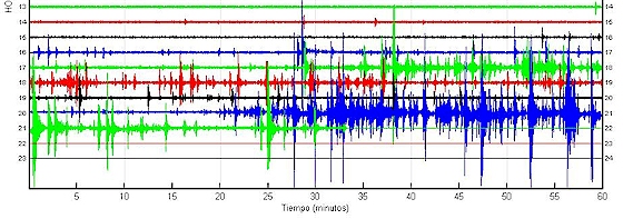
-The island of El Hierro is currently been shaken by a number of strong repetitive earthquakes. A lot of these earthquakes are greater than M3.0
- At least 6 of the latest earthquakes have been felt by the people of El Hierro
Update 07/07 - 17:57 UTC
- The volcano always surprises with a set of new earthquakes every time that we think "now it will be over"
- 46 earthquakes so far today
- We think that the shallow earthquake close to the island volcano summit (depth 2 km) is not volcanic, but caused by the deformation stress. It happened also a couple of days ago on almost the same location. All the other earthquakes are still at a depth of 18 to 22 km

Update 07/07 - 13:25 UTC
- 26 earthquakes so far today
- Calm day which maybe the beginning of the end of this swarm
- A few images from Joke Volta
 Update 07/07 - 07:17 UTC
- 51 earthquakes in total yesterday (IGN is gradually picking up lower Magnitudes since the bigger energy quakes have ended)
- 17 earthquakes so far today
- same average depths than before with the exception of a few shallower ones. 14.9 km the shallowest earthquake today
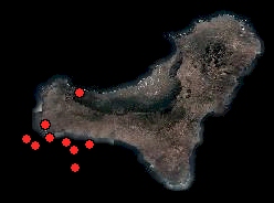
- Epicenters are a little more dispersed today. From the latest 10 earthquakes, at least 4 were to the east of the lighthouse (see Avcan map at right).
- All deformation data from Involcan / Univ. of Nagoya are not yet reported today, but thenew data for the FRON and REST stations are showing a strong increase (more than 1 cm) in UR (ultra rapid) vertical deformation
El Hierro earthquake notification in your Email (updated for El Hierro, La Palma and Tenerife)
Earthquake-report.com has a very speedy earthquake notification service linked the most important agencies of the world. IGN is not in our data group but EMSC is as quick as IGN in reporting earthquakes (and apparently uses IGN data). As you probably have witnessed the last couple of days, earthquakes and especially strong earthquakes are playing an important role in eruption activity. Subscribing and unsubscribing to our service is done in seconds and if an earthquake above your set level occurs a notifications is being send the next minute.
How to subscribe : Click on this Canary Islands Volcanoes - Only earthquake page - Click on the banner above this listing
Next : fill in your email address, the choice of your frequency (immediately looks logical to us) and finally the email triggering level (3 or 3.5 for volcanic earthquakes seems logical to us).
Every email send will contain an unsubscribe link.
Important : This is an opt-in subscription list and after filling and sending the form, an email will be send to confirm your subscription. This Email often lands in the spam folder (although we are definitely NO spammers). Pick it up there and please reconfirm
Read also : Scientific paper reveals massive historic Tenerife volcano flank collapse
Read also: Economic impact on El Hierro and the Canary Islands if an aerial eruption would occur
Volcano Discussion Panel : If you are a person who wants to discuss and read about all aspects of volcanoes, this discussion panel might be a very good place to hang around. Especially if we start speculating about what to happen next.
