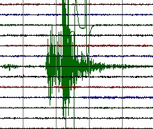
M 5.2     2011/02/13 23:51    Depth 43.8 km   NEW IRELAND REGION, PAPUA NEW GUINEA
February 14, 2011 at 09:51:01 AM at epicenter
Moderate earthquake at an intermediate depth below the wilderness of Latangai Island. No people around.
89 km (55 miles) E (95°) from Rabaul, New Britain, PNG
Quake-maps.com satellite map + I Did Feel It form
Alternative satellite map
M 4.5     2011/02/13 19:25    Depth 8.1 km   DOMINICAN REPUBLIC / PUERTO RICO
03:25:25 PM at epicenter
A safe distance out of the Puerto Rico and Dominican Republic coast.
145 km (90 miles) NNW of Mayaguez, Puerto Rico
Quake-maps.com satellite map + I Did Feel It form
Alternative satellite map
M 5.0     2011/02/13 19:12    Depth 41.8 km    KYRGYZSTAN
February 14, 2011 at 01:12:35 AM at epicenter
Moderate earthquake at an intermediate depth near the Chinese border and only a few km from Nura and Irkeshtam
58 km (36 miles) ESE (105°) from Sary-Tash, Kyrgyzstan
Quake-maps.com satellite map + I Did Feel It form
Alternative satellite map
3-dimensional view of the earthquake area (USGS epicenter location)
M 4.5     2011/02/13 17:51    Depth 32.6 km   NEPAL
11:36:22 PM at epicenter
Weak shallow earthquake close to Gudel and approx. 35 km from Lukla, known with Everest area tourists as the Hilayan Airport.
46 km (28 miles) SSE (159°) from Namche Bazar, Nepal and 159 km (98 miles) E (100°) from KATHMANDU, Nepal
Quake-maps.com satellite map + I Did Feel It form
Alternative satellite map
M 4.4     2011/02/13 16:42    Depth 105.8 km   MYANMAR
11:12:11 PM at epicenter
Weak and deep earthquake only 164 km (102 miles) NW (308°) from Mandalay, Myanmar
93 km (58 miles) NNW (340°) from Monywa, Myanmar
Quake-maps.com satellite map + I Did Feel It form
Alternative satellite map
M 6.0     2011/02/13 10:35    Depth 13.3 km   OFFSHORE BIO-BIO, CHILE
07:35:06 AM at epicenter
Very strong aftershock. More information : click on the link below
Please read our in-depth report about this earthquake - Click here
Quake-maps.com satellite map + I Did Feel It form
Alternative satellite map
M 5.8     2011/02/13 08:51    Depth 25.4 km   OFFSHORE BIO-BIO, CHILE
05:51:34 AM at epicenter
Very strong aftershock. More information : click on the link below
Please read our in-depth report about this earthquake - Click here
Quake-maps.com satellite map + I Did Feel It form
Alternative satellite map
M 4.7     2011/02/13 00:12    Depth 35.4 km   ANDAMAN ISLANDS, INDIA REGION
05:42:05 AM at epicenter
Moderate earthquake in between the North Andaman Islands and Coco Island
Approx. 20 km from the epicenter of the August 11, 2009 magnitude 7.5 earthquake (NO casualties)
Quake-maps.com satellite map + I Did Feel It form
Alternative satellite map
Daily summary of deep moderate or weak quakes only faintly felt by people living above it
M 5.1     2011/02/13 19:05     Depth 206.4 km   FIJI REGION
Earthquakes occurred yesterday (UTC time), but today local time
M 6.1     2011/02/12 17:57    Depth 81.0 km    TONGA
February 13, 2011 at 06:57:56 AM at epicenter
Very strong earthquake weakened by the intermediate depth of 81 km. Approx. 40 km from Kolovai, Tonga
55 km (35 miles) NW of NUKU`ALOFA, Tonga
NOAA did NOT published a tsunami report. (as could be expected)
62,000 people will probably have experienced a V MMI shaking = moderate shaking.
80,000 people live in a radius of 100 km around the epicenter
The islands have been regularly struck by multiple moderate to strong earthquakes the recent months.
GDACS published a GREEN earthquake alert for this earthquake = very limited chance on damage and/or injuries
Quake-maps.com satellite map + I Did Feel It form
Alternative satellite map
 Useful information to read this daily earthquake list
This earthquake list covers important earthquakes in the world.
If a more detailed page is present, the earthquake line will be linked to the detailed page.
For your comfort, we will provide in most cases Google Satellite Map links to give you an idea where the earthquake struck, which terrain it happened and if villages or cities are located in the immediate vicinity. The reference for the time zone is UTC (Coordinated Universal Time, also called GMT)
The page is regularly updated to add new earthquakes.
green color = NOT dangerous for damage or injuries
orange color = MODERATE risk for damage or injuries
red color = CONSIDERABLE risk for damage or injuries
 QuakeSOS+ is an iPhone application developed by Armand Vervaeck, the creator and main contributor to Earthquake Report. The Application simplifies immediate group communication to friends and family members (with your exact GPS location) and is constantly feeding the users with œEarthquake Report news. Together with your own family and friends, QuakeSOS+ will be your closest earthquake friend. Buying QuakeSOS+ will support the activities of SOS Earthquakes.
a
 Quake-Maps.com was also created by SOS Earthquakes. Quake-Maps.com makes it easy to let the world know which shaking people have experienced during the earthquake. Quake-Maps.com gives also the opportunity to write some additional text. Filling up the form takes only 1 minute. Quake-Maps.com gives an overview of all the resent earthquakes and let you even go back in time and retrieve earthquakes of a certain date in the past.
Earthquake-Report.com headlines on twitter
@OnlyQuakeNews : Get all the headlines of our earthquake-report.com articles + regular updates on ongoing events
@QuakeSOS : earthquake-report.com news + automatic earthquake notifications of USGS earthquakes of M 4.0 or higher with emphasis to earthquakes in the America's and the Pacific Ocean sphere (4 and up) and a lot of the rest of the world (5 and up). This account was created for our QuakeSOS and QuakeSOS+ iPhone applications
@ShakingEarth : earthquake-report.com news + automatic earthquake notifications of EMSC earthquakes of M 4.0 or higher with emphasis to earthquakes in European and Asian / Middle East sphere (4 and up) and a lot of the rest of the world (5 and up). This account was originally created to stimulate our Facebook account
@QuakeMaps : earthquake-report.com news with mapping notifications of ALL earthquakes M 3.0 and higher from all over the world via EMSC and USGS. This account was created for our http://www.quake-maps.com website