We have created this special in-depth article for the activity of New Zealand volcanoes. This page will bring information on whatever interesting news of volcano activity. Just like we have worked in the El Hierro eruption, we have chosen for a continuing article with the most recent content on top of the article.
Best Webcams : White Island Crater Rim and White Island Crater (1 image every 30 minutes) - Mt Tongariro (1 image every 15 minutes). If you know about a better one, please inform us and we will include it here
Read also our archived parts of this activity report : (31/7 – 05/08) – (06/08 - 07/08) -
-
Update Nov. 23 , 00:12 UTC - Ruapehu volcano
Likelihood of eruption at Ruapehu still remains
Volcanic Alert remains at Level 1
Aviation Colour Code remains Yellow
Results from the analysis of the crater lake samples taken on Wednesday suggest that the level of activity at Ruapehu hasn’t changed since last week. There are still indications of volcanic unrest, and despite Ruapehu being quiet at the moment, an eruption could occur with little or no warning. The Aviation Colour Code remains at Yellow and the Volcanic Alert Level remains at 1. GNS Science continues to closely monitor Ruapehu.
Update Nov. 23 , 00:11 UTC - Tongariro volcano
Eruption update: Activity still low at Tongariro
Volcanic Alert Level remains at Level 2
Aviation Colour Code changed to Yellow
Activity recorded at Tongariro remains at a low level. There is still a substantial amount of gas emitted but no ash. Gas smell may therefore be expected downwind from Tongariro. GNS Science lowered the Aviation Colour Code to Yellow from Orange due to the absence of ash being emitted from the volcano since the eruption. The Volcanic Alert Level remains at 2 and the volcano may erupt at any time with little or no warning. This morning, GNS Science installed some additional equipment at an existing monitoring site, 3 km north-west of the active crater. A “gas flight” is also planned as soon as possible when weather allows, with the intent of measuring the amount of gas coming out from the volcano. The Aviation Colour Code is now at Yellow. The Volcanic Alert Level remains at 2. GNS Science continues to closely monitor the situation.
Update Nov. 22 , 05:23 UTC - Tongariro volcano
Tongariro still gassing but no ash
Volcanic Alert Level remains at Level 2
Aviation Colour Code remains Orange
Activity at Tongariro remains low but the volcano is still emitting a significant amount of gas, but with no ash. Today’s observations confirm that the volcano is producing a lot of gas. The odour was noticed in the Manawatu and Hawke's Bay, the primary downwind areas of Te Maari (Tongariro). Depending on weather conditions people may notice the smell of sulphur a hundred kilometres or more from the volcano. However, any health impact is likely to be limited to minor irritation of the skin and eyes, and possibly some irritation of the throat. Anyone who has respiratory problems and/or uses asthma medication, and has concerns with their health related to the gases, should seek medical advice.
GNS scientists carried out an observation flight around Tongariro today and were able to assess the general extent of the yesterday’s eruption. GNS scientist Craig Miller reported that “The Upper Te Maari hasn’t changed significantly after the eruption”.
The Volcanic Alert Level remains at 2 and the Aviation Colour Code at Orange. GNS Science continues to closely monitor the situation.
Background
The Volcanic Alert Level ranges from 0 to 5 and defines the current status at a volcano. Level 2 indicates that a minor eruption has occurred. Aviation Colour Codes are based on four colours and are intended for quick reference only in the international civil aviation community. Code Orange indicates that a volcanic eruption is underway but with little or no ash being produced.
Brad Scott, Nico Fournier - Volcanologists
Update Nov. 22 , 00:45 UTC - Ruapehu volcano
Likelihood of eruptions at Ruapehu remains
Volcanic Alert remains at Level 1
Aviation Colour Code remains Yellow
Yesterday GNS Science volcanologists visited the summit crater lake to sample the water and gas. Some provisional results should be available within a few days. GNS volcanologist Brad Scott said, “The lake remains similar to our last visit on 10 November. The lake is a uniform blue colour with very little convection and the temperature was only 19.5 °C. Everything looks quiet at the surface”.
Recent measurements at Ruapehu indicate that the likelihood of eruptions has increased and the observations yesterday don’t change this. The Aviation Colour Code remains at Yellow and the Volcanic Alert Level remains at 1. We are monitoring Ruapehu closely, but it often does not give any immediate warning that it is going to erupt. Since late-October small earthquakes have been occurring about 5 km beneath the summit area of Ruapehu, but these may not be directly related to the high temperatures beneath Crater Lake as the earthquakes are much deeper.
Background
A build-up of pressure beneath Crater Lake is thought to have caused the 2007 eruption and a smaller eruption in 2006. We think that the temperature a few hundred metres beneath Crater Lake is about 800 °C, but the lake itself is only about 19-20 °C. This suggests the vent is partly blocked which may be leading to a pressure build-up beneath Crater Lake. A sudden release of the pressure may lead to an eruption.Aviation Colour Codes are based on four colours and are intended for quick reference only in the international civil aviation community. Code Yellow indicates that a volcano is experiencing signs of elevated unrest above known background levels. The Volcanic Alert Level ranges from 0 to 5 and defines the current status at a volcano. Level 1 indicates a departure from typical background surface activity.
Brad Scott, Nico Fourier, Volcanologists
Update Nov. 22 , 00:40 UTC
Eruption update: activity decreased at Tongariro but risk remains high
Volcanic Alert Level remains at Level 2
Aviation Colour Code remains Orange
Activity at Tongariro has been at low level since yesterday’s eruption. There remains a significant probability of sudden eruption within the next week. After reviewing monitoring data, videos and images for yesterday's eruption at Tongariro, GNS Science confirms that the eruption lasted approx 5 minutes, with an ash column and plume being ejected 3-4 km above the Upper Te Maari crater. An inspection flight will be made later today and GNS Science continues to closely monitor the situation.
Background
The point of origin of yesterday’s eruption was similar to that from 6 August, 2012. During yesterday’s eruption, two small pyroclastic density currents were produced at the base of the column, to the West and North of the crater, and reached a limited distance of a few hundred metres downslope. These pyroclastic density currents are a mixture of ash, volcanic gas and atmospheric air flowing horizontally and being driven by gravity. Scientists believe that these were produced by part of the ash column not being energetic enough to rise, causing it to collapse at the base and flow downhill. There is no evidence at this stage of big blocks having been ejected far from the crater during the eruption.
From the preliminary examination of ash, GNS Science volcanologist Michael Rosenberg reported that “we haven't found any evidence yet of magma having reached the surface during the eruption”. More ash sampling and analyses by New Zealand volcanologists are planned or already underway.
There was no observed warning immediately prior to yesterday’s eruption. Future eruptions could also occur with little or no warning.
Aviation Colour Codes are based on four colours and are intended for quick reference only in the international civil aviation community. Code Orange indicates that a volcanic eruption is underway but with little or no ash being produced.
The Volcanic Alert Level ranges from 0 to 5 and defines the current status at a volcano. Level 2 indicates that a minor eruption has occurred.
Brad Scott, Nico Fournier, Volcanologists
Update Nov. 21 , 08:56 UTC
Did we had a new small eruption a short while ago or is the tremor on the seismogram from an earthquake elsewhere ?
The webcam image is not conclusive because of the low clouds
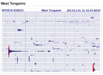
21 November 2012, 5:30 pm (local time)
Eruption update: activity decreased; Volcanic Alert Level is at Level 2; Aviation Colour Code changed to Orange
This afternoon’s small eruption at Upper Te Maari Crater appears to be over for now, GNS Science said today.
GNS Science has now decreased the Aviation Colour Code from Red to Orange signalling that ash is no longer being erupted. However, minor eruptive activity continues and the Volcanic Alert Level remains at 2.
The eruption occurred from the Upper Te Maari crater, in the same area that erupted on 6 August this year. Today’s eruption happened at 1:25 pm and lasted for less than 5 minutes although local earthquake activity continued for about 15 minutes. The eruption appears to have ceased for now.
GNS Science staff Nico Fournier, Agnes Mazot and Craig Miller witnessed the eruption from a few kilometres away. “We didn’t hear anything but could suddenly see an ominous dark grey cloud of ash drifting towards us” said Dr Fournier. The eruption was also seen by trampers walking on the Tongariro Crossing. There are no reports of injury.
Ash erupted during the first few minutes reached 3 km to 4 km height and was clearly seen from Taupo. A light dusting of ash fell across part of State Highway 46 and north-east towards Turangi but no more ash has been reported this afternoon as the gas and steam cloud drifts towards the south east. Ash is being collected this afternoon and will be analysed at Massey University to assess potential human and animal health effects. Results are expected in the next few days.
Today’s eruption did not produce any directed rock blasts or debris flows like those made by the August eruption.
Background
This afternoon’s eruption occurred without any measured precursory changes and this reinforces the unpredictable nature of volcanoes. We cannot say what will happen next at Tongariro but the scenario considered most likely, based on the August 2012 eruption and the description of late 1890s eruptions, is that we could expect another eruption of similar size at any time during the next few weeks. Eruptions are not expected to escalate in size. Aviation Colour Codes are based on four colours and are intended for quick reference only in the international civil aviation community. Code Orange indicates that a volcanic eruption is underway but with little or no ash being produced.
The Volcanic Alert Level ranges from 0 to 5 and defines the current status at a volcano. Level 2 indicates that a minor eruption has occurred.
Brad Scott, Nico Fournier
Volcanologists
November 20/21, 2012 volcano activity
Tongariro volcano (New Zealand) erupts again
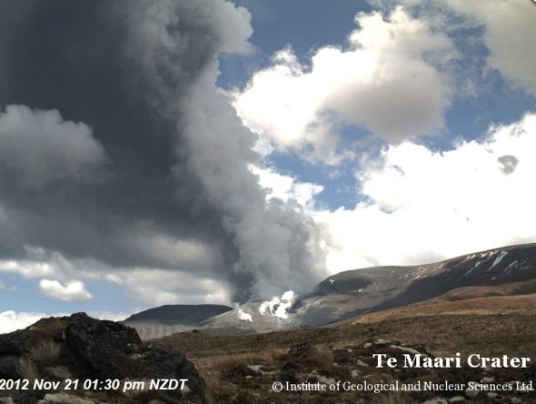
On the webcam from Geonet, the black/Grey somle column can clearly be seen.
Click here to follow the views of the Geonet Tongariro webcams - Visibility is fair
The Geonet staff has currently blocked the webcam view at the eruption time.
Update 01:07 UTC : As could be expe"cted in the current conditions, the airspace alert color has been changed to RED from Yellow. Airplanes are NOT allowed to fly over or near the volcano.
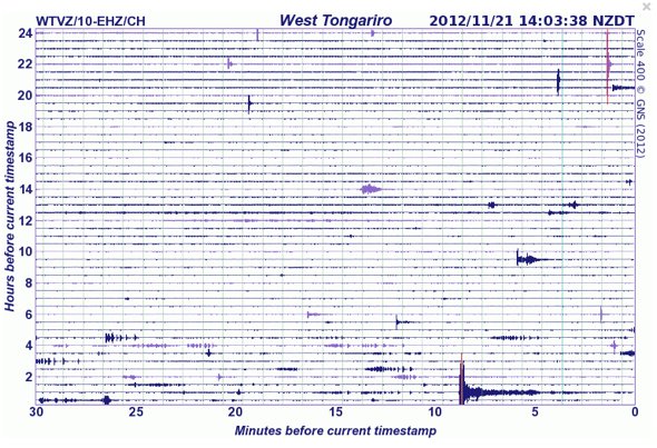
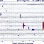
The eruption seismic event can well be seen on the Tongariro seismograph below.
21 November 2012, 1:45 pm - Eruption at Tongariro/Te Maari Craters; Volcanic Alert Level is raised to Level 2; Aviation Colour Code is changed to Red
An eruption occurred at Te Maari Craters, Tongariro at approximately 1:25 pm today (Wednesday, 21 November 2012). GNS Science volcanologists are monitoring the eruption and further information will be released as soon as it is available.
Michael Rosenberg
Duty Volcanologist
Update August 24 - 22:00 UTC - Mt. Tongariro
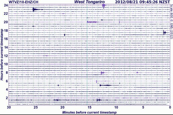
Mount Tongariro volcano (New Zealand) showed some seismicity earlier today (see seismogram below). The activity can only be seen in Oturere and West Tongariro seismograms (close to the Te Maari craters). Below also one of the rara clear view images of Mt. Tongariro with a strongly steaming vent. N report from GNS science about the seismicity however. The Park service has announced that the trekking trails at Mount Tongariro would be reopened. A 3 km hazard and risk zone will remain in place for some time and might be further reduced once new information of the gas and ash composition is known.
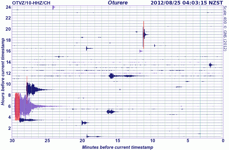
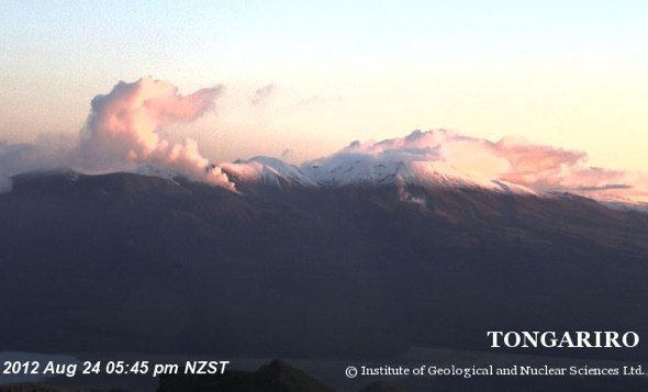
Image courtesy GNS Science and Geonet
Update August 20 - 20:47 UTC - Mt. Tongariro
No more news bulletins from GNS Science. Bad weather is still prevailing in New Zealand and volcanologists are hindered in their normal work. The drum at West Tongariro shows some minor activity during the last 24 hours, but whether this letaes to stronger venting cannot be seen on the webcams.
Volcanic alert level remains at 1 and Aviation color code remains at Yellow
Update August 20 - 22:00 UTC - White Island
No more news bulletins from GNS Science. The drum at White Island crater shows some stronger activity periods ot they may have been influenced by bad weather what we do not believe.
Volcanic alert level remains at 1 and Aviation color code remains at Yellow
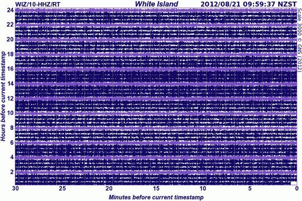
Image courtesy Geonet - GNS Science
Update August 17 - 00:15 UTC - Mt. Tongariro volcano
Ten days has elapsed since the eruption of Tongariro on the evening of August 6. Although very minor amounts of ash were emitted in the first few days after the eruption, there has been no significant activity since August 6. Seismic activity which had been above normal for some of the period preceding the eruption returned to normal low levels after the eruption. Volcanic gas flux measurements after the eruption were high, but poor weather has prevented any recent measurements. Minor eruptive activity, which is required for Volcanic Alert Level 2, is no longer occurring and the Volcanic Alert Level is consequently reduced from 2 to 1.
The New Zealand Volcanic Alert Level system is based on the current level of activity at a volcano. It does not include any forecast of possible activity in the future. Level 1 at Tongariro indicates “Departure from typical background surface activity. Signs of volcano unrest”.
The Aviation Colour Code, which applies only to aircraft near the volcano, remains at Yellow. This indicates that the “Volcano is experiencing signs of elevated unrest above known background levels” and is still considered to be appropriate for Tongariro.
Over the next seven days the scenario considered most likely is that there will be no further eruptions. The next most likely scenario is that any eruptions will be of similar size to the eruption on August 6. The scenario considered least likely is that larger eruptions will occur. Any further eruptions could occur with little or no warning.
Update August 17 - 00:15 UTC - White Island volcano
Over the last week the amount of ash being erupted at White Island has gradually declined. Little or no ash has been visible in the plume this week. Seismic activity has also remained low during this period. Sulphur dioxide (SO2) flux from the volcano is at typical levels. Minor eruptive activity, which is required for Volcanic Alert Level 2, is no longer occurring and the Volcanic Alert Level is consequently reduced from 2 to 1.
The New Zealand Volcanic Alert Level system is based on the current level of activity at a volcano. It does not include any forecast of possible activity in the future. Level 1 indicates “Departure from typical background surface activity. Signs of volcano unrest”.
The Aviation Colour Code, which applies only to aircraft near the volcano, remains at Yellow. This indicates that the “Volcano is experiencing signs of elevated unrest above known background levels” and is still considered to be appropriate for White Island.
The sequence of events over the last few weeks has been:
- July 27-28: a sudden rise in the level of water in the Crater Lake;
- August 5: a small explosive eruption in the Crater Lake;
- August 8: eruption of ash from a new vent formed in Crater Lake;
- Since about August 12: declining ash emission.
(text courtesy Geonet and GNS Science)
Update August 16 - 10:28 UTC - Mt. Tongariro volcano
Seismic activity at Tongariro remained low overnight. Poor weather continues to prevent any views of the mountain, but volcanic activity is thought to also have been low.
The weather today is likely to prevent any fieldwork at Tongariro. Once the weather improves additional gas sampling flights and surface gas sampling will be attempted. Data will also be collected from portable seismographs on Tongariro.
- The seismogram at West Tongagariro shows some very weak to non-existent action, but the seismogram at Oturere (closer to the vent following a New Zealand reader), shows some action. Always hard to tell whether the action is weather noise or is volcanic action. In this case, we think it is (bad) weather related (metservice data are showing a lot of wind).
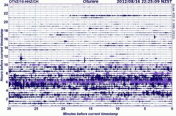
Image courtesy Geonet and GNS Science
Update August 16 - 10:28 UTC - White Island volcano
Volcanic and seismic activity at White Island has remained low overnight.
A minor steam plume is visible via a camera on the island. No ash is apparent.
Update August 14-15 - 21:55 UTC - Mt. Tongariro volcano
Seismic activity at Tongariro remained low overnight. Poor weather continues to prevent any views of the mountain, but volcanic activity is thought to also have been low.
The weather today is likely to prevent any fieldwork at Tongariro. Once the weather improves additional gas sampling flights and surface gas sampling will be attempted. Data will also be collected from portable seismographs on Tongariro.
Update August 14-15 - 21:55 UTC - White Island volcano
Volcanic and seismic activity at White Island has remained low overnight.
A minor steam plume is visible via a camera on the island.
Update August 13 - 22:33 UTC - Mt. Tongariro volcano
Seismic activity at Tongariro remained low overnight. Poor weather has prevented any views of Tongariro since Saturday, but volcanic activity is thought to also have been low.
The weather today is likely to prevent any fieldwork at Tongariro. Once the weather improves additional gas sampling flights and surface gas sampling will be attempted. Data will also be collected from portable seismographs on Tongariro.
Update August 13 - 22:33 UTC - White Island volcano
Volcanic and seismic activity at White Island has remained low overnight.
An ash and steam plume has been commonly rising to only a few hundred meters above the island.
Update August 13 - 07:43 UTC - Mt. Tongariro volcano
Volcanic activity remains low. There has been no significant seismic activity at Tongariro for several days. Heavy rain on Sunday produced minor lahars which affected State Highway 46. No further reports have been received since Sunday. Of the three eruption scenarios deemed possible over the next seven days, the scenario considered most likely is that there will be no further eruptions, the next likely is that any eruptive activity will be of similar magnitude to that on August 6, and the least likely that larger eruptions will occur.
Seismic activity at Tongariro has remained low since the August 6 eruption. No ground deformation originating in the Tongariro area has been observed. Recent poor weather has prevented visual observations.
Scientists have considered three eruption scenarios deemed possible over the next seven days and have evaluated these based on monitoring data, historic activity at Tongariro, and experience of New Zealand and overseas eruptions. Over the next seven days the scenario considered most likely is that there will be no further eruptions. The next most likely scenario is that any eruptions will be of similar size to the eruption on August 6. The scenario considered least likely is that larger eruptions will occur. This assessment is valid for only the next seven days and a change in monitoring parameters may change the assessment.
On Sunday heavy rain remobilised some ash erupted on August 6 and a minor lahar crossed State Highway 46 at the northern foot of Tongariro. No further reports of lahar flows have been received since Sunday.
Some concerns remain over the debris flow formed by the August 6 eruption that is blocking two small streams draining the northern slopes of Tongariro and the potential this has to produce larger lahars. A process is in place to start to assess this threat.
Analyses of volcanic gases from airborne measurements last Thursday have been completed and showed 3,900 tonnes per day of carbon dioxide (CO2) and 364 tonnes per day of hydrogen sulphide (H2S) gas, in addition to the 2,100 tonnes per day of sulphur dioxide (SO2) reported previously. These gases confirm the presence of magma beneath the volcano, but do not give any indication about its depth or volume.
The smell of hydrogen sulphide (H2S) gas was reported from several localities south of Tongariro over the weekend. High hydrogen sulphide (H2S) gas levels have been observed in the volcanic plume, and may potentially cause some discomfort for those with breathing difficulties. The areas affected will always be downwind of the volcano, and may change daily.
Several days of microscopic and geochemical analysis of the widespread ash (by Massey, Waikato, Victoria and Otago universities, and GNS Science) shows that there is very little or no new magma in the ejecta of the August 6 eruption. This suggests that the eruption was predominantly gas driven, but the involvement of magma in the future cannot be ruled out.
On Friday scientists collected gas and water samples from Ketetahi hot springs and collected some of the ballistic ejecta from the Ketetahi Hut area to help determine the nature of the erupted products.
Poor weather has prevented any further fieldwork today (Monday). Once the weather improves additional gas sampling flights and surface gas sampling will be attempted. Data will also be collected from portable seismographs on Tongariro. (report courtesy GNS Science and Geonet)

Seismogram of the last couple of hours at West Tongariro - image courtesy and copyright Geonet and GNS Science
Update August 13 - 07:43 UTC - White Island volcano
As a result of generally reduced ash emission the Aviation Colour Code has been reduced from Orange to Yellow.
Volcanic tremor remains at low levels compared to a week ago. The ash and steam plume remains at low levels and is commonly rising to only a few hundred metres above the island, although the plume height and ash content does vary.
On Friday a gas monitoring flight was carried out to measure the level of volcanic gases in the plume. This showed that all gases were at levels lower than the previous measurement on August 1. (report courtesy GNS Science and Geonet)
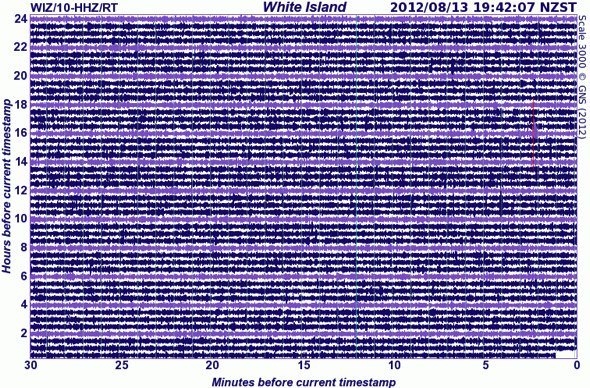
Seismogram at White Island (update time) - image courtesy and copyright Geonet and GNS Science
Update August 13 - 00:11 UTC - Mt. Tongariro volcano
Overnight, the volcanic and seismic activity from Tongariro Volcano remained weak. Although low cloud obscures direct views this morning, it is highly likely that steam and gas is continuously venting from the August 6 eruption craters.
On Saturday August 11 GNS Science advised of the potential for mud and debris flows in the northern Tongariro area given the forecasted heavy rain. Rain-triggered mudflows (lahars) are common on volcanoes following eruptions, due to the presence of loose ash and debris in stream catchments.
Following heavy rainfall yesterday morning (Sunday August 12), flows of muddy sediment-rich water crossed State Highway 46, approximately 6 km west of Rangipo. Taupo District emergency management teams responded to the situation. Scientific research teams from Massey University travelled to the area to record the flow characteristics and inspect other streams and stream channels. Further information will be reported as it becomes available.
Update August 12 - 00:11 UTC - White Island volcano
Overnight activity at White Island has remained at similar low levels to yesterday. Volcanic tremor remains weak at about the same level as it has been during the past four days. A low altitude plume of steam and gas with intermittent minor ash is being emitted.
Update August 12 - 15:09 UTC - Mt. Tongariro and White Island
Activity at both volcanoes remains very weak. Both drums have no special events.
The Taupo authorities are examining reports from local people that a lahar was being formed (lahars are dangerous mudslides formed by erupted ashes combines with rainwater). Staff from GNS Science will join the Taupu authorities in the investigation. State Highway 46 has been closed as a precaution but GNS staff said that, although possible, it is not necessarily a lahar. A Lahar is only a secondary (ash) effect from the eruption and has NO direct relation with the eruption itself.
Update August 12 - 00:16 UTC - Mt. Tongariro volcano
Overnight the activity from Tongariro Volcano remained weak. Seismicity in the local Tongariro area has remained low. The “noisy” signal on the seismograph drums is due to windy weather conditions.
Ash fall prediction plot (when a strong emission would happen) shows ash coming don to the south-west of the volcano (towards Okahune).
Update August 12 - 00:16 UTC - White Island volcano
Overnight activity at White Island has remained at similar low levels to yesterday. Volcanic tremor remains weak and a very low altitude plume of steam and gas with intermittent minor ash is being emitted.
White Island is an active volcano and always presents some level of risk. Visitors to the island are now at a high level of risk, particularly when approaching the active crater. Explosive eruptions can occur at any time with little or no warning. Additional hazards to visitors to the island include the health effects of volcanic ash and acid gas exposure, including respiratory issues, skin and eye sensitivity to acid gases. We advise a high level of caution should be taken, if visiting the island.
Ashfall prediction plot shows an area surrounding the island but not on the mainland..
Update August 11 - 12:16 UTC - Mt. Tongariro volcano
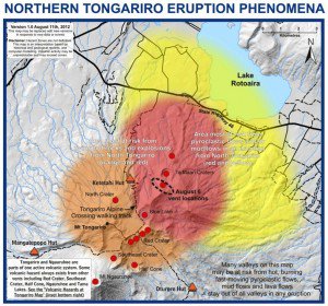
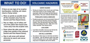
The following map and instructions has been produced by GNS Science using modeling of volcanic phenomena at Massey University and with expert input from both GNS Science and Massey University. It shows the currently most hazardous areas around the mountain.
During the past two weeks, GNS Science has been working with Massey University, Department of Conservation and the Taupo and Waikato Civil Defence and Emergency Management Offices to develop an updated map of volcanic phenomena that might be experienced during an eruption of Tongariro Volcano as part of the current unrest episode. The aim is to inform the public about which areas are more hazardous and should be avoided during an eruption. A similar map was produced in late 2007 covering the summit of Mount Ruapehu during the unrest period following an eruption there.
The map was developed using knowledge of the geological history of Tongariro, experience from other similar volcanoes internationally, volcanological expert opinion as well as mathematical modeling of possible phenomena undertaken at Massey University. For the modeling, scientists used a range of scenarios including different vent locations and different volumes of ejecta.
The map builds on a long term hazard map for awareness during times without obvious volcanic unrest that was developed for the whole of Tongariro in 2007. The new map includes a new zone to the north of Te Māri where the explosion on August 6 occurred.
This new zone shows areas that are at risk from volcanic flows (red and yellow on the map). These include mudflows, pyroclastic (hot ash) flows and lava flows. Mudflows are more likely during heavy rain and will be channelled down river valleys. Pyroclastic flows only occur during explosive eruptions and may not be confined to valleys. Both pyroclastic and mudflows can travel fast (up to around 100 km/h for mudflows or much faster for pyroclastic flows). Lava flows tend to be slow moving.
The most hazardous zone is within approximately 3 km of the area of potential new vents on the northern flanks of Tongariro – the summit hazard zone (red and orange on the map). Helicopter observations of the deposits by scientists this week have shown multiple impacts in this zone from flying rocks during the 6th August eruption, especially close to the vents. The area within both the flow and summit hazard zones is coloured red.
Currently the activity of the volcano is quiet, and there are no signs of an imminent eruption. We would likely expect to see an increase in unrest indicators prior to eruptions larger than the explosion on 6th August. Due to the potential hazards and the fact that they could affect state highway 46, authorities are recommending that people do not stop their vehicles while travelling along StateHighway 46 in the potential hazards area. The New Zealand Transport Agency has erected signage to this effect along the road. The map below may be updated as more information about the status of the volcano becomes available. GNS Science, Civil Defence and other agencies are working together closely on planning to ensure effective and timely reaction to various future eruption scenarios.
Hazard maps are common tools used by volcano monitoring agencies and emergency management officials around the world to inform the public about the threats from volcanic phenomena.
Earthquake-Report.com congratulates the New Zealand authorities for the way they are handling this volcanic alert. Efficient and in-time information, balanced graphics, technical details and seemingly a good cooperation in between different services. It does not surprise us, as also the Christchurch earthquake handling was probably the best we have seen in our reporting so far (the Chinese are in a close second position).
Update August 11 - 00:02 UTC - White Island volcano
Overnight activity at White Island has remained at similar levels to yesterday. Volcanic tremor remains weak and a low altitude plume of steam, gas and minor ash is being emitted. During the past few days the plume colour has been changing between pale grey and white as the ash content varies.
Update August 11 - 00:02 UTC - Mt. Tongariro volcano
Overnight the activity from Tongariro Volcano remained weak. Regional earthquakes have been recorded by GeoNet seismometers around the mountain but seismicity in the local Tongariro area has remained low. The Te Māri vents are not visible at this time from the north due to low cloud, but the view from the Ngauruhoe webcam does not show any significant plume.
No field work is planned for today, Saturday.
Update August 10 - 09:35 UTC
We had to cut off the first parts of this article because it became far too lengthy. Links to part 1 and part 2 are mentioned on top of this page.
Update August 10 - 08:17 UTC - Mt. Tongariro volcano
Overnight there was no further activity from Tongariro Volcano. Seismicity has remained low. The steam vents are clearly visible today as the weather is clear. A very minor amount of ash is reported from some of these vents. Results from a gas flight on Thursday show around 2,100 tons per day of sulphur dioxide (SO2) are being emitted from the volcano along with quantities of carbon dioxide (CO2) and hydrogen sulphide (H2S) gas. These gases confirm the presence of magma beneath the volcano. Analysis of ash continues to determine whether any of the magma reached the surface and was erupted on Monday night. Scientists today are undertaking further visual observations and will be collecting gas and water samples from the nearby Ketetahi hot springs. They will be collecting some of the ballistic ejecta from the Ketetahi Hut area to help determine the nature of the erupted products. An ashfall prediction plot is follows for this bulletin should a future eruption occur.
Update August 10 - 08:17 UTC - White Island volcano
- Alert levels remain the same (Level 2 and Aviation Orange)
- Official communique at noon NZT from GNS Science / Geonet New Zealand :
Overnight activity at White Island has remained at similar levels to yesterday. Volcanic tremor remains at low levels and a weak ash and steam plume is being emitted. The amount of ash emission varies over time and the plume is rising to only a few hundred metres above the island.
Reports last night of lightning from the island are incorrect. We have confirmed there was a lightning storm around 50km to the north of White Island which may have appeared as originating from the volcano when observed from the mainland. Satellite observations show no ash was detected in the atmosphere in sufficient quantities to cause lightning.
Visitors to White Island are now at the highest level of risk since the end of the 2001 eruptions. Additional hazards to visitors to the island now include the health effects of volcanic ash and acid gas exposure, including respiratory issues, skin and eye sensitivity to acid gases. Explosive eruptions can occur at any time with little or no warning. We advise a high level of caution should be taken if visiting the island.
Below this bulletin follows an ashfall prediction should ash continue to be emitted from the volcano.
Update August 9 - 22:35 UTC
- Both volcanoes are quiet silent at the moment. People who are following the seismograms will have seen a serious bump approx. 3 hours ago. This was however a non-volcanic M4.7 earthquake at a depth of 40 km in the bay of plenty.
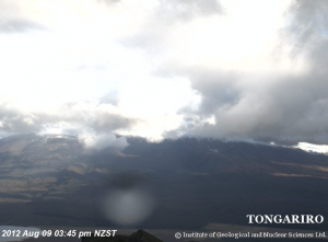
- As the weather cleared we are finally able to show the steaming plume of Mt. Tongariro.
Update August 9 - 15:07 UTC - White Island
- A lot of local reports are talking about lightning above White island. Volcanologists are telling the media that this does not mean an increased eruption but static electricity in the ash cloud. The volcano is currently erupting steam which contains a lot of ash. As far as we could see until now, nobody has good footage and some distant images from a webcam at Whakatane are the only testimonies of the lightning.
- Seismic activity at White Island has not changed since more than a day (see seismogram below)
Update August 9 - 09:18 UTC - Mt Tongariro
- At the time of writing, the skies cleared completely at Mt. Tongariro. The webcam is showing a sky full with stars.
- Some foreign tourists canceled their reservations at Tongariro National park after Sunday's eruption of Mt. Tongariro. Main reason is that they are scared of continuing eruptions. The news is normal but contradicts the authorities decision to re-open the majority of popular walking tracks in Tongariro National Park. Nevertheless, some overseas visitors have already decided they don't want to spend their holidays near an active volcano.
- GNS Science and Geonet published the following report at noon August 9 (NZT) :
Seismic activity at Tongariro was low overnight. Preliminary analysis of ashfall by Massey University shows moderate levels of fluorine in the ash. Initial microscopic examination of ash suggests that there was little or no new magma erupted on Monday night. Current eruptive activity is low level but could re-commence at any time. Seismic activity overnight was low with only a few small volcanic earthquakes recorded.
Ashfall collected on Tuesday from various locations around the volcano have been analyzed for fluorine content by Massey University. These results show that moderate levels of fluorine are present, but due to the restricted distribution of the ash, this currently poses no current human-health or agricultural threat beyond the immediate vicinity of the volcano. Enquiries about the fluorine analyses can be answered by Professor Shane Cronin of Volcanic Risk Solutions or Professor Mike Hedley of the Fertiliser and Lime Research Centre. Initial microscopic analysis of the ash also shows that there is very little or no new magma in the ejecta. This suggests that the eruption was predominantly steam driven, but the involvement of magma in the future cannot be ruled out.
The weather around the volcano has cleared this morning and a team from GNS Science and Massey University are currently making observations of the active vents and new deposits from the helicopter. We also hope to measure gas output from the volcano using an airborne platform and by road, weather permitting.
We continue to monitor the volcano carefully and will issue further updates as more information becomes available.
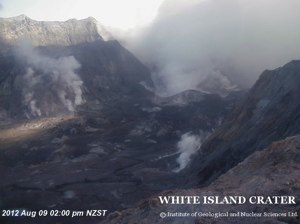
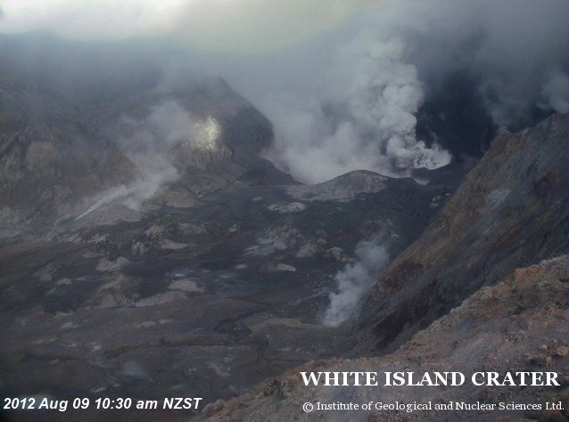
Webcam image after cleaning the webcam at the White Island Crater Rim - image courtesy and copyright Geonet and GNS Science
Update August 9 - 09:18 UTC - White Island
- The seismogram is not showing any increased activity at the time of this update
- GNS Science and Geonet published the following report at 14:00 August 9 (NZT) :
A visit was made to White Island this morning and observations confirm the volcano is in eruption. This is the first ash emission from White Island since February 2001 and represents the start of a new phase of volcanic activity at White Island. A vent has been established towards the south-west corner of 1978/90 Crater Complex and is now erupting an ash charged plume. The ash is only rising 2-300 m above the active vent, ie. a weak eruption. The ash is black and is depositing on the wall of the Main Crater to the west of the vent (light easterly wind). The ash from the past 2 days has washed away from the factory area. The active vent has started to build a tuff cone and there are impact craters around it created by ejecta from explosions. There was no sign of impact craters or blocks outside of the 1978/90 Crater area. The Factory and Rim web cameras were cleaned. Visitors to White Island are now at the highest level of risk since the end of the 2001 eruptions. Additional hazards to visitors to the island now include the health effects of volcanic ash and acid gas exposure, including respiratory issues, skin and eye sensitivity to acid gases. Explosive eruptions can occur at any time with little or no warning. We advise a high level of caution should be taken, if visiting the island. We continue to monitor the volcano and will issue further updates as more information becomes available.
Update August 8 - 22:41 UTC - White Island
- Better webcam weather at White Island where the crater webcam shows finally a good picture from the crater floor
- No harmonic tremor or seismic activity since many hours
Update August 8 - 22:41 UTC - Mt Tongariro
- The weather at the ski station looks a little better than a couple of hours ago
- The seismogram at West Tongariro shows some weak activity (tremor ?). We do not think that the graph shows bad weather. We will have to wait the reports from GNS Science to find out of the tremor is indeed volcanic.
Update August 8 - 15:14 UTC - Mt Tongariro
- Still bad weather along the North Island with easterly winds. The outlook seems also bad for the next 24 hours (at least for visibility). Webcams are showing a black screen
- Only some minor seismic events and no harmonic tremor at all
- We would urge the Ski Slope owners to point a HD webcam zoom camera towards Mt. Tongariro on one of their highest slopes. As most of the action is occurring at the north side of Mt Tongariro a HD webcam positioned at Tongariro Holiday Park might catch a glimpse of possible incandescent activity when another blast would take place. We will be happy to point our many readers to this webcam.
- The Department of Conservation says three new lakes have been created by Mount Tongariro's eruption on Monday night. Read more ...
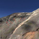
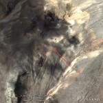
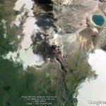
- We admit that the GNS Science observation flight images were a great help to have a glimpse of what really happened but most people still do not know to which area of the volcano the steaming activity refers to. Lets make an effort to solve this question (this is a trial to put some puzzle pieces together). With the help of the great Google Earth spot images (copyrights on the images), we have tried to simulate the same angle than the picture with the steaming vents below. The leftmost image shows the steaming area in detail (notice also the 2 seemingly earlier vents on the ridge (dark green patches)). The middle image shows a helicopter view of the same area with some coloring of earlier events and the right picture an image of even greater height. To understand these 3-d images you should first check the upper observation flight image below.
 |
 |
 |
Update August 8 - 12:04 UTC - White Island and Mt Tongariro
VAAC Wellington volcanic Ash expectations at 18:00 UTC today :
White Island - level of cloud 6000 ft (1.8 km). At midnight today VAAC does not expect a remaining ash cloud based on the current observations (12:00 UTC)
Mt Tongariro - level of cloud 18000 ft (5.4 km). At midnight today VAAC does not expect a remaining ash cloud based on the current observations (12:00 UTC)
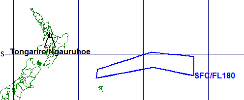
Mt Tongariro ash cloud prediction for aviation - Courtesy Metservice
Update August 8 - 09:55 UTC - Mt. Tongariro - Aviation alert color lowered to Yellow
GNS Science and Geonet published the following press report at 03:00 PM (15:00) NZ time :
Active craters and the near-vent effects of Monday night’s eruption at Te Māri craters were observed this morning during an observation flight to Mount Tongariro. Current activity is weak with some steaming vents visible below the cloud level. Explosions at a new vent area below the Upper Te Māri crater have thrown blocks out more than 1.5 km. Current eruptive activity is low level but could re-commence at any time. The Aviation Colour Code is reduced to Yellow, which recognises that activity has decreased but renewed unrest is possible.
A brief period of good weather this morning allowed GNS Science and Department of Conservation scientists to make an observation flight to Mount Tongariro. Seismic activity remains at a low level with only a few small events being recorded today. These observations and current monitoring data do not change the prognosis for future eruptions. Actively steaming vents were visible at a new crater area below Upper Te Māri crater but low cloud prevented any views above this elevation.
No vents have opened in or around the Lower Te Māri crater, or at lower elevations on the mountain. There are no new vents or craters at the Ketetahi thermal area. Previously steaming ground at Ketetahi and Lower Te Māri crater appears more vigorous, but there were no obvious major changes there.
Blocks of old lava and hydrothermally altered lava up to approximately 1 metre size have been ejected by the eruption. There are extensive areas to the east and west of the new vents where falling blocks have formed impact craters in the ground. No burnt vegetation was seen. No steaming hot blocks were visible and all appeared to be angular shapes more typical of existing old rock, rather than fresh lava or scoria. Most blocks were covered by grey ash but many on the western slopes were not, which suggests that they were ejected after the main ash-producing phase of the eruption had finished. Blocks had reached 1.5 km to 2 km from the Te Māri craters area.
A flow of rock and soil debris generated by the eruption partly fills a stream valley draining north-west from Upper Te Māri crater area. The deposit has blocked some stream tributaries but most water appears to be diverted around the edges. Ash has slumped from the banks into this stream valley and in other stream valleys ash has been re-mobilised in slurry flows. No lahars were generated by the eruption.
New rock falls were visible around the walls of the new vent area and Lower Te Māri craters and in some stream valley walls near the craters. This is a sign that significant ground shaking took place during Monday night’s eruption.
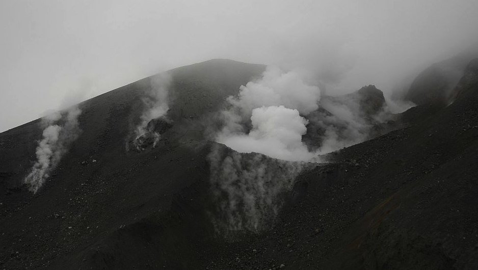
Mt. Tongariro new vents and active crater - image courtesy Geonet and GNS Science
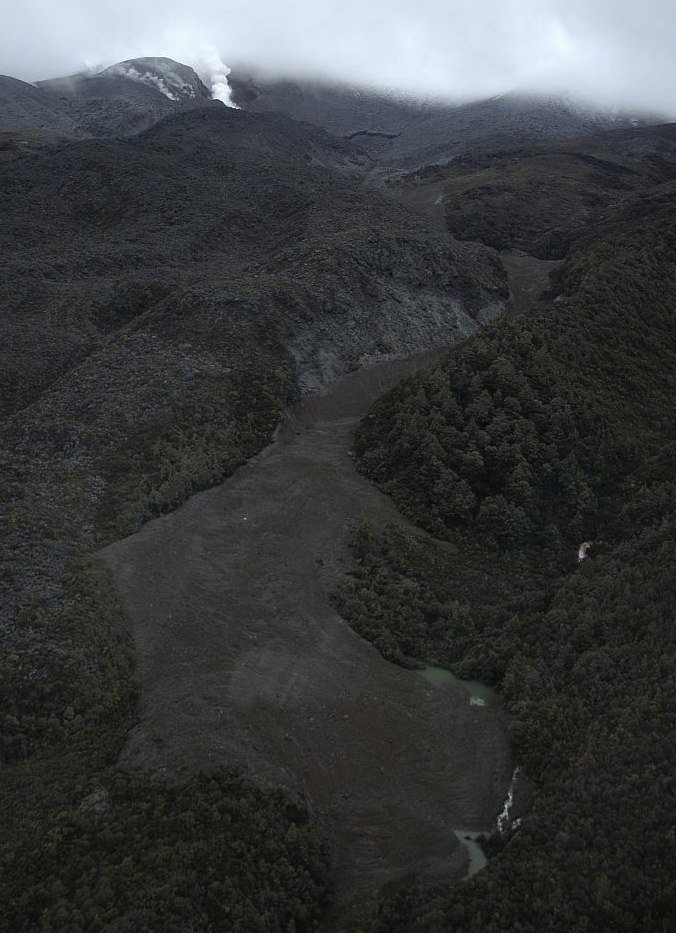
- Ash flow after Mt Tongariro's eruption, no lahar though - image courtesy and copyright Geonet and GNS Science
More pictures of the observation flight, Click here
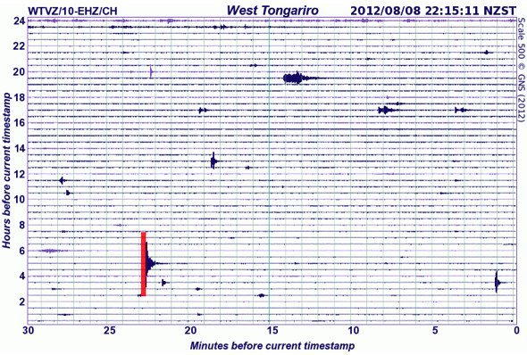
Seismogram at 22:15 local time - image courtesy and copyright Geonet and GNS Science
Update August 8 - 08:24 UTC - White Island
GNS Science and Geonet published the following press report :
Around 11:30 pm on August 7 volcanic tremor at White Island sharply decreased to levels seen prior to the current episode of unrest in late July. A few hours after this drop in tremor, the color of the plume changed from white to light brown, indicating more ash is now in the plume. Visual observations in recent days show that a small cone is being built in the lake, around the main area of degassing. This is the first time ash has been produced from White Island since 2000 and may represent the start of a new phase of activity at White Island.
Visitors to White Island are now at the highest level of risk since the end of the 2000 eruptions. Additional hazards to visitors to the island now include the health effects of ash and acid gas exposure, including respiratory issues, skin and eye sensitivity to acid gases. These hazards increase significantly towards the Crater Lake rim. Eruptions can occur at any time with little or no warning. We advise a high level of caution should be taken, if visiting the island.
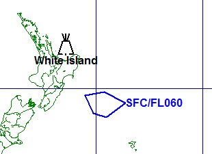
The ashfall prediction plot for 6:00 pm today indicates where volcanic ash may be deposited if ash continues to be produced from the volcano.
GNS volcanologists plan to visit the island this week to assess the situation and undertake further sampling and measurements.
- Alert level (2) and Aviation Alert color (Orange) remain the same
The video below shows a Time-Lapse video of the initial White Island eruption on Sunday morning (NZ time) or Saturday evening UTC time. the video is composed of 1 image per second.
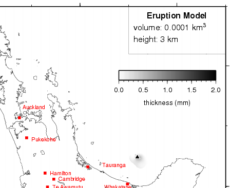
Probable volcanic ash distribution from White Island eruption - image courtesy Geonet and GNS Science
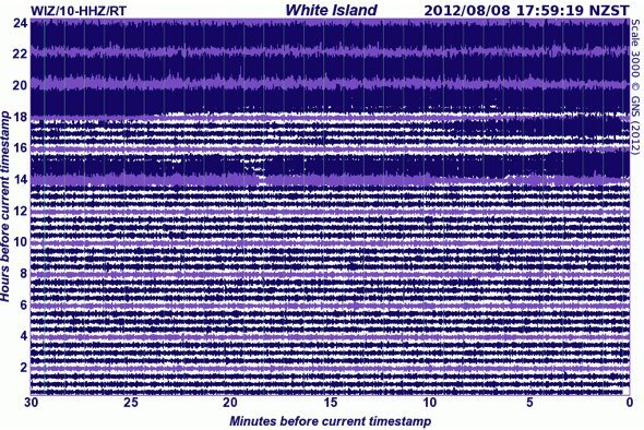
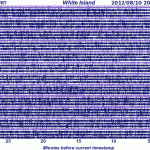
- Seismogram at White Island New Zealand - harmonic tremore has decreased to low levels - image courtesy Geonet and GNS Science




now let me understand this in the months leading up to Tongariro there were earthquakes for thefirst time in a hundred years...duh okay then the volcano erupts unexpectedly for the scientists. ....duh okay then the earthquakes continue...duh okay then we open the hiking tracks to tourists duh okay then we all gawk at the pyroclastic event which if had only been one magnitude bigger would have fricasseed the hapless students...duh okay but we are still thinking of opening some of the tracks duh okay and Ruapehu is looking a tad bit suspect(800C 1 km below crater lake which is full) yet kayaking and rafting continues on the whangaehu and maunganui a te ao rivers ...duh okay.... we already know that the eruption will be quite unexpected but get this despite ruapehu and tongaririo misbehaving the aviation codes at yellow on both its quite okay to fly over Ngaruahoe ( code green)
which happens to a humongous vent of the Tongariro system.and sits between the 2. check the geonet site. oh dear oh dear oh dear lordy lordy lordy where do these people get their degrees and hit me with the sillystick but one thing is certain if ngaruahoe erupts it will be quite unexpected.
3 new lakes:
http://www.radionz.co.nz/news/national/112694/new-lakes-formed-by-mt-tongariro's-eruption
Thanks Kukide - enclosed in the update
Please could you tell me the tsunamai risk if at all for Fiji post the eruption in NZ as travelling there 14/07/2012. Kind regards , Marg.
Dear Margaret. The possibility is non-existent. Enjoy your vacation.