–
Update March 11/12 - Overwhelming relief effort bu the community
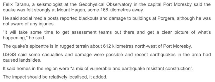
A LoopPNG article
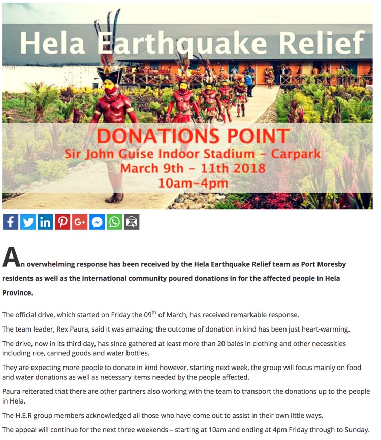
Update March 11/12 - Continuing (weaker) aftershocks and a rising death toll says PNG PM
Article excerpt from Radio New Zealand
Papua New Guinea's prime minister says the land is still moving and the death toll still growing after last week's magnitude 7.5 earthquake in the Highlands region. Peter O’Neill comforts a woman in an area affected by the 7.5 quake.Peter O’Neill comforts a woman in an area affected by the 7.5 quake. Photo: Supplied/ PNG Government Peter O'Neil said the lives of over 100 Papua New Guineans have been lost, with many more missing and thousands injured. Mr O'Neil said the scale of the disaster was immense and ongoing, as huge aftershocks continued to rock the region. He said he flew over major landslips on Wednesday  hat were not there after the initial quake.
Update March 11/12 - On top of the 108 fatalities (a preliminary count as almost everybody is convinced that more people have been killed), we have to report also that thousands have been injured and that 7000 houses/buildings have been destroyed. At least 26,000 people have been displaced.
To be honest and based on our experience, we believe that these (official) numbers are simply not true. They do not correspond with the destruction we have seen the last 2 weeks. We truly hope that the true size of this earthquake will be soon revealed.
Update 19:22 UTC: Israel contributes 40 generators to the relief efforts
A LoopPNG article
Update 08:31 UTC: The earth started to shift and started to shake violently
A LoopPNG article
Update Thursday March 8, 08:26 UTC: Missionary Aviation Fellowship issues warning to locals
A LoopPNG article
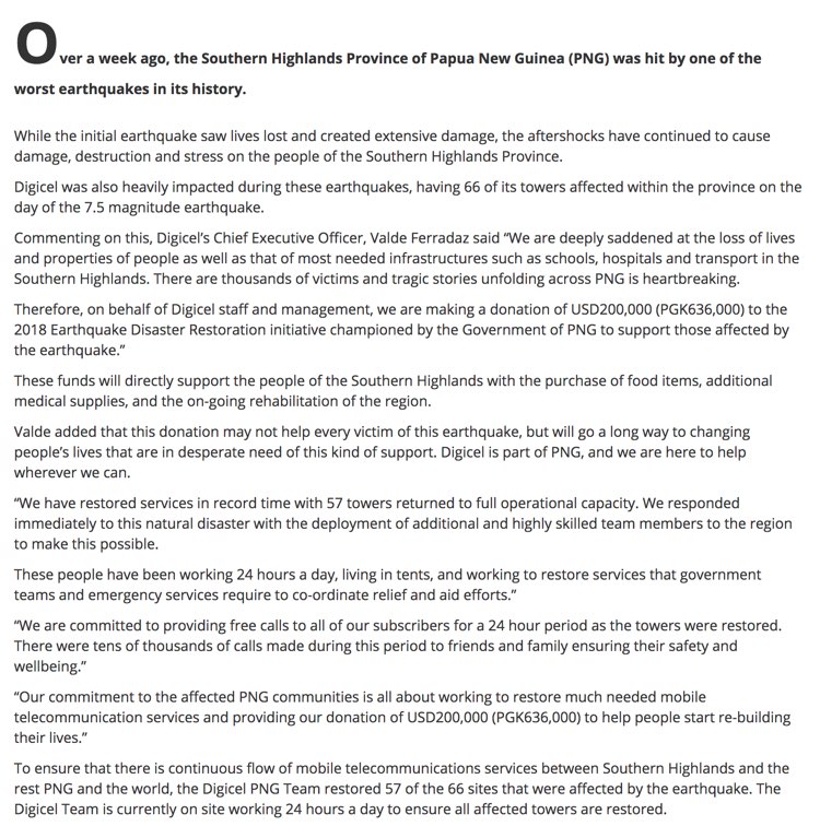
Update 23:12 UTC: A LoopPNG article - DIGICEL donates 200,000 US$
Update 15:45 UTC: Our colleagues of EID (Earthquake Impact Database) current count is 117 fatalities. EID scans a lot of articles from different sources and only compiles numbers at the lower end. Link to the EID
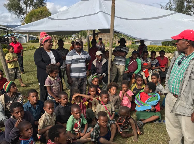
Wednesday (Thursday local) March 7/8
Update 15:42 UTC: RNZ article : Relief supplies on their way to quake-hit Hela in PNG
Quake-affected communities in Papua New Guinea's Hela province are in urgent need of basic supplies.
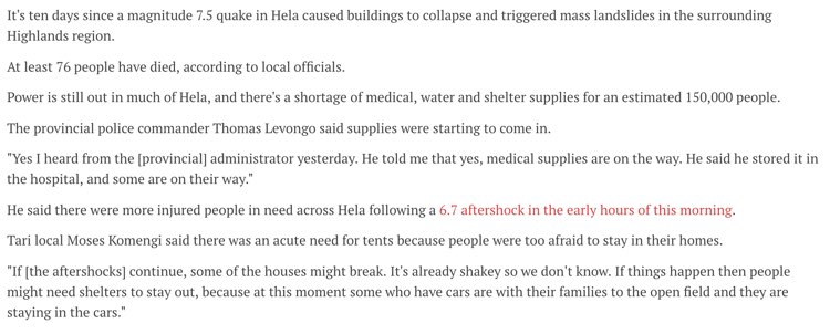
Tuesday :
Another very strong dangerous aftershock in New Guinea, Papua New Guinea
In depth report via this link
Update 23:41 UTC: Catherine Graham from Humanityroad.org is making the following remark, question! (see her comment below)
I have a question, why do you say the world is looking the other way? I see many who wish to respond but can't until the assistance is requested. The government of PNG must first request help before the world is authorized to respond, have they asked for international assistance?
Update 20:02 UTC: There we go for another strong aftershock. Preliminary M5.6 to M6.0 - Depth 20 km Time : 19:56 UTC (6 minutes ago)
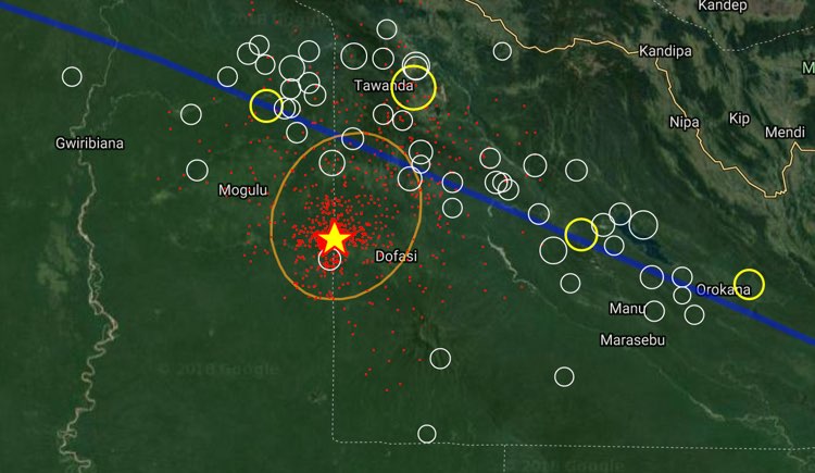
Update 14:54 UTC: The Magnitude has been updated to M6 at a depth of 30 km = potentially dangerous for additional damage
Update 14:41 UTC: 8 minutes ago another M5.5 aftershock 🙁 Other seismology agencies are mentioning M5.7 and extremely shallow.
Update 13:31 UTC: Again a M5.0 and a M5.4 which will be surely followed by Many M'+ aftershocks 🙂 Will be again a shaky night in New Guinea
Message from Earthquake-report.com:
Apart from the direct line we have with our followers and EQ Report App users in New Guinea, we also have to emphasize the valuable work of both Post Courier PNG and LoopPNG. Thank you all for your support. We, at earthquake-report.com, are trying to radiate the message to the outside world who continues to look the other side instead of massively helping PNG.
Update 10:08 UTC: Hela disaster team visits the quake-stricken areas
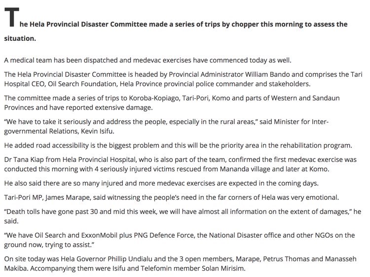
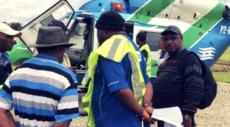
Update 09:52 UTC: Humanitarian supplies have been delivered to Moro Airport in the Southern Highlands today following the devastating earthquake in PNG. The Royal Australian Air Force C130 will continue to deliver supplies over the weekend.
Update Sunday 09:49 UTC (just 1 week after the massive M7.5 quake) : PNG woman groups mobilize to help victims
A LOOP article
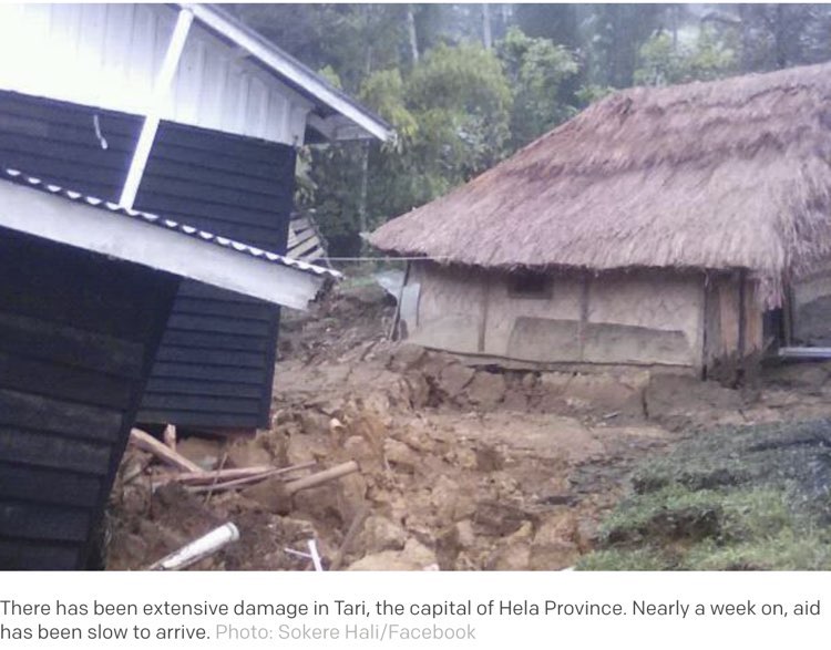
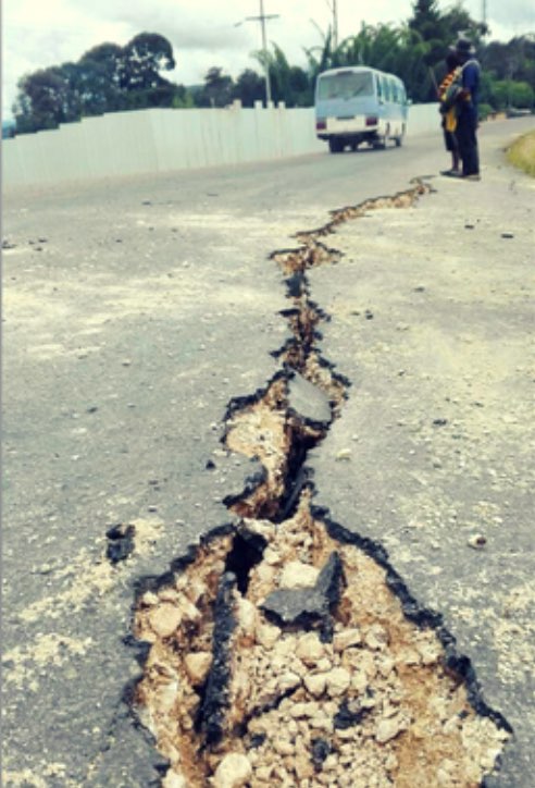
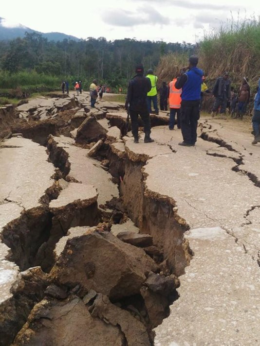
Update 22:54 UTC: The below message can also be found in the I FELT IT user experiences in the list. The message is not official, but we believe that it is true. It reached us from Tari where EXXON is constructing the gas field. The picture below the text comes from the HIDES-Gas Facebook site and we can assure you that such broken roads are rarely seen.
"death toll of 156, houses destroyed, landslides took building infrastructure, bridges covered, land splits in half. Mountain collapsed killing people and covered more than ten villages, rivers changed its colours to red and black."
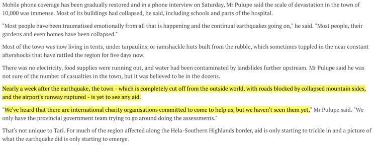
Update 10:21 UTC: Radio New Zealand article : "Help is slow to come, nearly a week after PNG quake"
The number of casualties remains patchy, but as many as eighty deaths have been reported in areas surveyed so far, the Red Cross said. However, that toll could still climb further, as much of the hilly, jungle-covered region is still cut off.
Health services were struggling too, with medical centers having to perform surgeries in darkness, and already short-supplied clinics fast running out of supplies to treat the sick and wounded.
Rescue efforts have been hampered by landslides, which have wiped out roads and cellphone towers, while poor weather and runway damage has held back relief from the air.
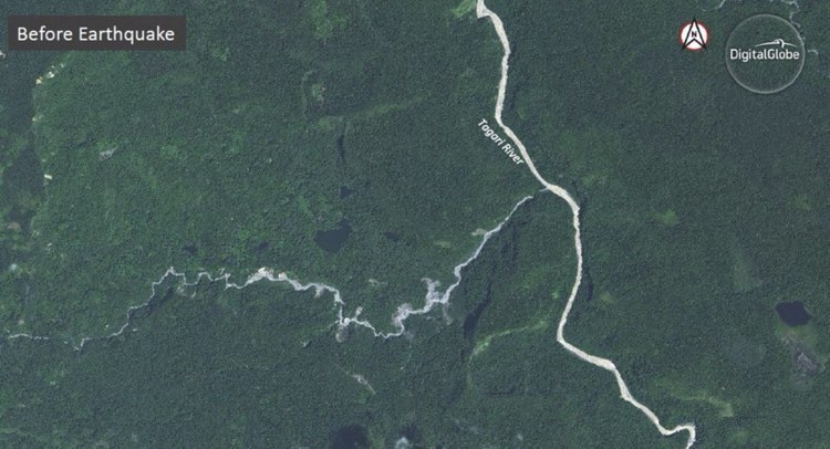
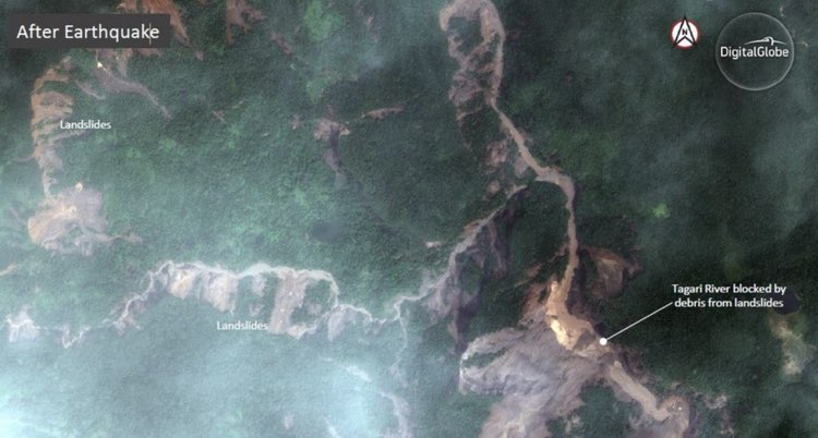
Update Saturday 10:13 UTC: Hard to believe landslides after the M7.5 earthquake. Satellite images from Digitalglobe are revealing the incredible size and number of the landslides.
Images by Aaron Clark and Stephen Stapczynski
Update 23:09 UTC: Aftershocks are back after a relatively quiet period. Generally spoken the Magnitude gas now decreased to an average of M4 to M4.5 with some peaks to M5. Yje following weeks we believe that they will further decrease to M3 to M4 but M6's or even stronger can still occur from time to time.
Update 17:54 UTC: Ching-Fang Lee (@ChingFang_Lee) Combining the ALOS2 interferogram and earthquake data, 7 large-scale landslides (A>50 ha) and 2 landslide dams were detected and mapped on the Sentinel-2 satellite image.
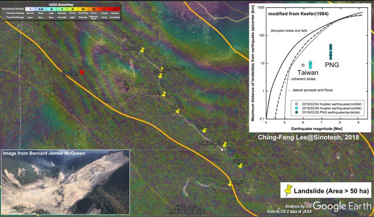
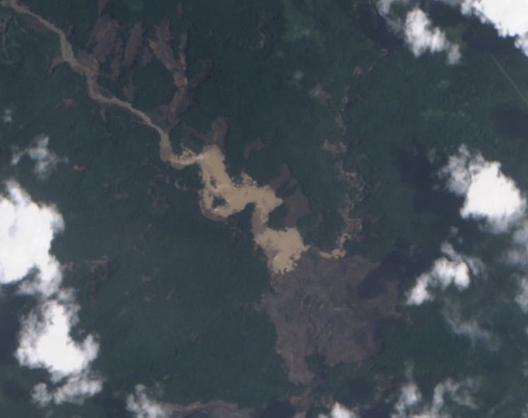
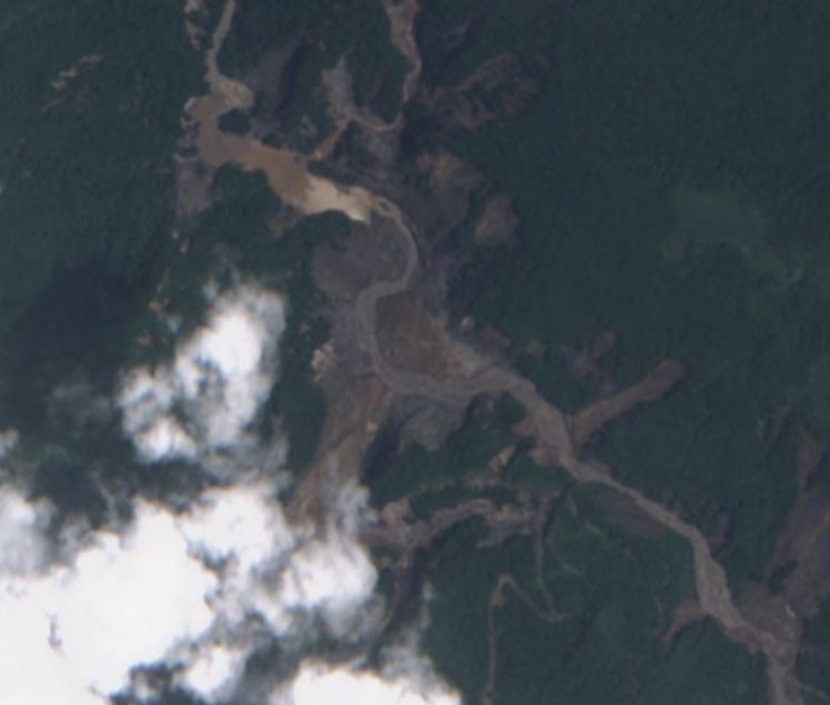
Update 11:52 UTC: Warning about dangerous landslide dams (see also the 2 satellite images below)
Dave Petley (landslide expert) said the risk was that behind landslide dams significant volumes of water build up and may spill over.
"Generally speaking the landslide blockage is loose and broken up material. So as the water starts to flow over the top it erodes the landslide away," said Mr Petley. "The water gets released very very quickly, and it picks up all the debris from landslides, generating what is essentially a huge debris flow that then travels all the way down the river channel and that's really destructive, because the volumes of water can be quite large." Dave Petley said the challenge for PNG was to urgently establish how many landslide cases posed a potential risk of water overflow, the time scale involved, and who was downstream.
"This is a problem that needs attention. It might well be that although there is the potential to generate significant floods here, in fact the number of people who would be affected is relatively low," he said.
"But it feels to me that that sort of assessment needs to be done fairly urgently."
Source article : Radio New Zealand
Update 11:39 UTC: The NEW GUINEA EARTHQUAKE tends to become THE MOST FORGOTTEN DISASTER of 2018. 5 days after the earthquake, only the Australian government, the International Red Cross and some private companies are giving a helping hand on top of the PNG authorities.
Update Friday 11:36 UTC: 2 landslide satellite pictures from the Sentinel 2 European satellite? The landslide scars are obvious.
Update 19:13 UTC: Link to another (better quality) landslide facebook video of Bernard James McQueen
https://www.facebook.com/bernard.j.mcqueen/videos/1312922438807256/
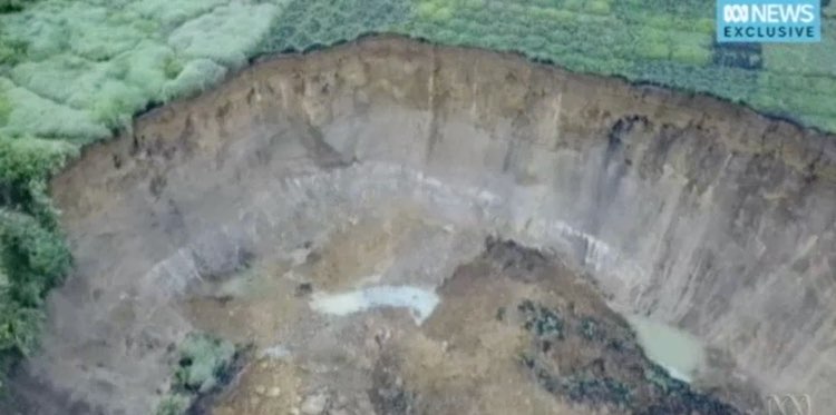
Update 17:56 UTC: Image of a sink hole via an ABC Australia video
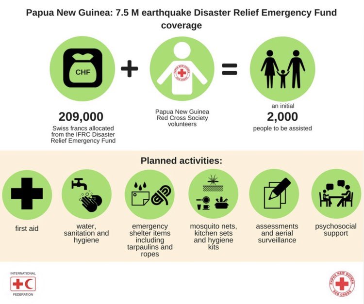
Update 17:33 UTC: International Red Cross releases emergency funds
The International Federation of Red Cross and Red Crescent Societies (IFRC) has released 209,000 Swiss Francs (221,000 US Dollars) from its Disaster Relief Emergency Fund to support the needs of 2,000 people affected by the 7.5 magnitude earthquake, which struck Papua New Guinea on 25 February 2018.
The earthquake damaged buildings including schools and hospitals, and caused landslides that blocked roads, cutting communication lines and access to affected people.
“Our first challenge for humanitarian assistance is assessing people’s needs,” explains Udaya Regmi, the IFRC head of country office in Papua New Guinea. “The strong, shallow earthquake damaged or destroyed communication networks and infrastructure, so there is limited information on how people were affected and what they need.”
The emergency fund will also be used to support assessments and aerial surveillance to identify others in need, while providing an initial 2,000 people with first aid, water, sanitation and hygiene support, mosquito nets, materials for emergency shelters such as ropes and tarpaulins, as well as water containers. It will also cover psychosocial support.
Earthquake-report.com : WOW, 221,000 US$! #NOT ! Should we be happy with this amount of money. PNG is in need of a lot more money and we do not see a lot of incoming support for them. The world should wake up. This is a real humanitarian disaster.
Update 17:20 UTC: Updated preliminary earthquake toll
Our colleagues of the EID have now 51 fatalities listed. We emphasize however that this number is rather an estimate as some people are still missing and believed to have been buried by landslides.
1 person was allegedly killed due to the shaking of the M6.1 aftershock.
Source : Post Courier
Update 17:15 UTC: Sacred grounds ruined by the earthquake
Traditional and cultural sacred places and burial grounds have been exposed for the first time.
The recent earthquake that hit the Hela and Southern Highlands provinces not only killed people and destroyed homes but also damaged respected and sacred ritual sites and burial grounds by exposing the remains of the dead.
In the Nembi Plateau local level government (LLG) area, Nipa-Kutubu district, reports received from villagers say that many remains of the dead had been exposed.
Paul Mulip, a village councillor from Upa village in the Nembi Plateau LLG, said the earthquake split open rocks and caves used as burial places and destroyed all burial sites.
He said human remains, including bones, were scattered all over the place.
He said it was the first time for many to experience an earthquake which had destroyed many homes and properties.
Four people had been reported killed in the Nembi Plateau area while another three people had been killed after they were covered by rocks.
In Hela, cemeteries had been destroyed and the remains of the dead exposed.
Other important traditional ritual sites had also been destroyed in the two provinces.
Source: Post Courier
Update Thursday 15:58 UTC: State of Emergency declared in the earthquake stricken areas
The Government has declared an immediate state-of-emergency for the earthquake-devastated provinces of Hela, Southern Highlands, Western and Enga provinces. Cabinet met yesterday and also set aside K450 million for relief and service restoration operations.
Prime Minister O’Neill also announced yesterday that Cabinet had approved the establishment of a restoration authority that would manage long-term reconstruction efforts during a four-year period to fully restore normalcy.
Source: Post Courier
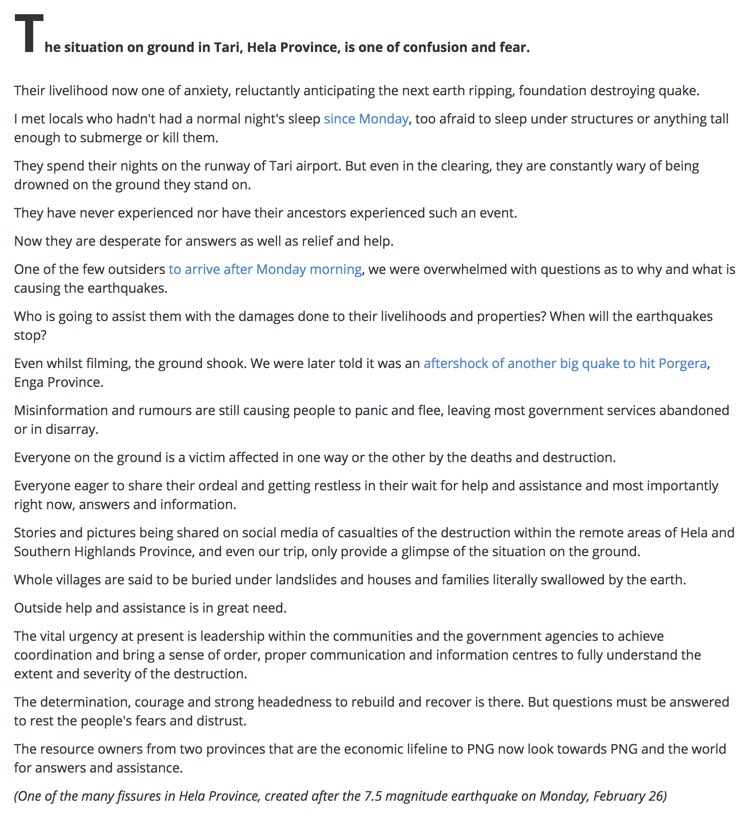
Update 00:05 UTC: CONFUSION AND FEAR IN TARI (article in LOOPpng magazine)
Update 18:36 UTC: Article from Post Courier PNG
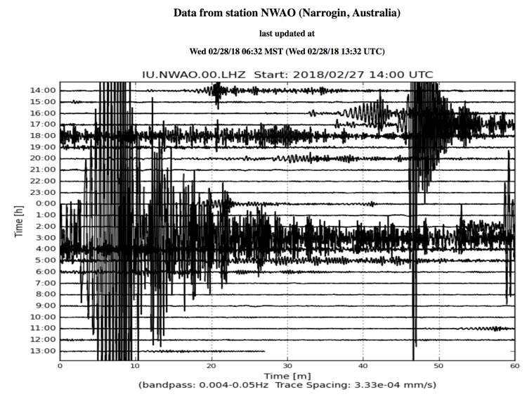
Update 13:54 UTC: Interesting seismogram recorded on a seismograph in Narrogin Australia. It shows the New Guinea M6.0 aftershock earlier today. The aftershock occurred at 2:45 UTC but registration on the Australian seismograph takes some time as the waves have to reach West Australia. The earthquake waves needed 10 to 15 minutes to travel 4000 km to the seismograph.
Update 11:49 UTC: Another Post Courier article is a SCREAM FOR (NATIONAL and INTERNATIONAL ) AID
Update Wednesday 10:56 UTC: We like more articles like this. Australia is ready to assist the PNG government.
Excerpt from article of the Post-Courier PNG
Update 23:36 UTC: Just in, this User I FELT IT experience report from Komo, New Guinea. This report comes from in the direct epicenter area and describes what happens if an MMI IX is experienced. 1 word: horror!
Building designed for 7.0 earthquake, it remained standing but was badly damaged. Shook so hard all the furniture in the room was smashing back and forward, tipping over, and jumping around the room. It was all I could do to hold onto the bed and try to stop things landing on me. The motion was extremely violent, it was backwards and forwards approx. 1 metre about 3 times a second, without much up and down. Doors had to be ripped off hinges once the shaking stopped.
Update 23:40 UTC: Understanding the M7.5 massive New Guinea earthquake
The February 25, 2018, M 7.5 earthquake occurred as the result of thrust faulting at shallow a depth. Preliminary focal mechanism solutions indicate slip occurred on either a moderately dipping fault striking west-northwest, or on a moderately dipping fault striking southeast. At the location of this earthquake, the Australia plate is converging with the Pacific plate, moving towards the east-northeast with respect to Pacific lithosphere at a velocity of approximately 107 mm/yr. Earthquakes in this geographical region are generally associated with the large-scale convergence of these two major plates, and with the complex interactions of several associated microplates, most notably the South Bismarck plate, the Solomon Sea microplate, and the Woodlark plate. The location, depth, and focal mechanism solution of this earthquake are consistent with it occurring as intraplate faulting within the crust of the Australia plate.
While commonly plotted as points on maps, earthquakes of this size are more appropriately described as slip over a larger fault area. Thrust-faulting events of the size of the February 25th, 2018 earthquake are typically about 85x30 km (length x width).
Papua New Guinea experiences a high rate of seismic activity, with 23 other events of M 6+ occurring within 250 km of the February 25, 2018 earthquake over the preceding century. The closest of these was a M 6.2 earthquake in August 1993, about 17km to the north of today's earthquake. The largest was a M 7.2 event in June 1986, 230 km to the north-northeast on or near the Australia:Pacific plate boundary in the region. With the exception of a M 7.5 earthquake at intermediate depth (186 km) in eastern Papua New Guinea in February 1963 (which occurred on the subduction zone at depth), all prior M 7.5+ earthquakes in this region have been associated with the shallow subduction zone plate boundaries in northern New Guinea. The vast majority of moderate-to-large earthquakes in this region are not known to have caused significant damage or casualties, though few have been as large as today's earthquake. A M 7.1 earthquake in June 1976, 340 km to the northeast of this event, resulted in over 400 shaking related deaths. Landsliding also caused a significant number of additional fatalities in that event.
Source : USGS
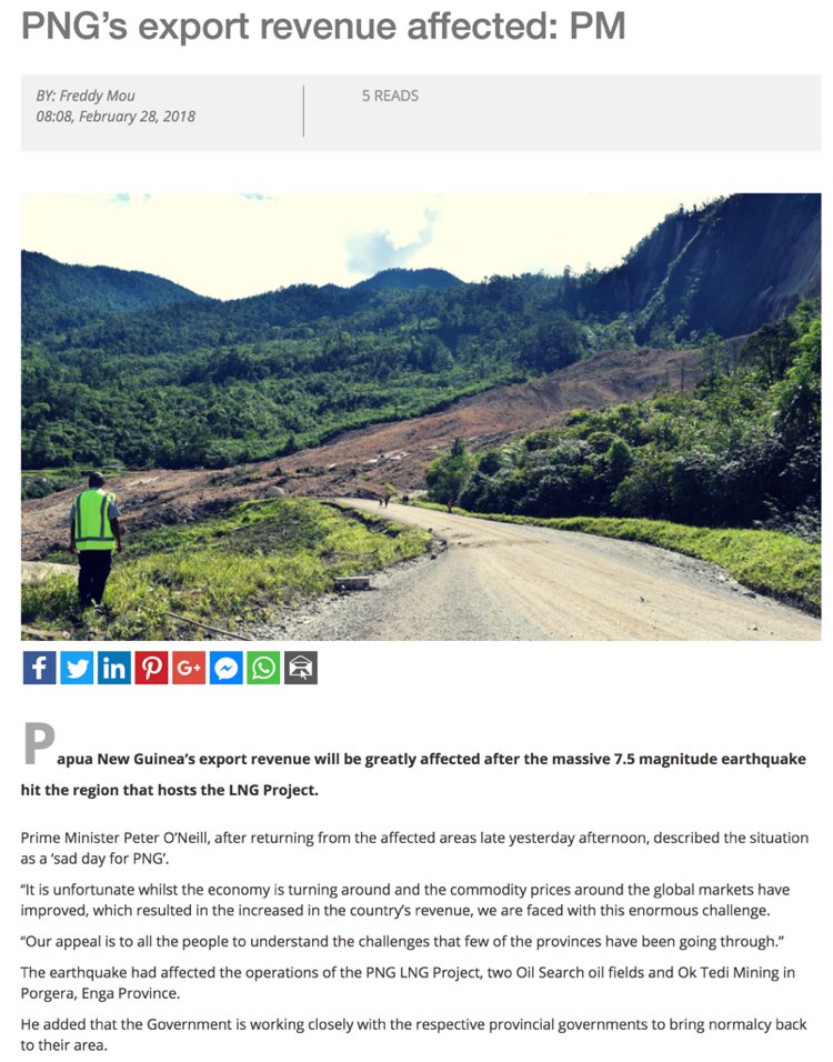
Update 22:35 UTC: The prime Minister said that the earthquake comes at an extremely bad time. The LOOP article is longer and we advise our readers to read in their site.
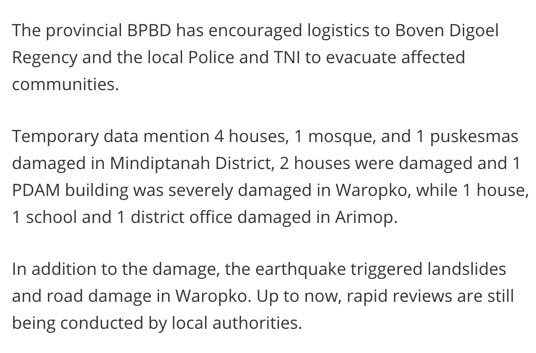
Update 22:23 UTC: This report hasn't mentioned eventual damage in the other side of the island, the (contested) Indonesian part. The specialized Indonesian provincial authority BPBD has reported that also their part of the island was damaged, although a lot less than in New Guinea because of the distance to the epicenter.
Update 16:33 UTC: Although the number of aftershocks is still extremely high, we are happy to report that the Magnitudes are gradually decreasing below the M5 level. Nobody can predict however and M6+ are still possible starting mostly a new series of M5+ quakes.
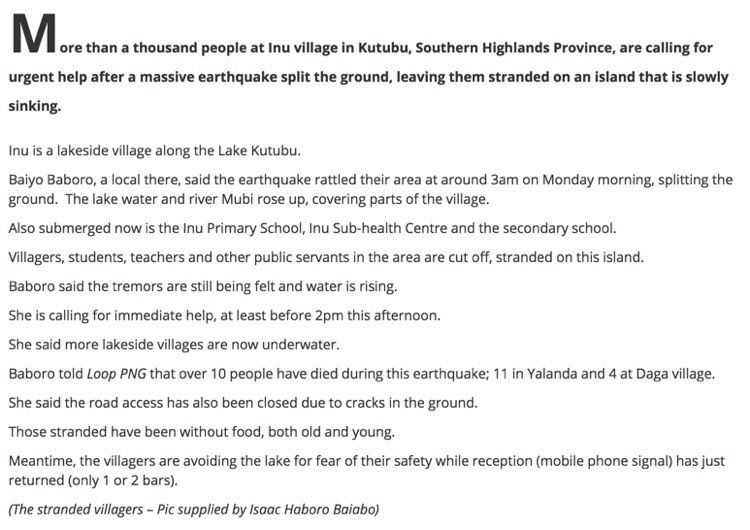
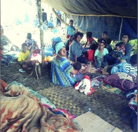
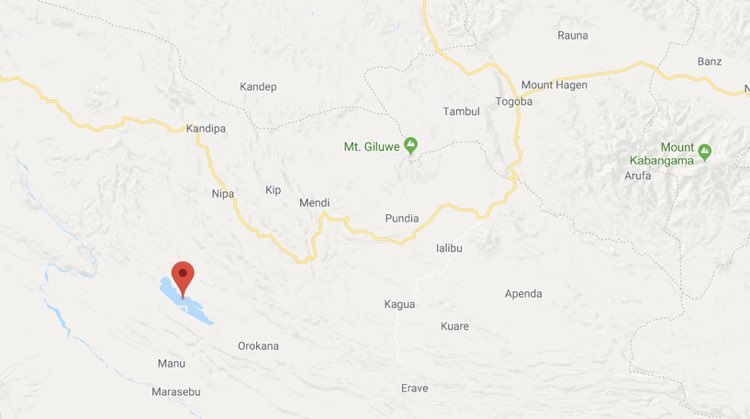
Update 16:09 UTC: Article in LOOP png with the title : "Earthquake split land, island slowly sinking"
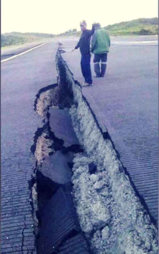
Update 15:54 UTC: Important new information coming in via the Facebook page of Bernard James McQueen
Links to 2 HD video's showing the INCREDIBLE extend of the landslides.
https://www.facebook.com/bernard.j.mcqueen/videos/1311389595627207/
https://www.facebook.com/bernard.j.mcqueen/videos/1311383648961135/
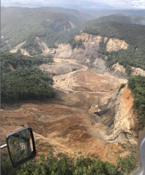
Update 13:47 UTC: We have now "finally" the first video but "only" showing the vast number of landslides. Difficult to know whether they buried villages or not.
Update 13:27 UTC: This I FELT IT report from Kiunga which we received this morning illustrates the current way of living in the earthquake zone :
... feeling a lot of tremors house swaying and 1000L tank had water spilling... cement flooring split in the middle in a shopping centre .... always feeling aftershocks and having sleepless nights ... :((
Update 10:21 UTC: If you like our website and our in-depth earthquake reporting, your donation (even small amounts) would be more than welcome. Server and specially written software costs are running high and as we are not getting help from organizations, authorities or companies, we are only able to survive with your donation support. Thanks for considering giving us a donation. The Paypal link allows you to donate via a wide range of cards.

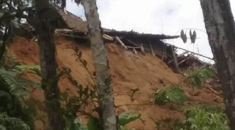
Update 10:01 UTC: a picture of the many landslides. Picture courtesy: Mission Aviation Fellowship.
Landslide expert Prof. Dave Petly wrote an extensive article about the many landslides. Link to his article.
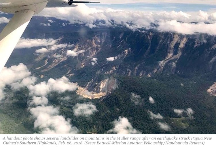
Update 09:08 UTC:

Update 08:47 UTC:
Earthquake-Report.com :
WHERE IS THE AID OF THE INTERNATIONAL COMMUNITY and the UNITED NATIONS ? ARE THERE NO MORE SAR TEAMS IN THE WORLD TO HELP POOR PAPUA NEW GUINEA?
Update 08:41 UTC: The reports coming out of PNG are looking grimmer and grimmer :((.
Excerpts of a report of Radio New Zealand International
A police spokesman said there were also reports of entire hillsides coming down and whole villages being buried by landslides.
Mr Tens told RNZ Pacific from Mendi that rescuers were trying to reach four people buried in a landslide. He said power and telecommunications were still out in most of the affected areas and the main roads into the region were cut off by landslips. "Our communication is not up to shit. We cannot communicate. All the power is cut off and I had to come to a mountain where I get a network to make a call. You are lucky to intercept."
PNG police say more than 400,000 people in four different provinces may be impacted by yesterday's 7.5 magnitude earthquake.According to police spokesman Dominic Kakas, at least 10 people died in landslips.
Superintendent Kakas said the quake and its after shocks have caused widespread movement of land in the provinces of Southern Highlands, Hela, Enga and Western Province.
He said reports are filtering through of extensive damage."To roads, landslips, entire mountains coming down, from reports some villages have been covered. The telephone lines the towers have been damaged, so yeah."
Mr Kakas said there had been no communication at all from the capital of Hela, Tari, a township which has a population of over 8000 people and is about 30 kilometres from the quake's epicentre. He said the Police Commander for the Southern Highlands Province had been in the capital Port Moresby and was returning home today by helicopter to further assess the situation in the region.
Earlier, Catholic priest Father Pius Hal told the Papua New Guinea Today website two children of a local government leader were among five killed by quake-triggered landslips in Mendi town. Two others were children of a senior Southern Highlands public servant.
Tuesday February 27 UTC
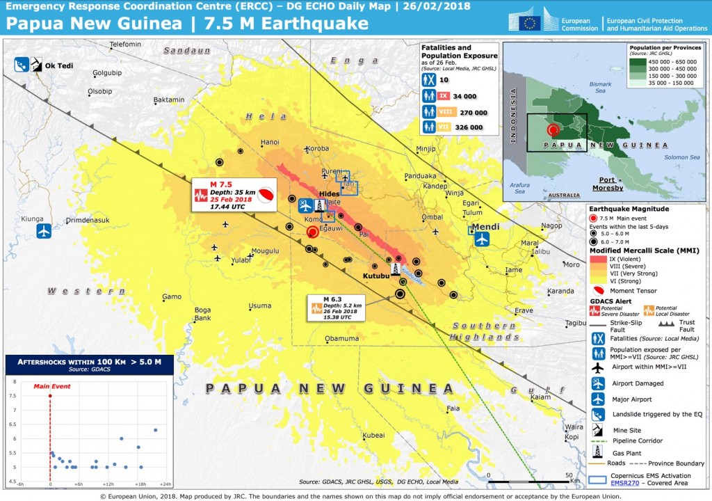
Update 21:59 UTC: Very informative poster with in red the MMI IX violent shaking ruptured area from Copernicus EMS
Update 17:04 UTC: Our colleagues at the "Earthquake Impact Database" just published new numbers and they might still not be the final ones :((.
** 31 people lost their life
** 300 people have been injured
** thousands of houses are either collapsed or damaged to various degrees
Update 16:30 UTC:
Papua New Guinea Red Cross is checking on relief stocks stored near the epicentre of today's 7.5M #earthquake and are ready to help, as in previous disasters like this one. #PNG pic.twitter.com/jRB0NP5eOE
— IFRC Asia Pacific (@IFRCAsiaPacific) February 26, 2018
Update 15:43 UTC: If you have only a smartphone with you and you would like to read a report like this, it may be wise to download our EQ Report app as this coverage makes also part of the many subjects in the app. It is still free with all the features and without ads. Besides ultra fast eq notifications, we also send "breaking earthquake news" (2 so far for the New Guinea eq), and besides sending us your I FELT IT experience, you can also read those of other people. The bigger the EQ Report family gets, the better our reports will be. Give it a try and if you like it, do not forget to give us your appreciation by giving your score in the App Store or Google Play. Thank you. Here is an example of the screens of this earthquake in the app. Google Play - App Store
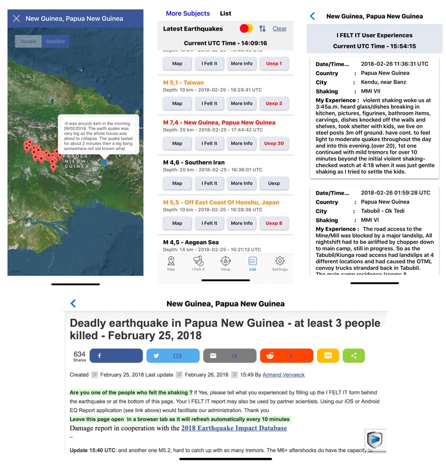
Update 15:40 UTC: and another one M5.2, hard to catch up with so many tremors. The M6+ aftershocks do have the capacity to inflict even more damage, especially on already damaged structures. As expected still no serious assessment of the damage, injured and fatalities. As night has fallen now in PNG (now 01:40 AM), we do not expect any more detailed numbers untill the morning hours.
Update 15:26 UTC: And yet ANOTHER M6.1 aftershock !!!
Update 14:15 UTC: PNG authorities call to stay out of multi-story buildings, to be aware of the potential of landslides, and to be prepared to move to open ground in the event that an aftershock is felt.
Update 12:01 UTC: Another strong aftershock just happened in the epicenter region. Preliminary Magnitude M5.8. It will be a almost sleepless night for people in the epicenter region.
Picture below is the M5.7 aftershock seismogram (right) + the prior smaller aftershocks
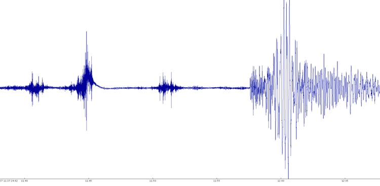
Seismogram courtesy Alomax.free.net
Update 09:41 UTC: Although there are mentions of "about" 10 people being killed, we keep the official number on 3 until the authorities do confirm the exact number.
Papua New Guinea Post Courier wrote earlier today :
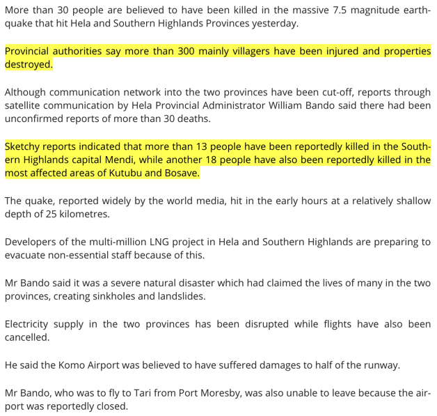
Although communication networks into the two provinces have been cut off, reports through satellite communication by Hela Provincial Administrator William Bando reveal that about 10 people have been killed while thousands of properties have been destroyed. Mr Bando said it is a very severe disaster as many lives have reportedly been lost.
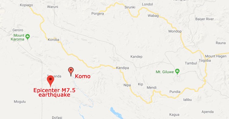
It is believed that the earthquake started around Kiunga and affected lives and properties in Hela and Southern Highlands while other provinces also felt the effect of the quake.
Mr Bando said the Komo Airport is believed to be damaged as half of the airfield has been destroyed.
The PA is now meeting with the department of inter-government relations in relation to the disaster.
Furthermore, schools in both provinces and in other provinces along the fault line have suspended classes indefinitely.
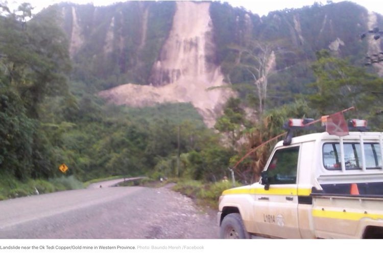
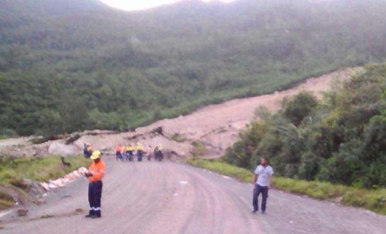
Update 09:25 UTC: a few pictures from landslides in mining areas
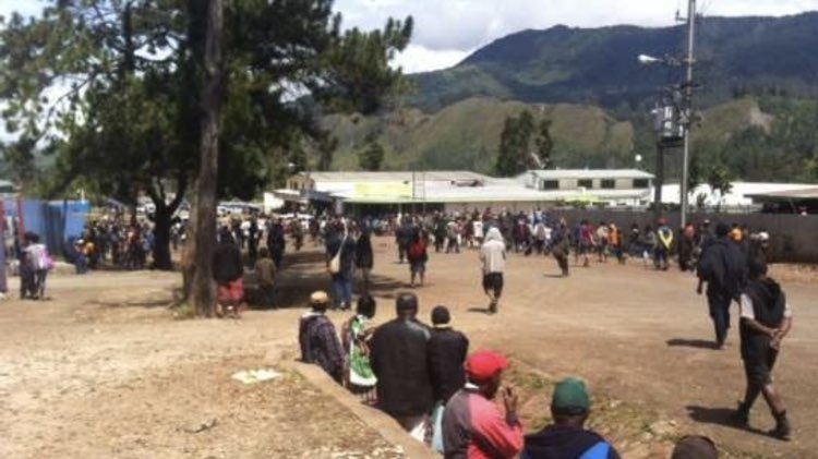
Update 09:18 UTC: Radio New Zealand International reports that at least 3 people have been killed. Authorities fear for more deaths in the rural, difficult to access, areas.
The bodies were brought in by police early on Monday morning, according to the chief executive of the Southern Highlands Provincial Health Authority Joseph Birisi.
More people are believed to have died in Mendi, Mr Birisi said. "Parents with a child and they were buried. So they were brought in this morning by the police. They are at our morgue now. The others are yet to come in. I can't confirm that now because the bodies are not in yet," he said.
Mr Birisi said he had also received reports of deaths in rural areas outside of Mendi. Roads and rivers in the region had been blocked by landslides and buildings damaged and destroyed, he said. Equipment in the hospital had been broken but the facility's power and water supplies had been re-connected, Mr Birisi said.
The International Committee of the Red Cross in Papua New Guinea says it has been difficult to establish communication with areas affected by the earthquake. Red Cross volunteers close to the epicentre could not be contacted because of damage to the mobile phone network, the head of the organization in PNG Udaya Regmi said.
Papua New Guinea Red Cross is gearing up to assess people's needs after today's big 7.5M #earthquake as they have done after previous disasters, like this El Nino operation. #PNG pic.twitter.com/dOm90Avf7k
— IFRC Asia Pacific (@IFRCAsiaPacific) February 26, 2018
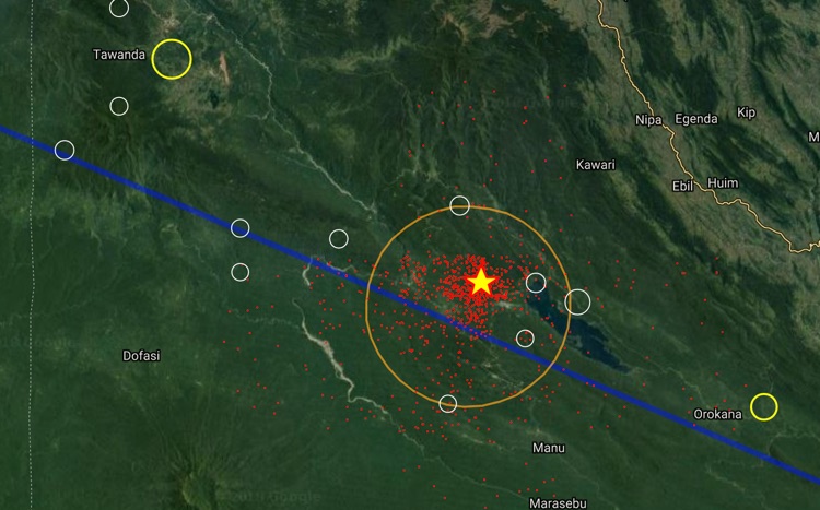
Update 09:13 UTC: The strongest MMI IX shaking intensity was experienced over a length of 170 km! Also to be seen here is that the aftershocks (orange bullets) have epicenters along the entire ruptured zone.
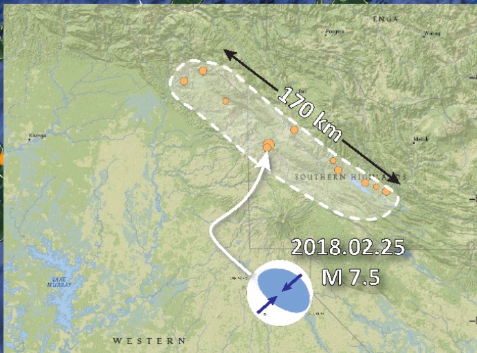
Update 08:44 UTC: The ultimate explanatory earthquake poster from this earthquake comes from geologist Dr. Jay Patton. Click on the image to be linked to his site. The poster contains lots of important scientific information and can be viewed in full format in his site. Dr Jay Patton is gifted with the ability to translate hard to understand scientific material into easy, everyday language (through texts and images).
Update 08:36 UTC: STRONG (preliminary) M6.1 Magnitude aftershock rattles again Papua New Guinea.
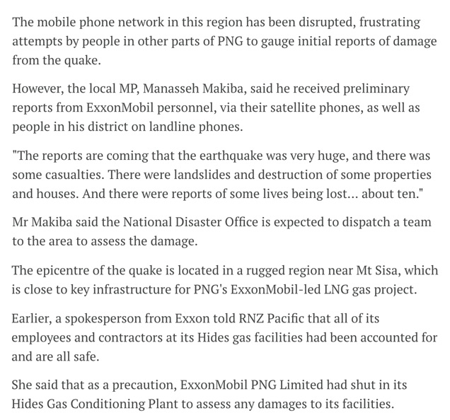
Update 06:50 UTC: A spokesman at Papua New Guinea’s National Disaster Center said by telephone the affected area was very remote and the agency could not properly assess damage until communication was re-established. He said there were no confirmed casualties.
“The Papua New Guinea Defense Force has also been mobilized to assist with the assessment and the delivery of assistance to affected people as well as the restoration of services and infrastructure,” Isaac Lupari, the chief secretary to the government, said in a statement.
ExxonMobil said it had shut its Hides gas conditioning plant and that it believed administration buildings, living quarters and a mess hall had been damaged. It also said it had suspended flights into the nearby Komo airfield until the runway could be surveyed.
“Due to the damage to the Hides camp quarters and continuing aftershocks, ExxonMobil PNG is putting plans in place to evacuate non-essential staff,” the company said in an emailed statement. Gas is processed at Hides and transported along a 700 km (435 miles) line that feeds a liquefied natural gas plant near Port Moresby for shipping. (Source: Reuters)
Update 06:48 UTC: At least one company began evacuating non-essential personnel after a powerful 7.5 magnitude earthquake hit Papua New Guinea’s energy-rich interior on Monday, causing landslides, damaging buildings and closing oil and gas operations.
Update 01:49 UTC: A good description how the earthquake was felt in Mount Hagen, 165 km from the epicenter
"The house was shaking terribly but wr evacuated the house fairly quickly. Once outside in a safe area I checked my wrist watch and it was precisely 3:55am; the quake lasted 2 and a half minutes. Damage has been minor. Fridges, stoves and cupboards have moved out of position. Mirrors smashed and some lights on ceilings broken off. No bridges have collapsed or landslips in this area. Villagers heard loud explosion like noises during the tremor. Smaller tremors are still being felt now at 11:42am"
Update 01:51 UTC: Seismogram as recorded in a seismological station in Port Moresby, New Guinea. The M5+ aftershocks are looking minimal compared to the mainshock but at the same time it gives an impression of the difference in energy in between M7.5 en M5.7 (strongest aftershock so far)
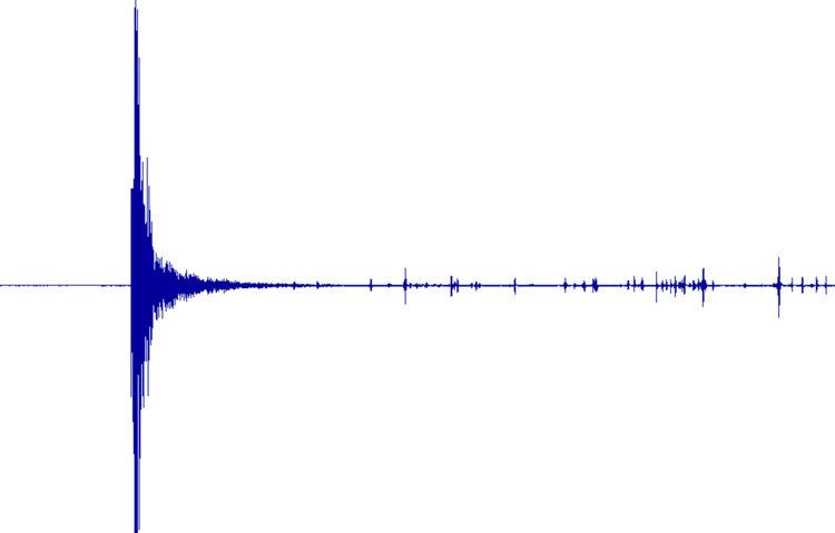
Update 00:57 UTC: Based on this excerpt from an article of Radio New Zealand International there may be fatalities :((
Update 00:21 UTC:
Update 23:47 UTC: Updated USGS shaking map (see below for the first one)

Update 23:39 UTC: The map below shows the elliptical form of the MMI IX shaking area (MMI IX = violent shaking) indicating that the ruptured zone will be more than 100 km long !!
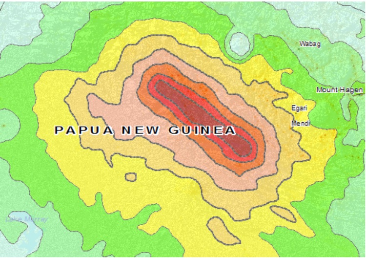
Update 23:29 UTC: We believe that all these (smaller) villages are at risk for serious damage. They are all located within a distance of 30 km from the epicenter. More than 50,000 people are living in and around these villages.
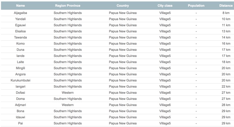
Update 23:24 UTC: Although people searching on the internet see everywhere "no damage so far", our own "Experience reports" show clearly that even at a distance of 100 to 150 km from the epicenter, a lot of (luckily) minor dame has been inflicted.
Update 23:13 UTC: A lot of aftershocks, some of them in the M5 to M6 range
Update 21:17 UTC: Request to our readers in the greater epicenter area in PNG, New Guinea : If you are aware of any damage, injuries and hopefully nothing else, please let us know by the form below, as it is very hard for the outside world to find out how the situation is at the moment. Thank You.
Update 20:56 UTC: Of course NO Tsunami risk as the epicenter is below land
Update 20:44 UTC: So far no news of damage and/or injured people. Due to the fact that a main road is located in the greater epicenter area + that it is currently daylight, reports may come in earlier. Inspecting the damage in the epicenter area may though be very difficult as this is rain forest and often covered with clouds. Sometimes assessment and rescue personnel has to walk via trails towards remote areas.
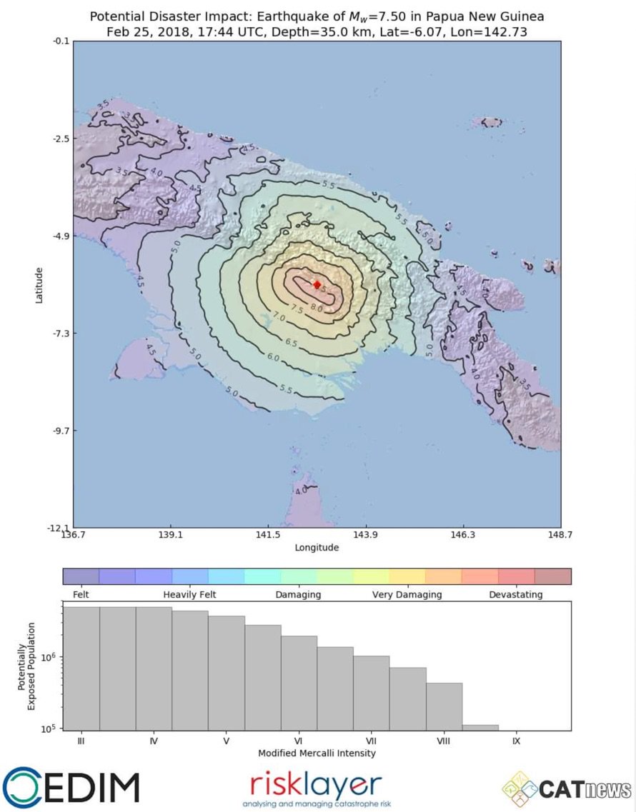
Update 20:11 UTC: Shaking map with possible related damage from the natural disaster specialists at CATnews (Risklayer - CEDIM), Karlsruhe, Germany. Map generated by Andreas Schäfer.
Update 19:59 UTC: Our historic earthquake map below shows another M7.5 earthquake in 1922.
Update 19:56 UTC: Good to know from the past : the last shallow M7+ in Central New Guinea was in 1976 on the Indonesian side of the border. The earthquake killed 5000 people :((.
Very complex faulting, probably involving more than one fault and at least one larger part with strike-slip component. And likely associated with surface rupture
Update 19:53 UTC: As said before, it can take many hours before we get news about the extend of the damage, injures and hopefully a confirmation of no fatalities.
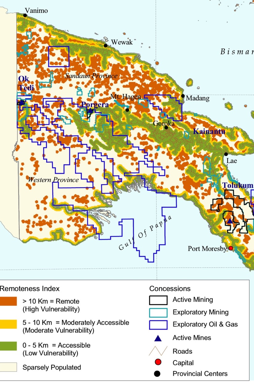
Update 19:43 UTC: The highlands of New Guinea are being mined heavily since 1970. Many minerals like Gold, silver and copper, to name a few, are being mined. The image below gives an idea about the mining concessions granted in New Guinea. The epicenter region is among the areas with mining concessions.
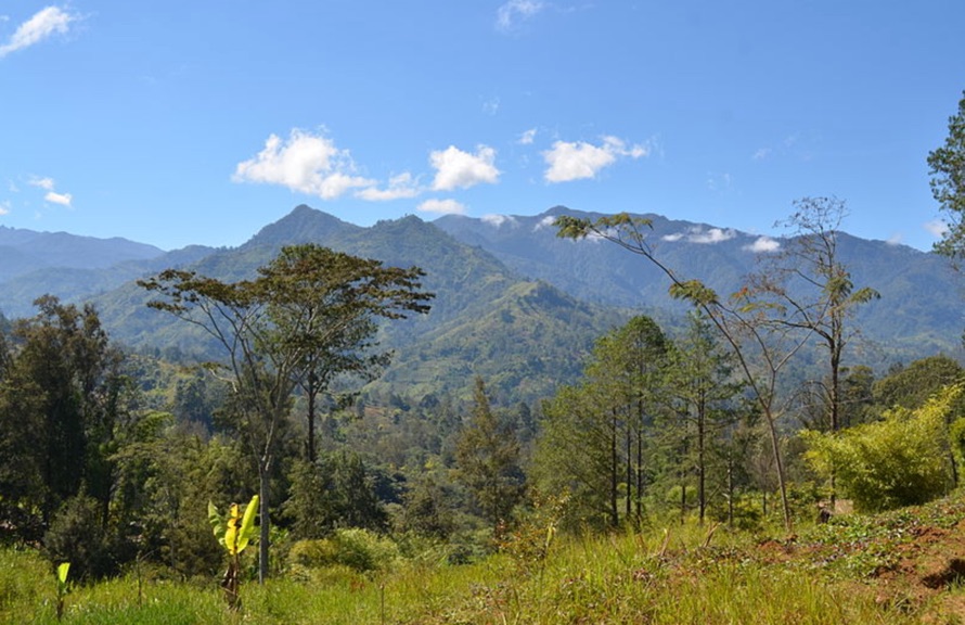
Update 19:39 UTC: Image below shows the landscape in the highlands. Landslides are common after massive earthquakes in the highlands in New Guinea.
Update 19:35 UTC: Most of the experience reports we receive are in between 150 to 200 km from the epicenter area and some are already reporting damage to their houses. We fear for serious damage in the direct epicenter
Update 18:58 UTC: A user experience from Mount Hagen :
"Went for longer than a minute.. was the strongest ive ever felt and Right now there is an after shock as im typing... we have some small damage broken glass ect. But we live in a two storey brick building and there are some big cracks in the walls now."
Update 18:47 UTC: The earthquake mechanism shows a thrust earthquake (2 sides of a fault colliding into each other).
Update 18:46 UTC: Main earth movement based on the current focal mechanism. Image courtesy Observatoire Geoscope
Do beach balls looks like Chinese or Latin to you, check this article "Understanding Beach Balls"

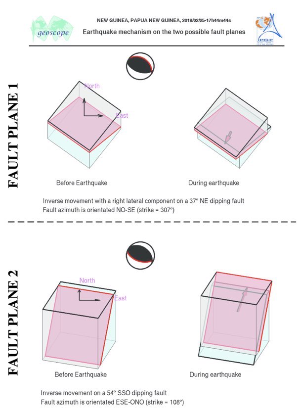
Update 18:38 UTC: Based on our experience we believe that it will last many hours before we will be informed about damage, injuries and fatalities.
Update 18:33 UTC: Professor Max Wyss, who specializes in theoretical prognoses of injuries and fatalities expects :
Injured people : 100 up to 1000
Fatalities : 10 to 400
ER does expect, based on earlier earthquakes in Papua New Guinea, max. the lower numbers
Update 18:24 UTC: People who have received the notification alert from the United States are in fact people from the USA coming to follow our Papua New Guinea alert
Update 18:22 UTC: Shaking impact on cities and population. Maximum shaking intensity is MMI VIII or severe shaking which may have been felt by 10.000 people
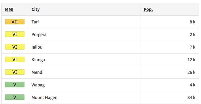
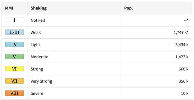
Update 18:19 UTC: People report that at least 3 aftershocks have been felt and that this earthquake was not at all like the usual very strong ones they felt before
Update 18:17 UTC: The first M5+ aftershock is being reported
Update 18:16 UTC: the earthquake's epicenter is in the Southern Highlands not heavily populated
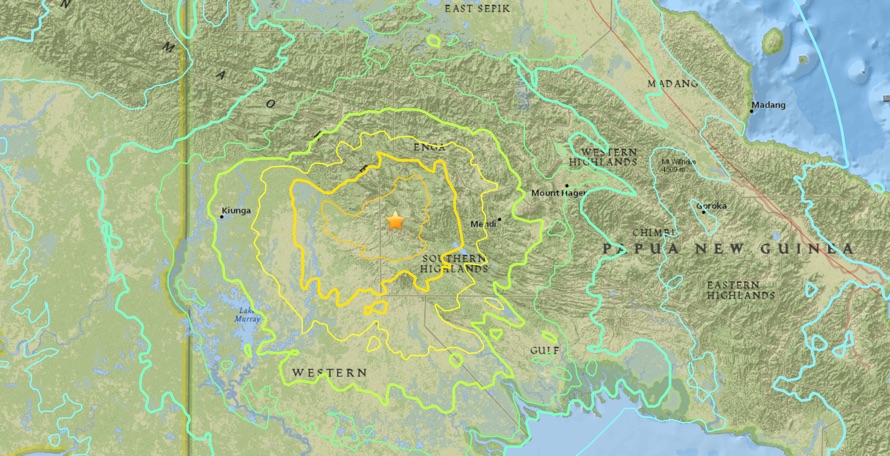
Update 18:15 UTC: We fear also for secondary earthquake effects like landslides
Update 18:13 UTC: PNG people are used to very strong earthquakes but massive earthquakes like this below land can still lead to a lot of damage
Update 18:11 UTC: Shaking map from this earthquake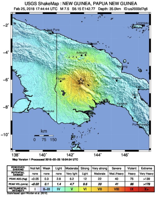 uake
uake
Update 18:10 UTC: : USGS reports a preliminary depth of 35 km, better than 10 but still very dangerous
Update 18:10 UTC: Based on the present earthquake parameters (Magnitude, Depth, Population, etc) and our experience with earthquake damage impact, earthquake-report.com calls this earthquake extremely dangerous and expects injuries and serious damage
Most important Earthquake Data:
Magnitude : 7.4
Local Time (conversion only below land) : 2018-02-26 03:44:42
GMT/UTC Time : 2018-02-25 17:44:42
Depth (Hypocenter) : 25 km
Depth and Magnitude updates in the list below.

Share your earthquake experience (I Have Felt It) with our readers.
Click on the "I Felt It" button behind the corresponding earthquake. Your earthquake experience is not only important for science, but also for people in the area as well as our global readership.
| Refresh this list | ||||||
| SRC | Location | UTC Date/time | M | D | INFO | |
| USGS | Mendi, Papua New Guinea | Feb 25 23:46 | 4.6 | 27 | MAP | |
|
|
||||||
| EMSC | New Guinea, Papua New Guinea | Feb 25 23:46 | 4.6 | 20 | MAP | |
| USGS | Mendi, Papua New Guinea | Feb 25 23:07 | 4.6 | 35 | MAP | |
| EMSC | New Guinea, Papua New Guinea | Feb 25 23:07 | 4.6 | 30 | MAP | |
| GEOFON | New Guinea, Papua New Guinea | Feb 25 22:57 | 4.8 | 14 | MAP | |
| EMSC | New Guinea, Papua New Guinea | Feb 25 22:57 | 4.7 | 91 | MAP | |
| USGS | Mendi, Papua New Guinea | Feb 25 22:57 | 5.0 | 35 | MAP I Felt It INFO | |
| USGS | Porgera, Papua New Guinea | Feb 25 22:28 | 5.0 | 35 | MAP | |
| EMSC | New Guinea, Papua New Guinea | Feb 25 22:28 | 4.8 | 10 | MAP | |
| GEOFON | New Guinea, Papua New Guinea | Feb 25 22:28 | 4.9 | 8 | MAP I Felt It INFO | |
|
|
||||||
| USGS | Mendi, Papua New Guinea | Feb 25 22:19 | 5.0 | 35 | MAP | |
| USGS | Mendi, Papua New Guinea | Feb 25 22:09 | 4.5 | 35 | MAP I Felt It INFO | |
| EMSC | New Guinea, Papua New Guinea | Feb 25 22:09 | 4.5 | 35 | MAP I Felt It INFO | |
| USGS | Porgera, Papua New Guinea | Feb 25 21:47 | 5.2 | 16 | MAP I Felt It INFO | |
| GEOFON | New Guinea, Papua New Guinea | Feb 25 21:47 | 5.1 | 22 | MAP | |
| USGS | Porgera, Papua New Guinea | Feb 25 21:11 | 5.0 | 35 | MAP | |
|
|
||||||
| GEOFON | New Guinea, Papua New Guinea | Feb 25 21:11 | 5.3 | 10 | MAP I Felt It INFO | |
| EMSC | New Guinea, Papua New Guinea | Feb 25 20:57 | 4.9 | 30 | MAP | |
| USGS | Porgera, Papua New Guinea | Feb 25 20:57 | 4.9 | 35 | MAP | |
| GEOFON | New Guinea, Papua New Guinea | Feb 25 20:57 | 5.2 | 10 | MAP | |
| USGS | Porgera, Papua New Guinea | Feb 25 20:17 | 5.2 | 35 | MAP I Felt It INFO | |
| GEOFON | New Guinea, Papua New Guinea | Feb 25 20:17 | 5.0 | 9 | MAP | |
| USGS | Mendi, Papua New Guinea | Feb 25 19:40 | 5.3 | 35 | MAP | |
| GEOFON | New Guinea, Papua New Guinea | Feb 25 19:40 | 5.5 | 10 | MAP I Felt It INFO | |
|
|
||||||
| USGS | Mendi, Papua New Guinea | Feb 25 19:05 | 4.6 | 34 | MAP | |
| EMSC | New Guinea, Papua New Guinea | Feb 25 19:05 | 4.6 | 34 | MAP | |
| USGS | Mendi, Papua New Guinea | Feb 25 18:54 | 4.9 | 35 | MAP | |
| EMSC | New Guinea, Papua New Guinea | Feb 25 18:54 | 4.9 | 30 | MAP | |
| USGS | Porgera, Papua New Guinea | Feb 25 18:47 | 5.0 | 35 | MAP | |
| USGS | Mendi, Papua New Guinea | Feb 25 18:26 | 5.4 | 35 | MAP | |
| USGS | Porgera, Papua New Guinea | Feb 25 18:11 | 5.5 | 38 | MAP | |
|
|
||||||
| GEOFON | New Guinea, Papua New Guinea | Feb 25 18:11 | 5.6 | 18 | MAP | |
| PTWC | Feb 25 17:54 | 7.6 | 0 | MAP | ||
| USGS | Porgera, Papua New Guinea | Feb 25 17:44 | 7.5 | 35 | MAP | |
| GEOFON | New Guinea, Papua New Guinea | Feb 25 17:44 | 7.4 | 25 | MAP I Felt It INFO | |
|
|
||||||
| USGS | Porgera, Papua New Guinea | Feb 25 17:44 | 7.6 | 10 | MAP | |
REAL TIME EARTHQUAKE LISTS - WORLD - REGIONS - COUNTRIES - STATE
Our Fast Earthquake and Tsunami Twitter Accounts : M4+ - ALL - M5+ - M6+ - CHILI – CANADA – BRITISH COLUMBIA - CALIFORNIA - OREGON – WASHINGTON - HAWAII – TEXAS – OKLAHOMA
Other earthquakes in the greater epicenter area
Strongest earthquakes (since 1900) within a 150 km radius from this earthquake

 APP STORE - GOOGLE PLAY


Hi Armand and all at EQR, You all have been doing a fabulous job. I have a question, why do you say the world is looking the other way? I see many who wish to respond but can't until the assistance is requested. The government of PNG must first request help before the world is authorized to respond, have they asked for international assistance?
It was a very strong shaking here in Ialibu in the early hours of the morning on the 26th February 2018. We lived on the top floor and had to rush out thinking the whole building would collapse.
I was in a building designed for 7.0 earthquake, it remained standing but was badly damaged. I was woken up by what felt like a strong earthquake, but within 1-2 seconds of the everything shaking, it very quickly shook so hard all the furniture in the room was smashing back and forward, tipping over, and jumping around the room. It was all I could do to hold onto the bed and try to stop things landing on me, standing up and getting out seemed more dangerous that riding it out, plus furniture was blocking the door. The motion was extremely violent, it was backwards and forwards approx. 1 metre about 3 times a second, without much up and down. Doors had to be ripped off hinges once the shaking stopped.
Tremors are still felt in kiunga...since Monday morning ...right now....just felt some shaking....a floor in a shopping center cracked and split in the middle and during the M7.5 earthquake tanks shook n water spelt out.....kinda thought it was the end of the world......